Orlando still in projected path of Hurricane Ian: What time should you be indoors?

Hurricane Ian nears Category 5 strength on approach to Florida
FOX 35 Storm Team has the hurricane forecast.
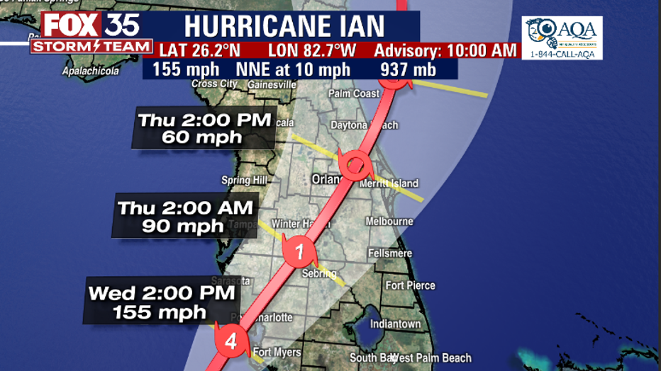
ORLANDO, Fla. - Hurricane Ian is heading toward Florida with landfall expected on Wednesday on the southwest part of the state. The system is now a major Category 4 storm, but is expected to weaken once it hits land.
According to the latest track released at 5 a.m. from the National Hurricane Center, Orlando and surrounding areas in Central Florida remain in the path of the storm. The track shows the system making its way through the Orlando area on Thursday afternoon possibly as a tropical storm.
FOX 35 Storm Team Meteorologist Allison Gargaro says on Wednesday at 10 a.m., residents should be in their safe place where they plan to ride out the storm for the next couple of days. Orange County Mayor Jerry Demings is asking residents to be off the roads by 2 p.m. Wednesday, but it is not a requirement.
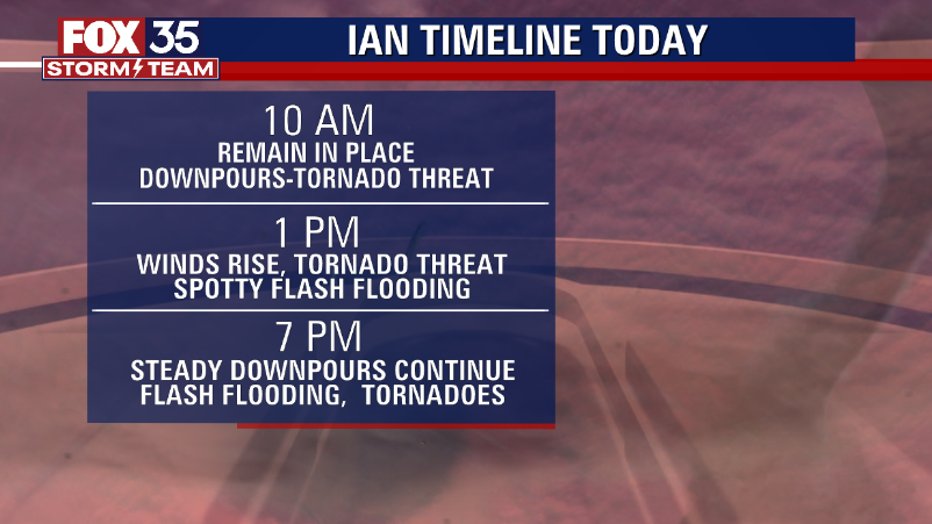
By 1 p.m. Wednesday, there is a tornado threat and risk of spotty flash flooding. By Wednesday night, even more downpours are expected with flash flooding and risk of tornadoes.
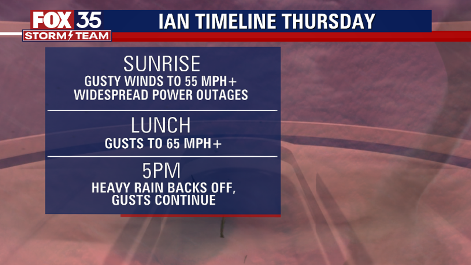
Sunrise on Thursday will bring gusty winds of 55 mph or more and widespread power outages are likely. By lunchtime, winds gusts increase to 65 mph+ but by 5 p.m., the rain back off but the wind gusts remain.