

Central Florida undergoes warm spell: Forecast for the week ahead

We Love Florida Forecast: Dec. 6, 2021
FOX 35 Storm Team Chief Meteorologist Jayme King takes a look into the future forecast as a front approaches.
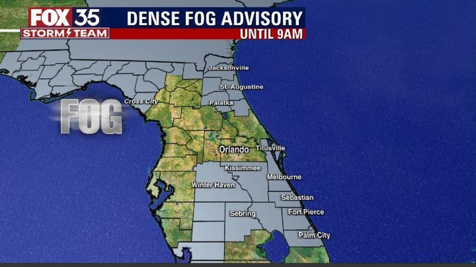
ORLANDO, Fla. - Looks like another foggy start to Monday in Central Florida.
Dense fog advisories are in play until 9 a.m., clearing from that point on. Skies will reveal a mixed look this afternoon featuring sun and clouds.
The 80s poke in for the afternoon. Expect warmth from the interior all the way to the coastal areas as a westerly breeze pushes the warmer conditions seaside.
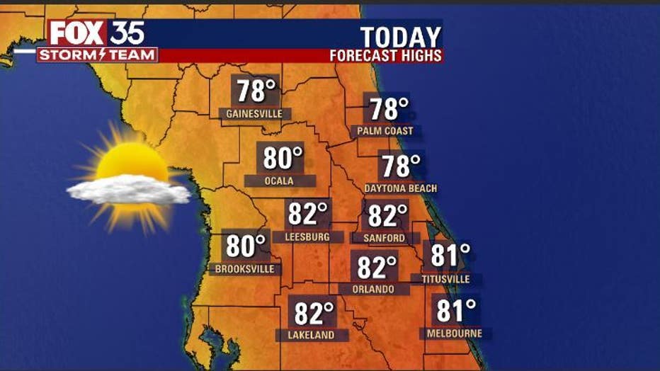
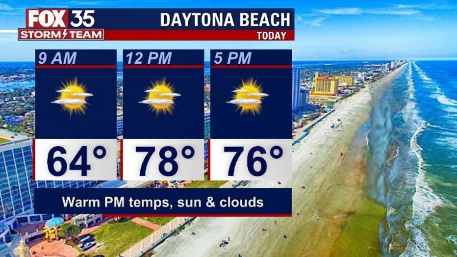
Areas like Daytona Beach should see some great weather on Monday. Highs there will be really close to 80 by the afternoon, with dry conditions and some sunshine.
WEATHER ALERTS: Download the FOX 35 Storm Team Weather app for live radar, severe weather alerts, and daily forecast reports on your phone
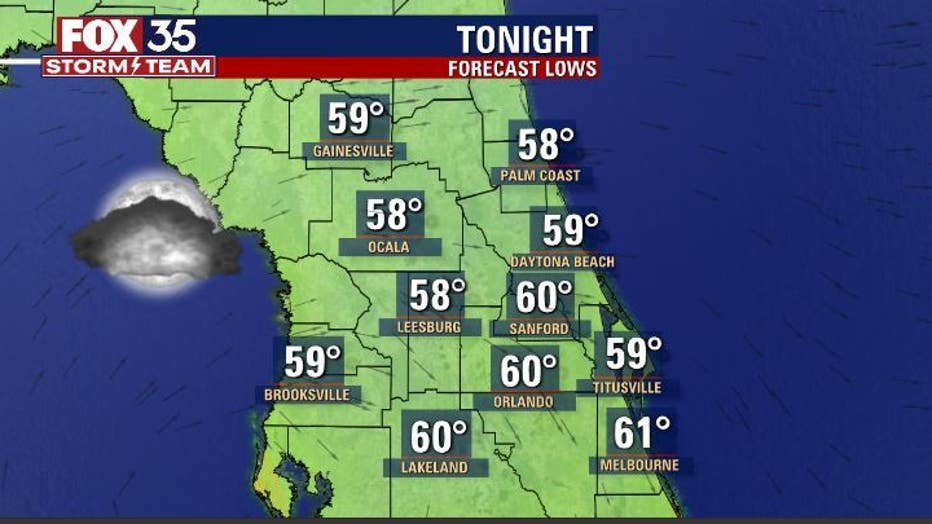
On Monday night, skies are partly cloudy with fog likely returning for the region. Advisories on the fog might be required early Tuesday morning.
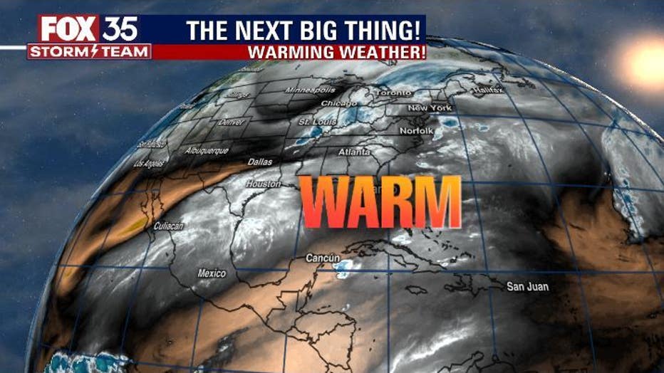
Our warm spell will remain in play for the week ahead.
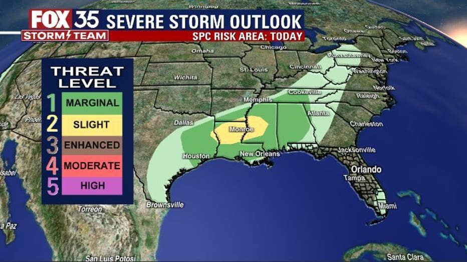
Closer to a cool front northwest of Florida, severe weather will be possible. Isolated damaging wind gusts and perhaps a tornado or two could be possible.
MORE NEWS: Still need a Christmas tree? What stock is like at Orlando tree lots
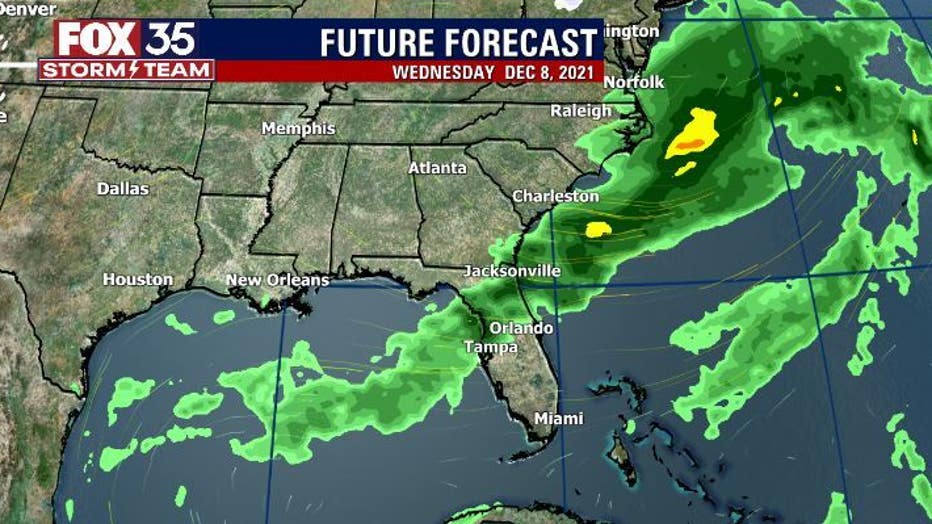
That front slides through Central Florida on Wednesday bringing just a few showers into the area. No cooldown is expected.
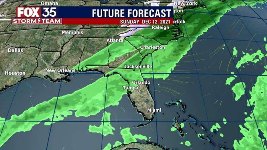
A stronger front approaches by late next weekend, Dec. 13. This system looks wetter and colder for the area.
Watch FOX 35 Orlando for the latest weather updates.