

Why did it rain so much in Brevard, Lake counties? High pressure and Hurricane Melissa
Rainfall totals: How much rain fell in parts of Lake County?
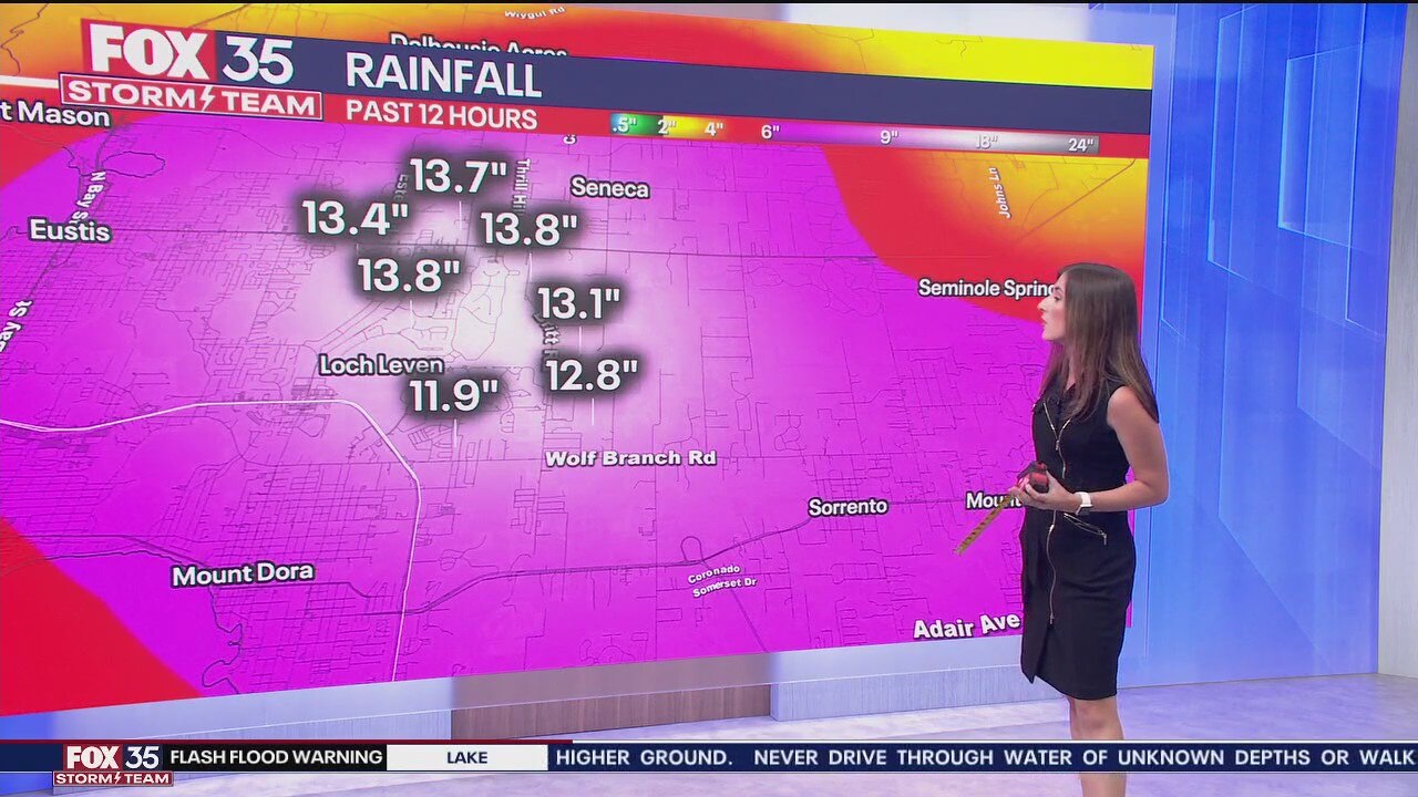
FOX 35 meteorologist Laurel Blanchard explains how much rain (estimated) has fallen in parts of Lake County over the last 12 hours, which led to a flash flood emergency being issued Sunday night.
Several inches of rain fell in parts of Brevard County and Lake County in Florida, causing major flooding along streets, roadways, and in some neighborhoods.
An emergency flash flooding alert – a rare weather alert – was issued for Lake County, and a severe thunderstorm warning and a tornado warning were issued for portions of Brevard County.
By FOX 35 Storm Track Radar estimates, several inches of rain – up to 13"+ – were reported in some spots. Official totals will be released soon.
What caused this heavy rain, flooding event?
North of Florida is a massive area of high pressure. South of Florida is Hurricane Melissa, a powerful major hurricane that's expected to bring catastrophic flooding and landslides to portions of Jamaica early this week.
Those two factors led to extra moisture that led to torrential rain along the coast.
1) Huge area of high pressure: The easterly wind coming off the Atlantic sparked the showers that formed earlier in the afternoon on Sunday. There is a huge area of high pressure over the Mid-Atlantic forcing moisture off the Atlantic into the East Coast of Florida. This was one factor that led to an immense amount of moisture in the atmosphere over Florida.
2) Moisture from Hurricane Melissa: Although Hurricane Melissa is hundreds of miles away from Florida, Melissa still had an influence on our weather. Melissa forced moisture northward, adding to the moisture in the atmosphere over Florida, leading to rain and thunderstorms.
With the moisture being forced into Florida from both of these systems, it created destructive flash flooding for communities in Central Florida.
Low pressure (from Hurricane Melissa) rotates counterclockwise. The high pressure to the north rotates clockwise. The "opposing" flow sandwiched between them is where central Florida was located Sunday evening.
There was a very strong push of moisture up in the clouds coming in from the east because of this flow between the hurricane and the high pressure.
This led to "training" showers and thunderstorms, referring to repeat showers and thunderstorms over a specific area, leading to heavy rainfall, saturated grounds, and flooding potential.
Think of it like train cars following one another on the track. The same thing can happen with storms.
The Source: FOX 35 meteorologist Laurel Blanchard explained what factors led to the heavy rainfall and flooding on Sunday in Brevard and Lake Counties.