Hurricane Ian projected track sends storm into Orlando: Timeline of arrival

Hurricane Ian’s path takes another shift with significant flooding expected
Hurricane Ian strengthened late Tuesday as it continues on its path to Florida. The National Hurricane Center said life-threatening storm surge, catastrophic winds, and flooding is expected with Hurricane Ian in the Florida peninsula.
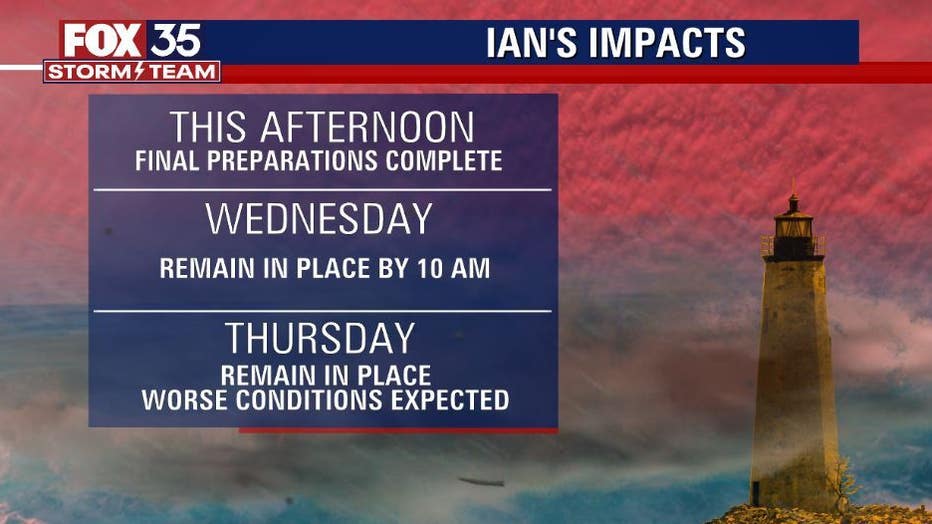
ORLANDO, Fla. - Residents are being urged to have their final preparations in place on Tuesday as Hurricane Ian threatens to make impact on Florida this week as a major hurricane.
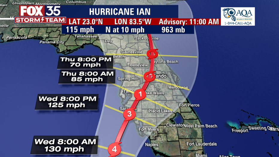
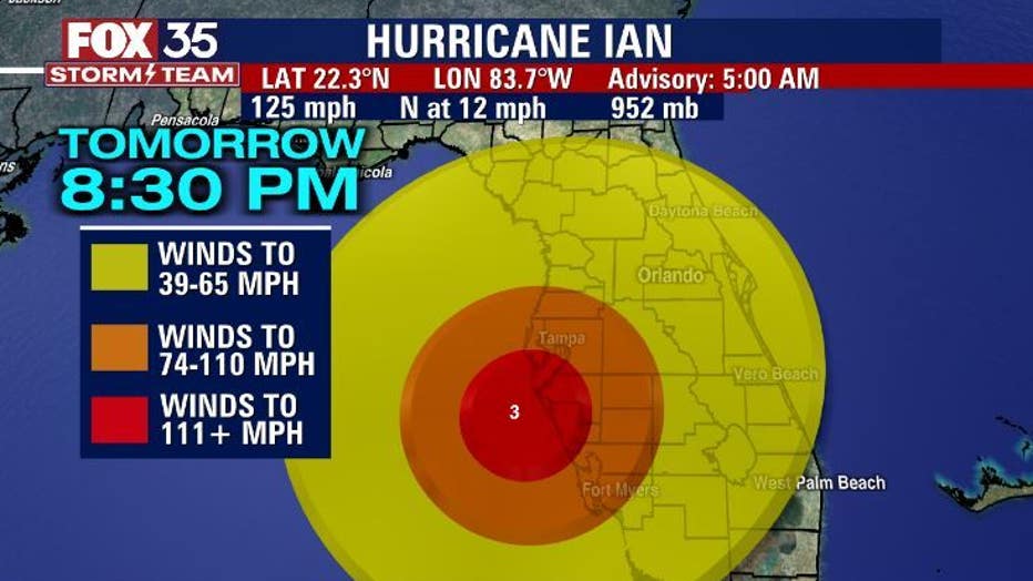
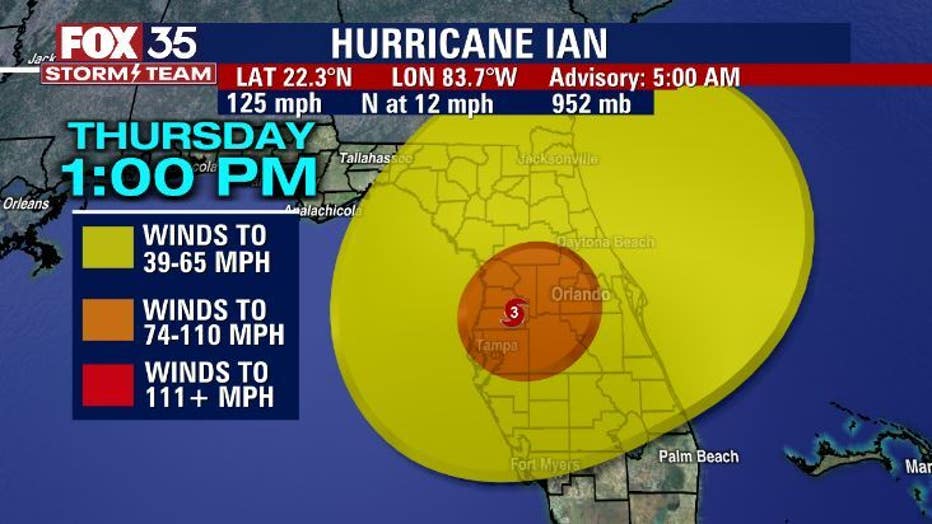
While Ian is projected to make landfall near Tampa Bay, the storm is expected to bring harsh conditions to all of Central Florida, so you should not let your guard down. The 11 a.m. track has Ian shifting more east over Central Florida.
"The new track sends Hurricane Ian right into Orlando as a diminishing Cat 1," said FOX 35 Storm Team Meteorologist Brooks Garner. "Prepare for long duration power outages and flooding rain."
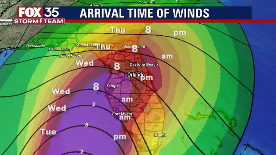
Here is the current timeline (as of Tuesday morning) of Hurricane Ian's arrival and impact on Central Florida counties:
TUESDAY
Weather conditions will continue to get worse starting Tuesday afternoon.
Hurricane warnings are now extended for Florida through Bonita Beach. A Hurricane Watch is in effect for Lake County. Tropical storm warnings are issued for Brevard, Volusia, Osceola, Orange, and Seminole counties. Tropical storm watches are in effect for Marion County.
A Hurricane Warning means that hurricane conditions are expected within the warning area. Preparations to protect life and property should be rushed to completion. A Tropical Storm Warning means that tropical storm conditions are expected within the warning area.
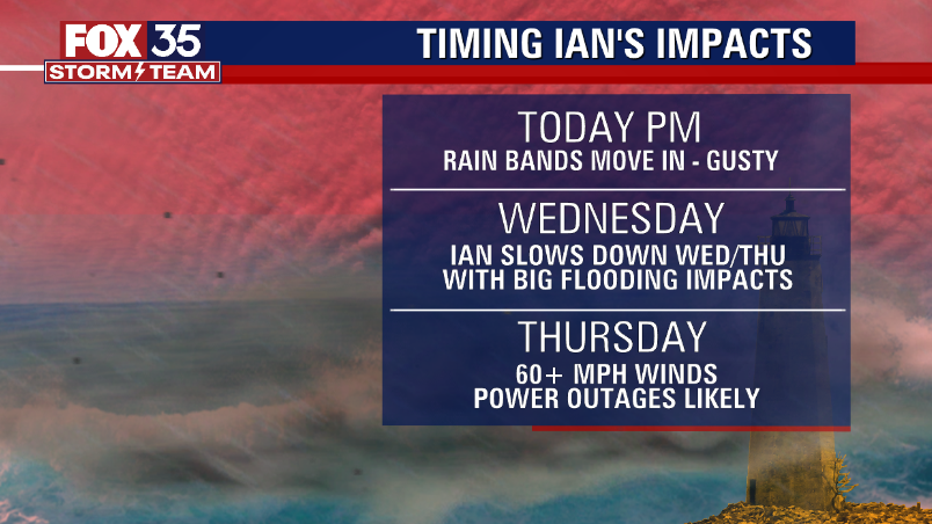
Heavy rain fall will also be a problem starting Tuesday. Flood watches continue across the area as outer rain bands from Ian start to move into the area this afternoon. The threat of severe weather including isolated tornadoes is also possible today, as the storm moves closer.
The FOX 35 Storm Team says to have your hurricane preparations done by today.
WEDNESDAY
Locally, around 8 a.m. on Wednesday morning, hurricane force wind speeds will be felt around Central Florida. As of now, hurricane-force winds associated with Ian extend outward up to 35 miles away from the center of the storm. Tropical-storm force winds extend outward up to 115 miles out.
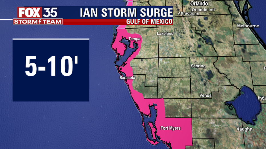

Storm surge will also be a major issue with Hurricane Ian. The deepest water will be along the immediate coast near the center of the storm. Tampa Bay will get the brunt of the storm surge expecting 5-10 ft. From the Suwannee River to the Anclote River expect 5-8 ft. storm surge is expected.
Impacts will even be felt on the opposite side of the Peninsula. Flager and Volusia County to Altamaha sound including the St. Johns River will see swells of 2-4 ft.
THURSDAY
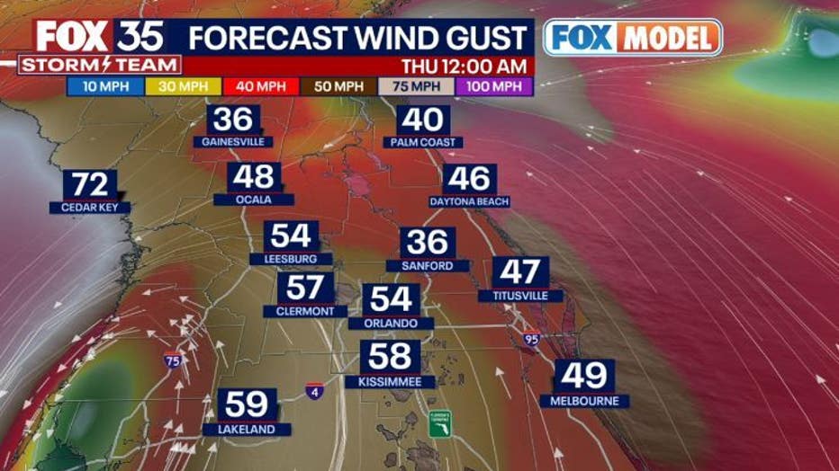
Through Thursday night, western portions of Central Florida can see between 12-16 inches of rain, with localized totals of up to 24 inches. The rest of Central Florida can expect 5-10 inches of rain, with local totals up to 12 inches.
RELATED: Hurricane Ian: Watches and warnings issued for Central Florida counties