

WATCH: EF-1 tornado touches down in Sarasota as storms sweep across state

EF-1 tornado touches down in Sarasota
A tornado was captured on camera by the Sarasota Police Department as a storm blew over the city on Wednesday afternoon.
LAKE MARY, Fla. - A tornado was caught on camera by the Sarasota Police Department as blew over the city on Wednesday afternoon.
The National Weather Service later confirmed that a very brief EF-1 tornado formed just after 2:15 p.m. with winds of approximately 90 mph.
There was damage to the roof of an industrial building on 10th street following an estimated 45-second touchdown.
WATCH: Large hail reported across Central Florida during storms on Wednesday
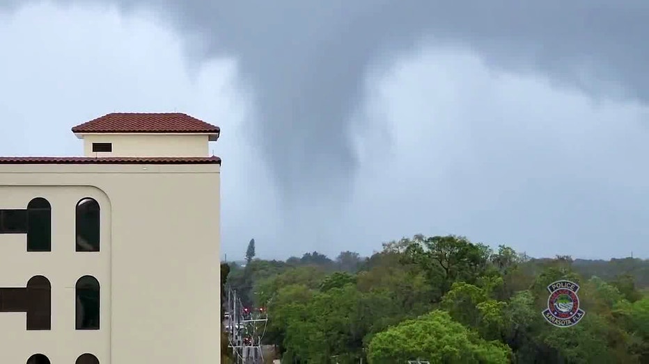
An EF-1 tornado touched down in Sarasota, Florida on Wednesday, March 16, 2022. [Courtesy: Sarasota Police Department]
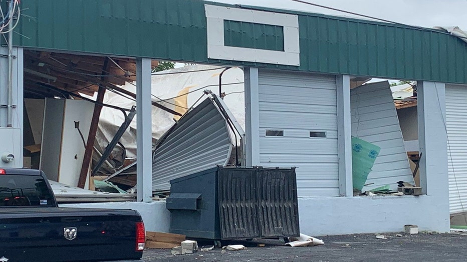
Courtesy: Kimberly Kuizon, WTVT-TV FOX 13
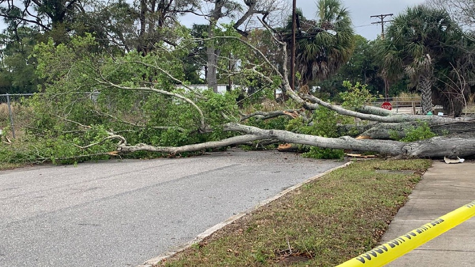
Courtesy: Kimberly Kuizon, WTVT-TV FOX 13
A Severe Thunderstorm Watch has been issued for several counties in Central Florida as another round of storms are developing Wednesday across the Southeast.
A strong low-pressure system tracking across the region is igniting more storms as a springlike weather pattern dominates the eastern half of the U.S. The same system will spark more storms Thursday.
Warm, humid air streaming northward from the Gulf of Mexico will be ingested into this storm system, providing the instability needed for the development of severe storms packing threats of large hail, damaging winds and an isolated tornado.
Watch FOX 35 News for the latest updates.