

Rain On The Way
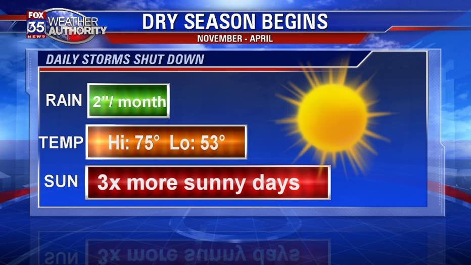
Orlando, Fl - Usually in late October we find the daily afternoon storms are a thing of the past and Central Florida starts to dry out fast! Our sandy soil can only hold so much water, so the periodic rain showers are needed. This November we are currently running below normal in rainfall so a nice round of rain would be welcome.
As I discussed in my past article https://www.fox35orlando.com/weather/heat-continues-through-winter this high amplitude jet stream pattern will lead to more frequent, and much stronger, cold fronts. Our next front is locked and loaded and ready to hit the area early Friday. The rainfall with this system will be much more generous with the Gulf of Mexico lending a hand. The rain should start up late Thursday evening and sweep out of here by mid-day Friday.
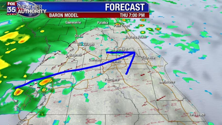
Unfortunately, the heavier rain is not expected to fall in the areas that need it the most. Right now Daytona has a rainfall surplus of 9"+, while Orlando has a rainfall deficit of 4". We need Friday's heavier showers to move into the Orlando area, but right now it appears that the heavier showers over Ocala and Lady Lake will weaken as they shift south into Orange county. With this being our "dry" season we are happy to get whatever we can. GR