

Heat Continues Through Winter
Orlando, Fl - After a record breaking October heatwave it appears this large-scale weather pattern is locked in. Most long-range models show a persistent trough in the middle of the U.S. which will pull up warmer than normal temperatures across Florida.
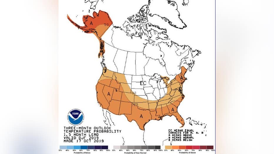
NOAA confirms above normal temperatures are likely for Florida and most of the southeastern U.S.. It does not mean we will not have cold fronts. I expect for us to get some wild extremes this Winter season with strong cold fronts slicing across Florida with strong storms and numerous rounds of arctic chill. To compensate for that, we will find many days of 80+ temps and record breaking highs. When all is said and done we will end up with above normal temperatures for the three month period starting in December.
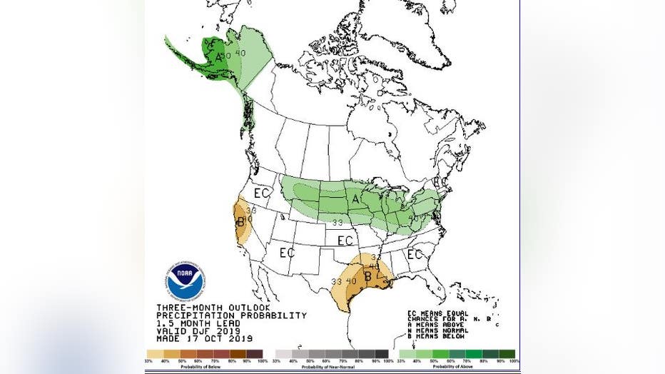
The active jestream pattern will lead to above normal precipitation across the Midwest and Northeastern U.S. Overall we will end up with normal rainfall across Florida due to the wild swings in the jestream which will produce many days of dry weather, in addition to the periodic cold fronts and rainfall. So don't expect a wet Winter, but rather many days of dry weather conditions to offset those stormy days.
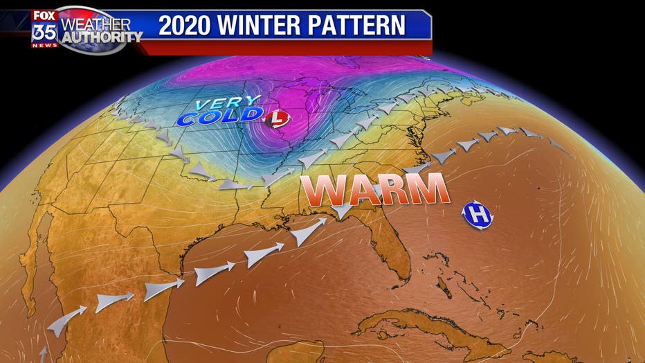
Most of our Winter season will look something like this. A deep trough with stormy conditions in the Midwest and very dry conditions and plenty of additional fires out in the western U.S.. A large high pressure center near Bermuda with very warm weather for Central Florida with periodic cold fronts. In years past this scenario produces major tornado outbreaks across the deep south where the airmasses clash and the upper level winds are strong. GR