

Incoming system brings possibility of severe weather, heavy rainfall, damaging winds, and isolated tornadoes

Weather Forecast: April 12
FOX 35 meteorologist Mike Linden gives the latest on the weather in Central Florida.
ORLANDO, Fla. - The rising risk of dangerous weather will be on the minds of many this Easter Sunday.
The current Storm Prediction Center forecast shows a moderate, enhanced risk of severe thunderstorms over the South Gulf area on Sunday, with a slight risk over from East Texas to Eastern Georgia.
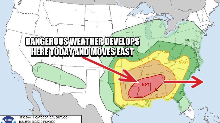
The potential for damaging tornadoes in the 'moderate, enhanced risk' area will develop Sunday afternoon.
Then on Sunday night, the strongest area of energy will move east, closer to the southeast Atlantic Coast. A few strong storms could possibly work into north Central Florida before sunrise on Monday. Heavy rains and damaging wind gusts would be the main threats during that time.
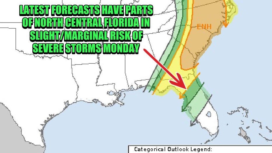
On Monday, the Storm Prediction Center is forecasting a slight risk of severe weather for north Central Florida with a marginal risk working south and down the Florida Peninsula. Residents in these areas should be aware of the possibility of rapidly changing conditions. Storms that do develop could spawn very heavy rainfall, damaging wind gusts, and even a few isolated tornadoes.
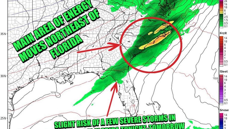
As of Sunday morning, the latest GFS forecast modeling showed the core -- or most energetic air -- remaining mainly north of the Florida Peninsula, Meanwhile, the southern end of the system over Florida begins to weaken.
It is important that Florida residents keep their guard up as much can change and any adjustment of this system further south could bring bigger impacts to Central Florida.
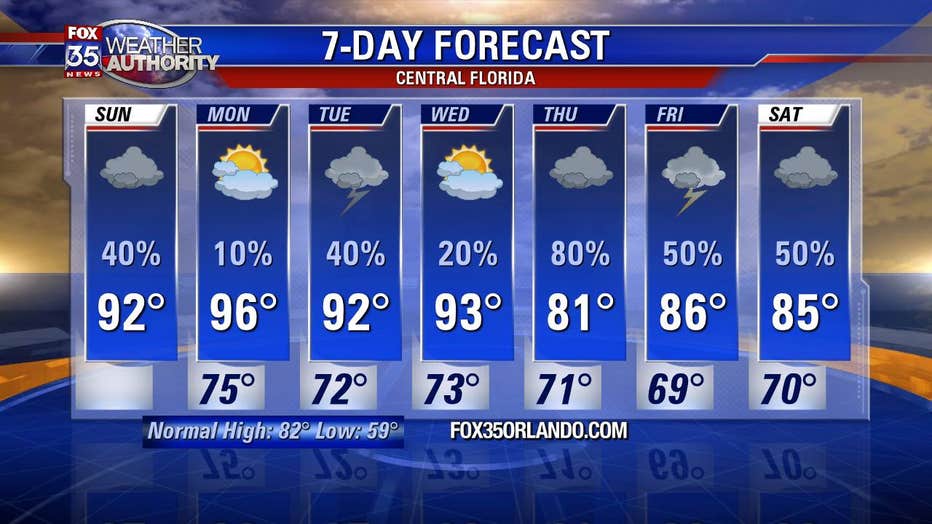
Following the possible severe weather, Central Florida will continue to experience warm weather with highs in the 90s.
Download the FOX 35 Weather App to track the storms and get the latest daily forecast reports.