

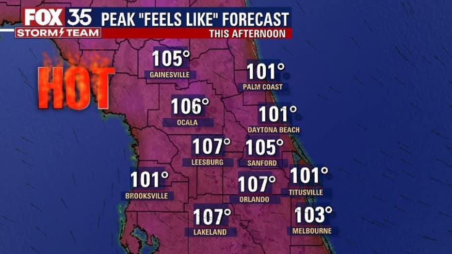
Heat index will reach 107 degrees in parts of Central Florida on Wednesday

Weather Report: August 18, 2021
FOX 35 Storm Team Chief Meteorologist gives the latest on the weather in Central Florida.
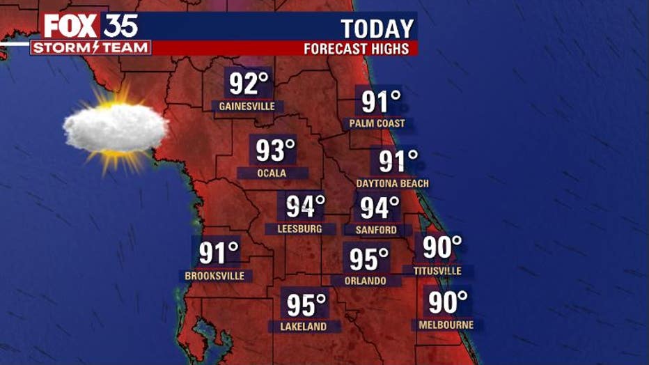
ORLANDO, Fla. - The sizzle of summer returns to Central Florida on Wednesday!
Area highs will soar into the mid-90s in many communities during the afternoon hours. Even along the immediate coast, highs will hit at least 90 degrees despite afternoon development of the Atlantic sea breeze. Skies will remain mostly sunny for much of the day with only a slight increase in p.m. cloud cover.
Many factors will be at play this afternoon causing the temperature to spike. Factor in high levels of humidity and you have got the recipe for a sharp rise in the heat index – or "feels like" temperature – during the afternoon heating cycle.
If you have plans outdoors, a good quality sunscreen is always a good bet. Also, make sure you are hydrating as heat-related illnesses can strike quickly and can really cause issues. Consider hanging out in the A/C if you can as breaks away from the heat will keep you safe.
MORE NEWS: Tracking the Tropics: Grace and Henri could become hurricanes
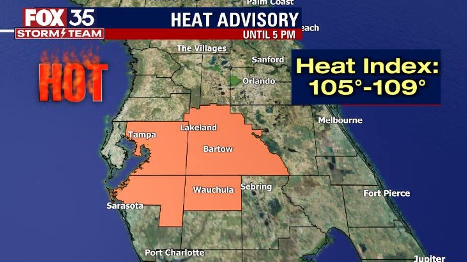
Currently, a Heat Advisory is in effect for Polk County and areas closer to Tampa. Heat index values in the advisory area could soar closer to 110°. The advisory will go until 5 p.m. Wednesday but temperatures will be slow to fall through the evening hours.
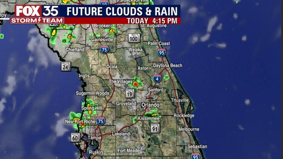
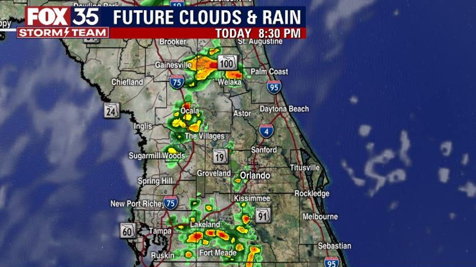
Rain chances will be around for the mid to late afternoon and up until sunset. There is some drier air on top of the state currently, so naturally, overall coverage will be a bit lower compared to days past. Much of the rain will fire up around or just west of the I-4 corridor, plowing closer to the I-75 corridor and the western Gulf as sundown approaches.
WEATHER ALERTS: Download the FOX 35 Storm Team Weather app for live radar, severe weather alerts, and daily forecast reports on your phone
Heavy rain and cloud-to-ground lightning will be the main hazards.
Watch FOX 35 Orlando for the latest weather updates.