

Heat and storms will kick off the weekend in Central Florida
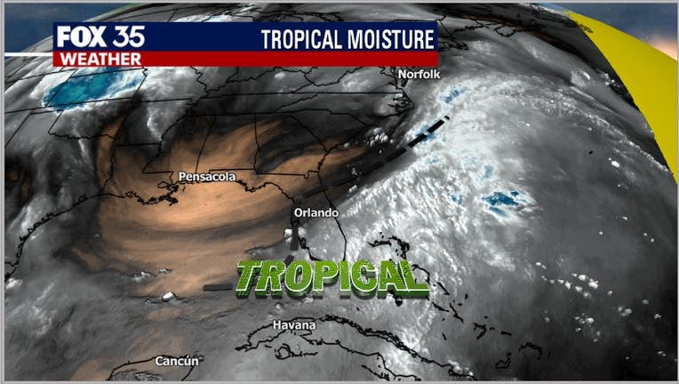
Orlando, FL - Well, unless you live in an underground cellar, you know it's been rather tropical feeling across Central Florida lately.
This taste of the tropics, unfortunately, doesn't come with a pina colada, but it does bring some very sweaty and at times extremely wet weather. This exact pattern is in play again today on this Friday with a little drying in the cards for this Saturday and Sunday.
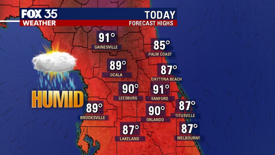
Expect another very warm day across the region.
Highs near 90 inland will mix with the tropical air making things feel a lot warmer overall. Once the rain moves in, temps should fall a bit by late afternoon and of course into the overnight hours.
Cooler numbers can be found along the coastal areas today as the Atlantic sea breeze will keep temps in check there with highs in mid-upper 80s.
If you happen to be getting some outdoor activities in, especially in the interior areas of Central Florida, use caution!
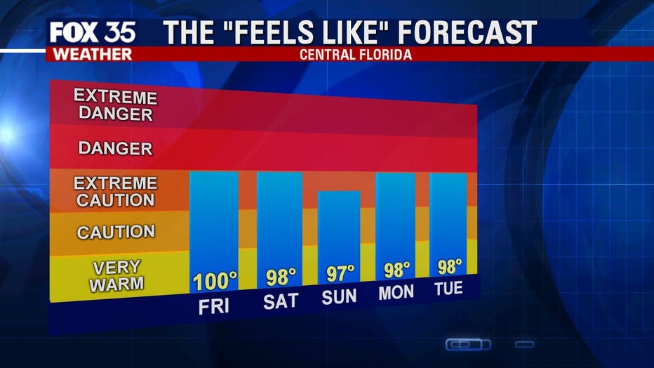
Staying hydrated and taking breaks in some A/C will be just what the doctor ordered or you might actually find yourself in a doctor's office. The "Feels like" forecast heads for a number near 100 degrees today.
Highs near 92 degrees combined with the tropical airmass will make it feel quite hot during peak afternoon heating.
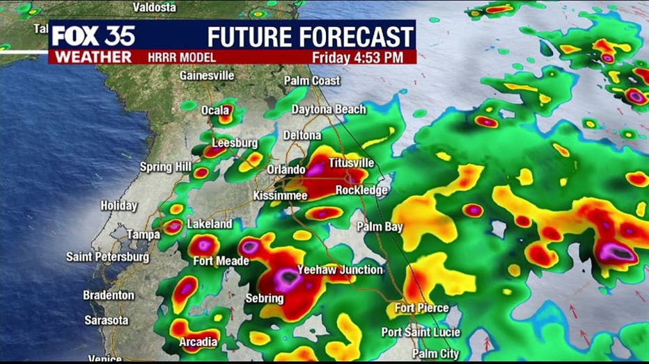
Our rainfall forecast models in the FOX 35 Weather Center are pointing towards a stormy afternoon.
Rain chances will rise rapidly after 12pm. Coverage will peak at 70% around Orlando, lower up near Ocala and Gainesville at 40%. Heavy rain, lightning, and even some small hail will be possible.
Remember, you can track storms in real-time on the FOX 35 Weather App! Storm tracks, warnings, and push alerts are all included!