

Changing wind brings red tide threat back to Florida
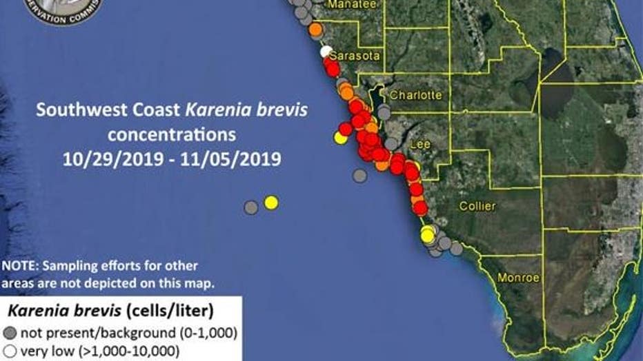
Orlando, Fl - Our upcoming cold fronts later this week and next week may bring back the red tide to the southwest coast of Florida. The past few weeks, a persistent easterly wind has helped in blowing the harmful marine algae, Karenia brevis, offshore. Currently, there are clusters of high levels being reported by the Florida Fish and Wildlife Conservation Commission along the southwest coast that is leading to fish and bird kills, in addition to irritating lungs for us landlubbers.
Our wind direction this week has helped a bit by blowing the red tide cells offshore. The most recent front never changed the wind direction across southwest Florida, but it appears all good things must come to an end. You can see below the current surface wind direction ahead of our Friday cold front.
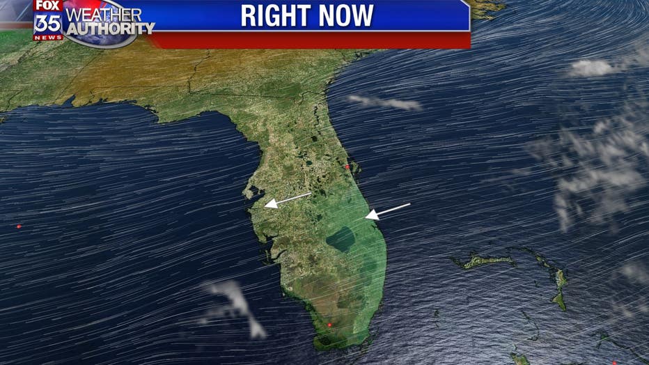
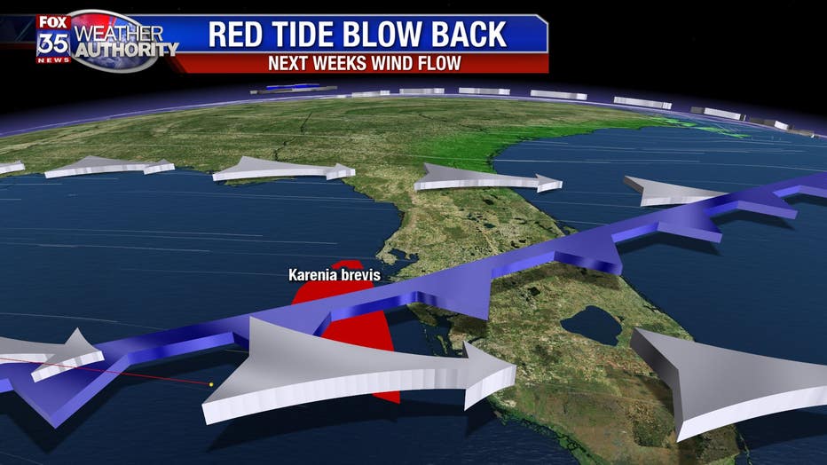
Friday's cold front will be strong enough to make it down to the north Florida Keys and will allow the wind direction to change for a few days. Instead of an east-northeast wind, the direction will switch and come in from the north-northeast. Later next week another front will move through and produce a north-northwest wind flow pattern that will begin to blowback the red tide toward the coast.
For weekly updates on the status of the red tide, you can check out this link, visit MyFWC.com. Also, you can monitor the wind direction across the state by using our FOX 35 Weather App for Apple or the FOX 35 Weather App for Android.