

Central Florida heat index could hit 110 degrees as afternoon storms approach

Weather Report: August 22, 2021
FOX 35 Storm Team Meteorologist Allison Gargaro gives the latest on the weather in Central Florida.
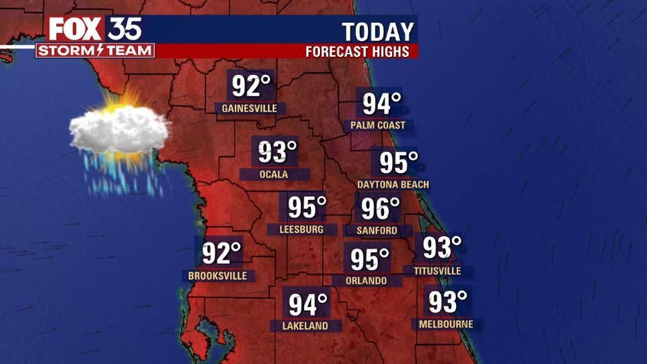
ORLANDO, Fla. - Sunday will be another hot and humid day across Central Florida.
Afternoon highs will be in the mid to upper-90s. Daytona Beach has the best chance of breaking its daily record high of 96 degrees, which was set back in 2016.
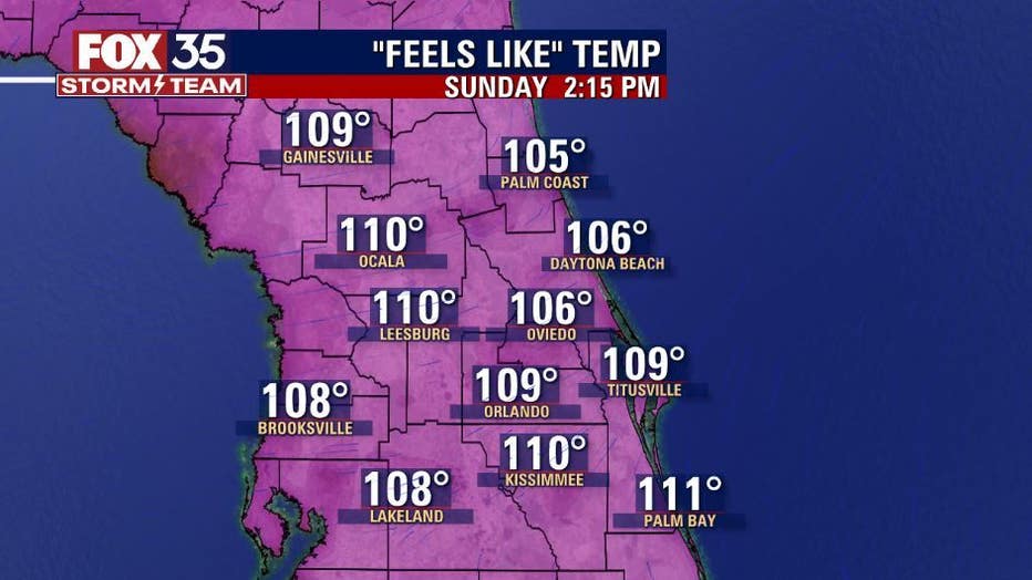
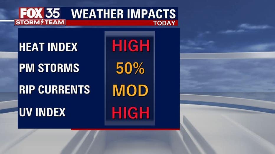
Heat index readings will range from 101 to 106 degrees, with the potential for even higher in some locations. Make sure you stay hydrated and reapply sunscreen as the UV Index remains high. If you were planning on cooling off in the Atlantic, here’s a friendly reminder of the moderate risk for rip currents.
WEATHER ALERTS: Download the FOX 35 Storm Team Weather app for live radar, severe weather alerts, and daily forecast reports on your phone
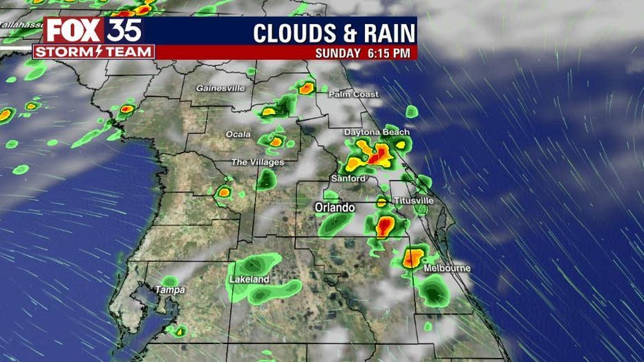
Afternoon and evening storm chances increase to 50 percent coverage Sunday. There is the chance for brief downpours, frequent lighting, and gusty winds with any storm east and south of I-4.
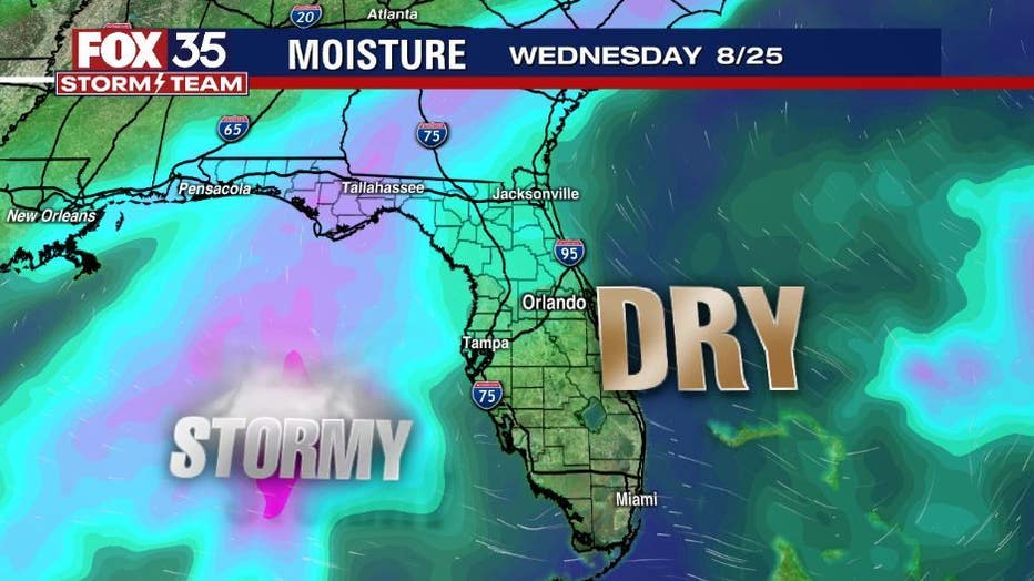
Rain chances stay elevated through Tuesday. Beginning on Wednesday, drier conditions return.
TRACK THE TROPICS: Henri downgrades into tropical storm on path towards northeastern U.S.
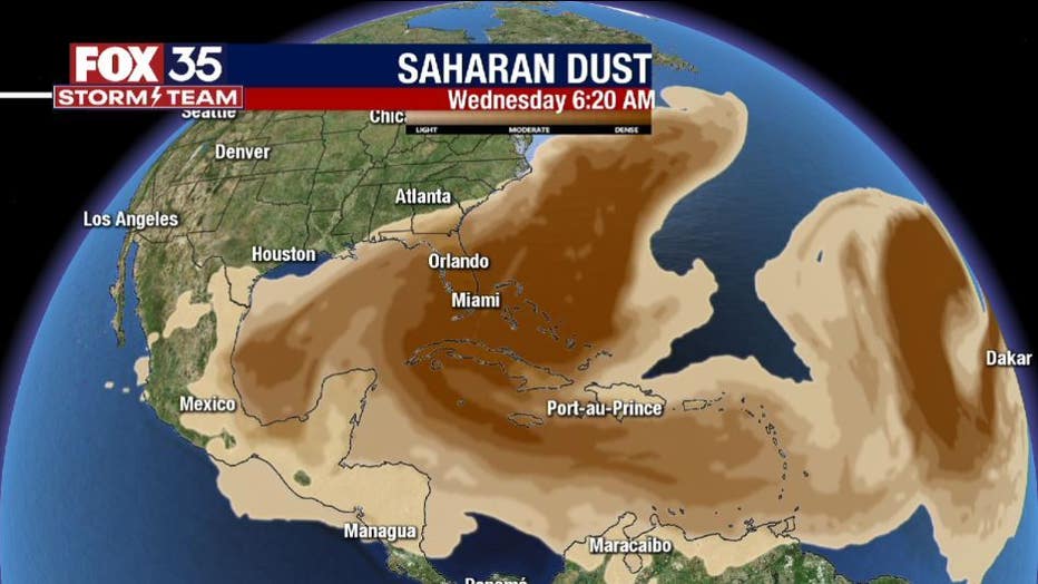
A plume of Saharan dust is currently making its way across the tropical Atlantic. It will arrive in Florida on Wednesday, dropping rain chances to 30 percent coverage.
You can depend on the FOX 35 Storm Team to bring you the latest weather update from across Florida and the tropics.