

Orlando weather: Cloudy skies with a few scattered showers possible through the night

Orlando AM Weather Forecast: May 3, 2025
More widespread rain chances on tap for the back half of the weekend into early next week. Meteorologist Laurel Blanchard has the timeline and storm threats to expect for the rest of the weekend.
ORLANDO, Fla. - The skies will remain cloudy with a few scattered showers and stray thunderstorms through the rest of the night across Central Florida.
What will the weather look like tonight?
What To Expect:
We are seeing partly and mostly cloudy skies across the region for the rest of the evening.
A few scattered showers and stray thunderstorms are possible.
We may maintain a few of these storms through the overnight, but most will fizzle in the early overnight hours.
Lows will drop into the 60s and lower 70s tonight with partly cloudy skies.
What will the weather look like tomorrow?
What's next:
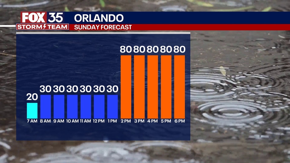
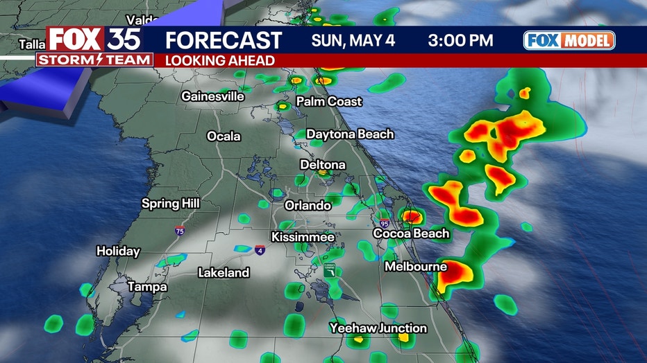
Sunday morning will start off calm with a few scattered showers, but our rain and storm chances will increase by the afternoon.
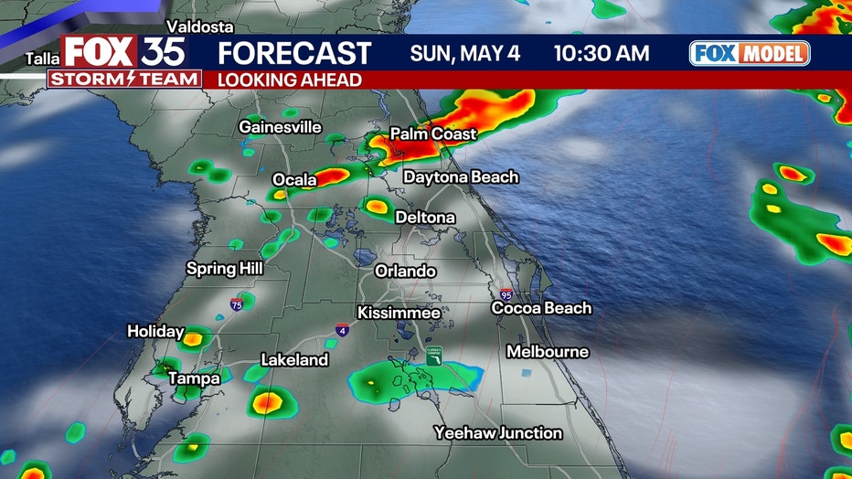
The system that has been once again firing up severe weather across the southeast and will push across Florida through the day tomorrow.
With the cold front interacting with the sea breeze storms, it will lead to not only more storms than what we saw on Saturday, but some of these storms could be on the stronger side.
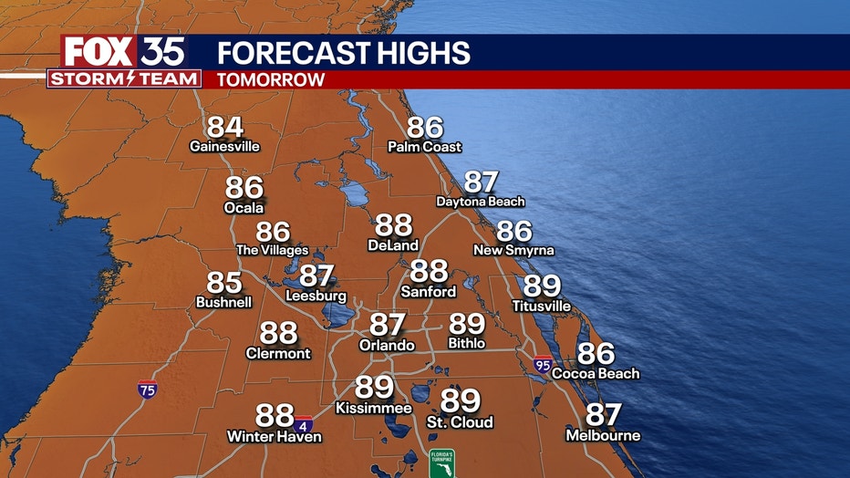
Highs round out in the upper 80s on Sunday, which will add that factor of instability to the atmosphere and may allow the storms to become strong.
Sunday storms on the way
Why you should care:
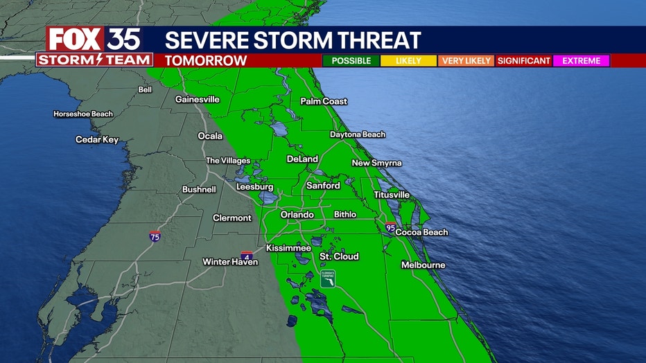
Tomorrow, most of the region is under a marginal risk or a level one-out of-five for seeing severe weather.
This means that we could see a storm or two become strong or severe.
The main threats tomorrow are heavy downpours, gusty winds and hail.
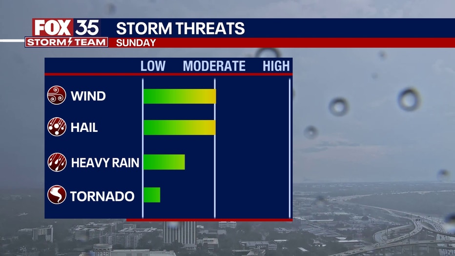
Because of the front interacting with the seabreeze tomorrow afternoon, there is a small chance of a quick spin up.
Although small, it is not zero, so this is something that we will be watching closely.
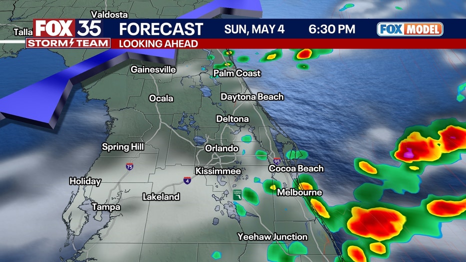
Showers and a few storms will linger through the night with lows dipping back into the upper 60s and low 70s.
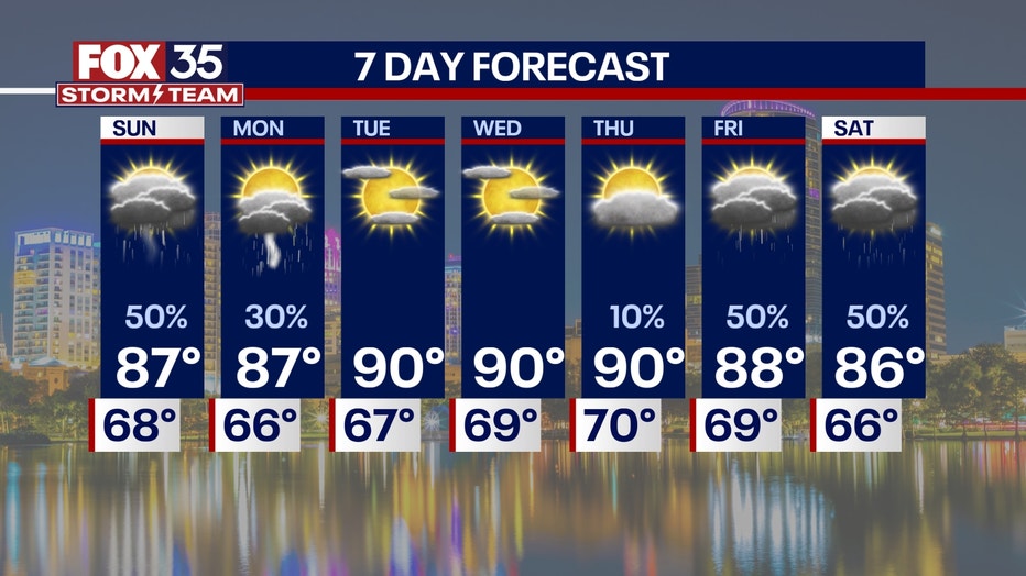
What will the weather look like next week?
Dig deeper:
To start off the workweek on Monday, the front will cool things down.
Seabreeze storms will kick back in on Monday afternoon with chances for showers and storms rising into the afternoon and lingering through the evening.
Parts of our region will also be at a marginal risk of an isolated severe storm, and hit-and-miss storms pop up in the afternoon.
With the front from Sunday bringing in colder air, hail becomes a bigger concern for Monday's storms.
Gusty winds are also a threat again with a very low, but not zero, chance of a quick spin up.
After the front clears out on Monday, high pressure takes back hold, and temperatures rise back into the low 90s with sunshine back in the forecast.
FOX 35 Storm Tracker Radar and Live Weather Cameras
Track live when storms move across your area using the FOX 35 Storm Tracker Radar below. You can also watch as heavy rain moves across Central Florida on our Live Weather Cameras' page here.

More radar maps from FOX 35 Storm Tracker Radar
- Brevard County
- Flagler County
- Lake County
- Marion County
- Osceola County
- Orange County
- Polk County
- Seminole County
- Sumter County
- Volusia County
- U.S./National Radar
STAY CONNECTED WITH FOX 35 ORLANDO:
- Download the FOX Local app for breaking news alerts, the latest news headlines
- Download the FOX 35 Storm Team Weather app for weather alerts & radar
- Sign up for FOX 35's daily newsletter for the latest morning headlines
- FOX Local: Stream FOX 35 newscasts, FOX 35 News+, Central Florida Eats on your smart TV
The Source: This story was written based on information shared by the FOX 35 Storm Team on May 3, 2025.