

Orlando weather: Severe storms threaten parts of Central Florida Thursday evening
ORLANDO, Fla. - Residents across Central Florida are being advised to prepare for potentially severe weather on Thursday evening, particularly in areas east of Interstate 4.
A slight risk of severe thunderstorms has been issued for Brevard, Flagler, Orange, Seminole and Volusia counties. Forecasters say multiple storms in these areas could reach severe levels, with the potential to produce damaging wind gusts and large hail.
The rest of the region remains under a marginal risk for severe weather, meaning isolated strong storms are possible.
What will the weather look like tonight?
What to expect:
FOX 35 has declared Thursday a Weather Impact Day.
The strongest storms are expected before 10 p.m., with primary threats including wind gusts topping 50 mph, hail, heavy rainfall capable of causing flash flooding, frequent lightning, and a low chance of a brief tornado.
The evening commute could be significantly affected, as downpours are likely to reduce visibility on roadways. Drivers are urged to use caution.
"We are going to have a very active evening, and I do expect we'll have a lot of storms that will be stronger than Wednesday night, and more widespread," said FOX 35 Storm Team Meteorologist Noah Bergren. "They’ll also end earlier than last night."
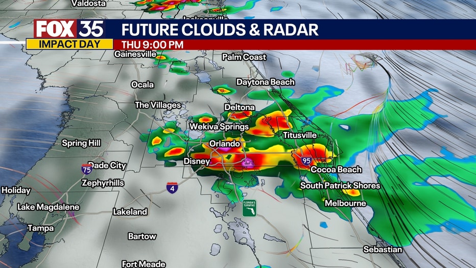
Storms are expected to taper off later Thursday night as daytime heating diminishes. Conditions will remain muggy, with overnight lows in the upper 60s to low 70s and lingering cloud cover.
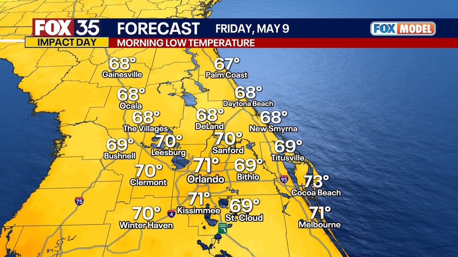
What will the weather look like on Friday?
What to expect:
On Friday morning, lows will dip into the upper 60s to the low 70s.
Highs for the day will reach into the upper 80s under a mix of sun and clouds.
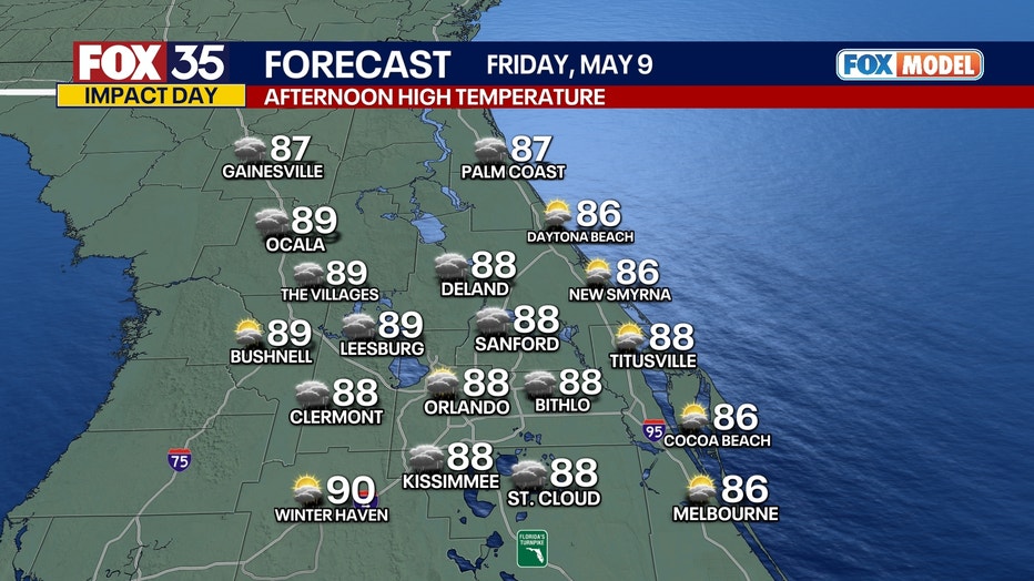
The weather pattern features more of the same, with more afternoon thunderstorms likely as daytime heating interacts with lingering moisture.
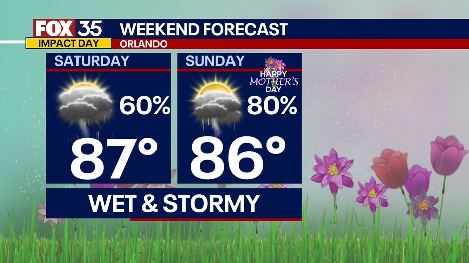
Orlando weather this weekend
Looking ahead:
Rain chances decrease slightly for Saturday and Sunday, appearing more scattered. This would mean better news for any Mother's Day plans with the moms out there! Plan for highs in the mid to upper 80s humidity continues.
A low-pressure looks to develop over the Gulf into early next week. This system is expected to bring additional moisture into the region, enhancing the likelihood of showers and storms. Heavy rain will be a safe bet for many on Monday and into early Tuesday morning.
The potential of a few strong storms exists during this same timeframe as well, but it's still a little too far out timing wise to get into a lot of the specifics. Be sure to stay close to the forecast and FOX 35 Storm team for the latest updates on our rain and storm chances in the coming days.
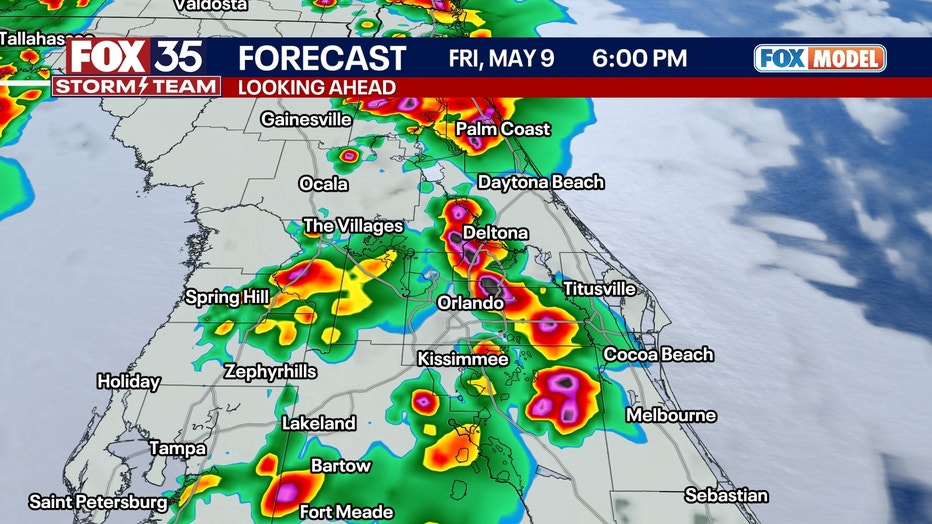
Orlando weather next week
Next Week:
A low-pressure looks to develop over the Gulf into early next week. This will sweep through the area, bringing widespread rain and storms on Monday and Tuesday. Heavy rain and a few strong storms are expected with this big wave of moisture. The timing of the worst is a little too far out to pin down yet, but it will be a wash out of a day to start off the workweek.
Orlando 7-Day Weather Forecast

FOX 35 Storm Tracker Radar
Track live when storms move across your area using the FOX 35 Storm Tracker Radar below.

More radar maps from FOX 35 Storm Tracker Radar
- Brevard County
- Flagler County
- Lake County
- Marion County
- Osceola County
- Orange County
- Polk County
- Seminole County
- Sumter County
- Volusia County
- U.S./National Radar
Stay connected with FOX 35
- Download the FOX 35 News app for latest news, weather, and traffic alerts
- Download the FOX 35 Storm Team Weather app for live, interactive radar
- Visit FOX35Orlando.com/weather for interactive radar, plus updated weather graphics, maps, and images
The Source: This story was written based on information shared by the FOX 35 Storm Team on May 8, 2025.