

Central Florida sizzles, rising rain chances this weekend

Weather Forecast: July 22, 2022
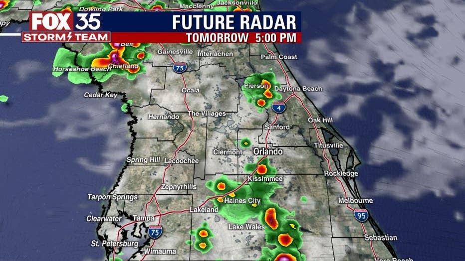
Orlando and Central Florida will continue to experience near-record heat over the next few days. Friday afternoon showers could linger into the evening hours over western portions of our viewing area.
WINTER PARK, Fla. - WHAT IS THE WEATHER FORECAST FOR TODAY AROUND ORLANDO?
Tonight’s forecast low: 76 degrees
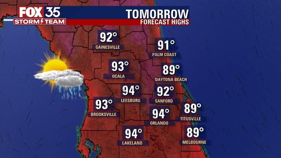
Tomorrow's forecast high: 94 degrees
MAIN WEATHER CONCERNS:
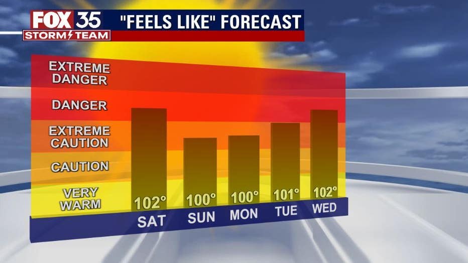
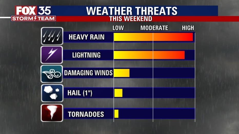
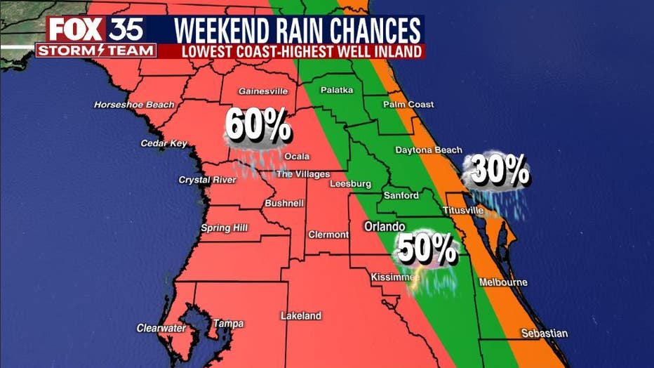
We have a hot weekend ahead. Temperatures will be in the low to mid-90s across the interior and upper-80s along the coast with feels like temperatures soaring to the triple digits. Showers and storms will be at 30% coverage along the immediate coast and 50% coverage inland. The shower and storm activity will be scattered across the interior of the Florida peninsula. You can expect frequent lightning, gusty winds up to 40 mph, and heavy rainfall within these storms.
WHAT IS THE WEATHER FORECAST FOR WALT DISNEY WORLD, UNIVERSAL, AND SEAWORLD?
It will be another hot day at the theme parks this weekend. Afternoon highs will be near 94 degrees with a lot of sunshine. Keep your sunscreen handy. Showers and storms are possible, and the rain will start around 3 pm each afternoon. Remember, when thunder roars, go indoors.
WHAT IS THE WEATHER FORECAST FOR THE BEACHES IN CENTRAL FLORIDA?
If you are headed to the Atlantic beaches this weekend, the chance for storms will be at 30% along the immediate coast. Temperatures will be warm in the low-90s with a high UV Index so reapply your sunscreen. There is a moderate risk of rip currents.
LOOKING AHEAD:
Rain chances will be around 50%+ coverage this weekend. It will be warm with temperatures heating up to the widespread mid to upper-90s. Feels like temperatures soar to the triple digits, so stay safe in this heat. The tropics remain quiet with no tropical activity expected within the next 5 days. The FOX 35 Storm Team continues to monitor the tropics this hurricane season.
The tropics are quiet with storm formation not expected for the next 5 days.