

Winter Weather? Not in Florida!
ORLANDO, Fl -
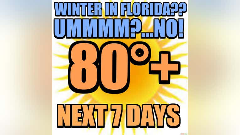
Forecast modeling coming into the FOX 35 Weather Center are indicating a HUGE surge in temperatures all across Florida as we head into the weekend. Typical or "average" highs this time of year should be in the low-mid 70s, lows/wake up temps closer to the lower 50s. This will not be the case over the next 7 days as temperatures soar above the norm.
A giant area of high pressure will anchor out over the Atlantic starting today. This feature will provide the State with gusty Easterly breezes, this alone will increase temperatures both day and night through today and tonight. Friday brings breezes from the Southeast and another boost in local temps bringing highs up to the 80 degree mark. Clouds will also increase with a few showers possible Friday, coverage is quite low though at 30% or less.
As the Atlantic High changes it's location over the Atlantic, winds will develop a bit more out of the South sparking yet another increase in the warmth. Solid low-80s will call Central Florida home both Saturday and Sunday, breezy weather will continue. Skies will feature a blend of sun and clouds.
Looking deeper into the forecast for next week, the high remains firmly in place and the conveyor belt of warmth continues streaming into the region. This simply means no cold fronts for the Sunshine State and above normal temps as we head into mid-January!