

Warm up comes before next strong cold front this weekend
ORLANDO, Fla. - Happy New Year Central Florida!
You'll need a jacket out the door, as early morning temperatures are in the 40s and 50s.
We'll start the New Year sunny and pleasant, with temperatures warming to the upper 60s, some low 70's under mostly sunny skies.
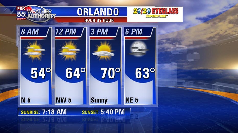
High pressure over the Gulf of Mexico is causing our winds to be out of the north today.
As that high pressure moves east, toward the Atlantic Ocean, our winds will become more south-southeasterly tomorrow, and out of the south on Friday.
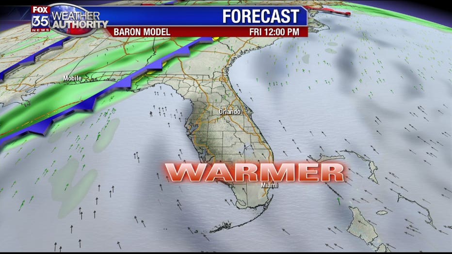
That will mean warmer weather, with temperatures near 80 degrees Thursday, and in the low 80s on Friday.
Our next cold front approaches the state Friday night, moving over Central Florida early Saturday morning.
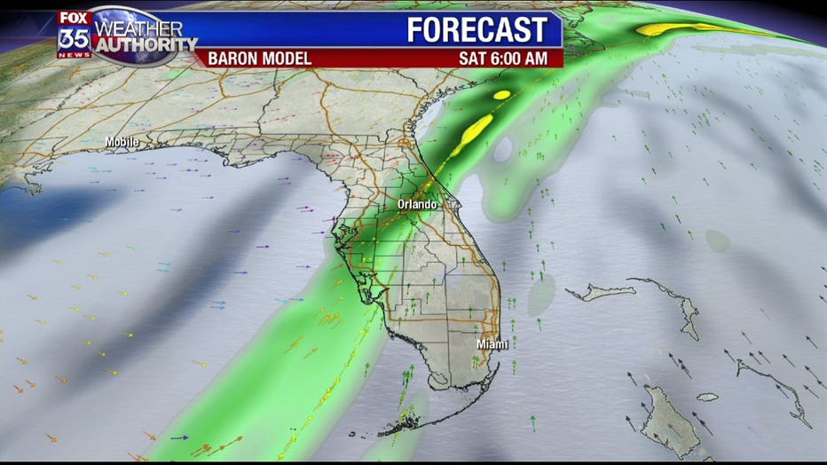
According to the latest model guidance, the front will move quickly over the state, with improving conditions by Saturday afternoon.
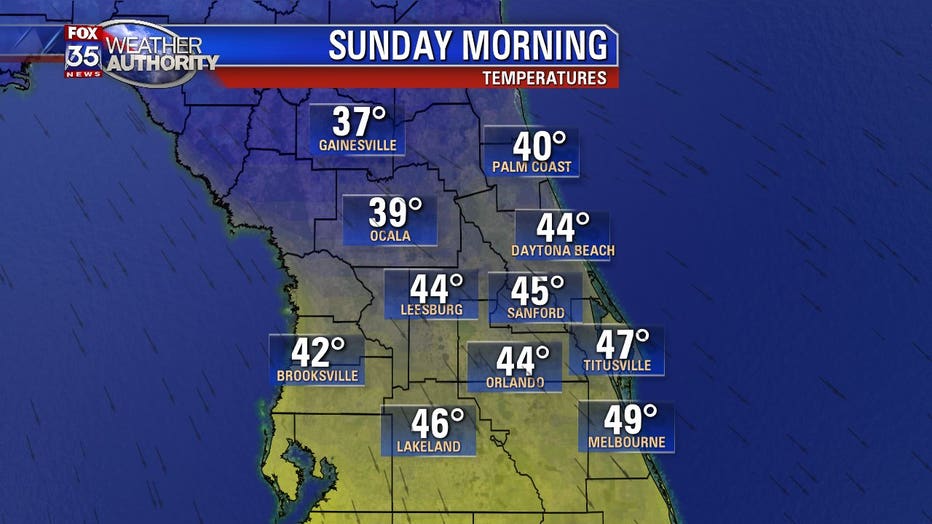
The coldest air will arrive Sunday morning, with wake-up temperatures in the 30s and 40s.
High pressure will settle in and conditions will improve as we start our first full work week of 2020.
Expect cooler and comfortable weather through mid-week.