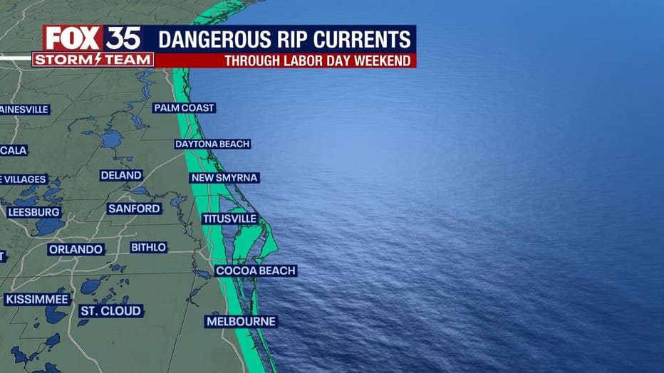
Orlando weather: Rip current risk remains high due to remnants of Idalia

Orlando Weather Forecast: September 3, 2023
FOX 35 Meteorologist Ian Cassette has a look at the weekend forecast in Orlando and Central Florida.
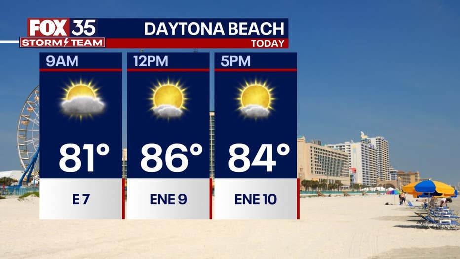
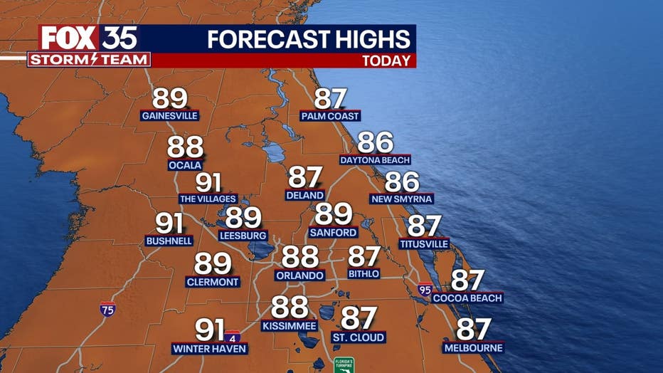
Today's high: 88 degrees
Tonight's low: 72 degrees
Main weather concerns:
We continue with more fair weather today thanks to a drier NE wind. Temperatures will still warm well into the 80s this afternoon, but humidity remains a touch lower than it's been lately. We can't rule out passing light showers through the early afternoon.
BEACHES:
A steady onshore wind returns Sunday allowing for highs to warm into the mid-80s under partly cloudy skies. We could see a light shower or two during the day. The rip current risk remains high with surf up to 3-5 feet thanks to Idalia's remnants in the Atlantic. This hazard continues through Labor Day weekend so please be careful if visiting.
THEME PARKS:
Another great day to head to the parks with a mix of sun and clouds and little to no rain chance. Highs will warm to near 90 with a NE breeze.
OUTLOOK:
A dry weather pattern will continue through Labor Day weekend and into much of this week with winds remaining out of the northeast. Lows will be comfortable through the first half of the week in the low 70s in inland areas. We could see more moisture and warmer weather by the end of the week. Rain chances don't appear to return until next weekend.
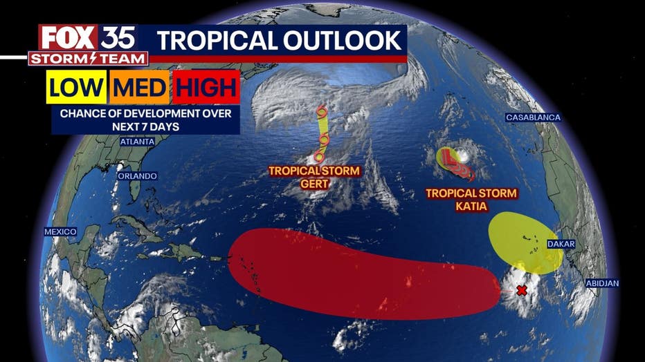
TRACKING THE TROPICS:
The tropics remain busy. Tropical Storms Katia and Gert remain deep in the Atlantic with no threat to land. A potent tropical wave (95L) remains just off the West African coast. Models indicate this wave could develop as it moves west and may be a threat to the Caribbean by next weekend. For now, it is too early to speculate where it may end up, but it is certainly something worth monitoring through next week. Keep with the FOX 35 Storm Team for more updates.