Orlando weather: Severe thunderstorms, quarter-sized hail possible in Central Florida Sunday evening

Thunderstorms moving towards Florida coast
Numerous tornado warnings have been issued in Northern Florida and Georgia as severe weather moves through parts of Florida.
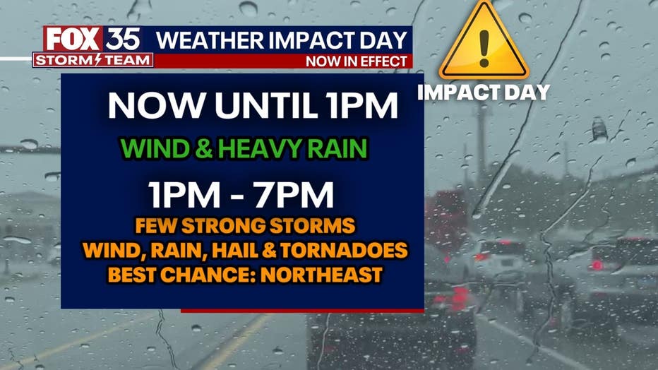
TODAY: Today is a FOX 35 Weather Impact Day.
PM UPDATE: Storms will continue to fire up along a front attached to a spinning low-pressure system over Northern Florida and the Southeast. We will watch for severe weather potential through this evening mostly in areas north of a line from Ocala to Daytona Beach. A number of storms have been tagged with tornado warnings already across Northern Florida. That isolated tornado risk continues through 9 pm. After 9 pm, activity should be off our coast with settled weather into the night.
MONDAY: As the low continues to meander near Florida, more unsettled weather is expected Monday. Another wet morning looks likely with scattered showers through the morning commute and through the rest of the morning. Scattered thunderstorms may develop again in the afternoon, but severe weather is not expected. We could still see small hail and lightning along with gusty winds. Highs will warm into the mid 60s under mostly cloudy skies.

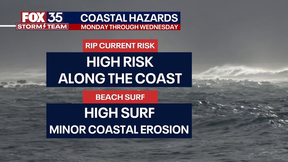
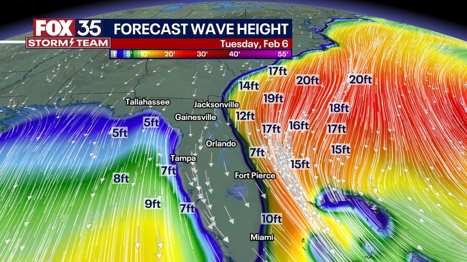
TUESDAY: Our system will be well out at sea by Tuesday which should mostly bring an end to our rain chances aside from a few coastal showers. The next impact would be a gusty north wind for Central Florida. Winds could gust up to 35-40 mph during the day. High surf will lead to a high rip current risk and potential for coastal erosion through Wednesday. Highs will be cooler into the upper 50s to low 60s.
OUTLOOK: Quieter and warmer weather arrives the rest of the week with abundant sunshine Wednesday. Highs will be back in the 70s Thursday onward into next weekend with dry weather expected.