

Orlando Weather Forecast: Hot, humid with storm chances Monday

Weather Forecast: August 8, 2022
FOX 35 Storm Team Chief Meteorologist Jayme King has a look at this week's forecast.
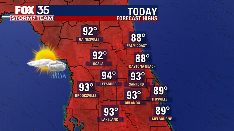
WHAT IS THE WEATHER FORECAST FOR TODAY AROUND ORLANDO?
Today's forecast high: 93 degrees
Tonight's forecast low: 75 degrees
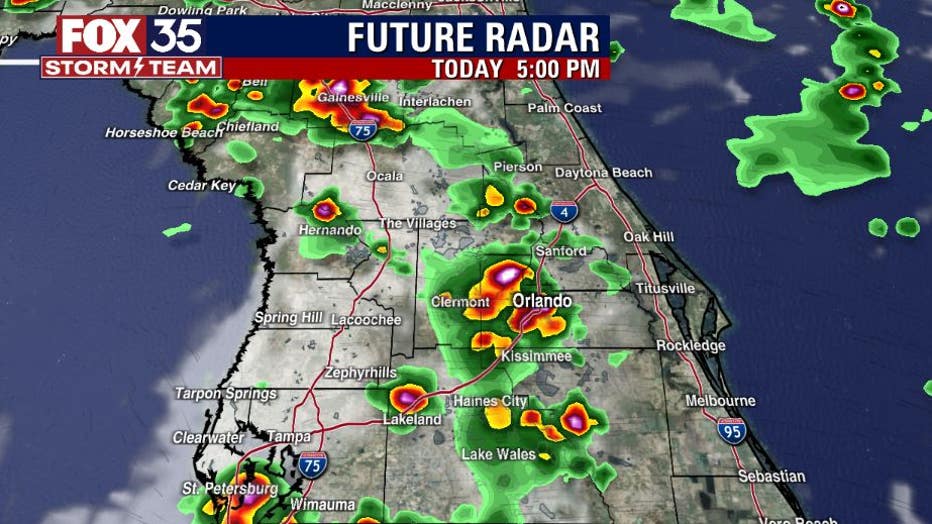
MAIN WEATHER CONCERNS: Happy Monday central Florida. It is another hot and humid day with the chance for scattered evening showers and storms. Best chance of storms is across the interior with heavy rain, lightning and gusty winds as the main threats. Forecast highs will reach the low to mid-90s with feels like temperatures in the triple digits.
WHAT IS THE WEATHER FORECAST FOR WALT DISNEY WORLD, UNIVERSAL, AND SEAWORLD?
If you head to the theme parks today, it will be hot with highs in the low to mid 90s. Scattered showers and storms could develop between 1-6pm at the Attractions. Lightning will be the main threat. Remember, when thunder roars, go indoors.
WHAT IS THE WEATHER FORECAST FOR THE BEACHES IN CENTRAL FLORIDA?
We start the day with showers and isolated lightning storms just off the east coast. These storms will continue through the mid-morning hours. Then there is the chance for a stray storm or two this afternoon, with the highest coverage west of I-95. Highs will climb to the upper 80s under mostly sunny skies. There is a moderate risk for rip current risk so swim near an open lifeguard stand.
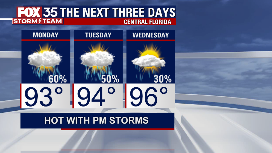
LOOKING AHEAD: An upper level disturbance will enhance our rain chances today. Rain chances will lower as dry air moves in by midweek with temperatures climbing into the mid 90s. Stay hydrated and weather aware.
TROPICS: We are starting to see an uptick in tropical activity. The National Hurricane Center is monitoring a tropical wave off the west coast of Africa. The disturbance has been given a 40% of development over the next 5 days.

Tracking the Tropics: August 8, 2022
FOX 35 Storm Team Meteorologist Jayme King has a look at the tropical wave in the Atlantic.
This could become a tropical depression by the middle to end of the workweek. Download the FOX 35 Storm Team weather app to not only track the tropics, but also the afternoon/ evening showers and storms.