

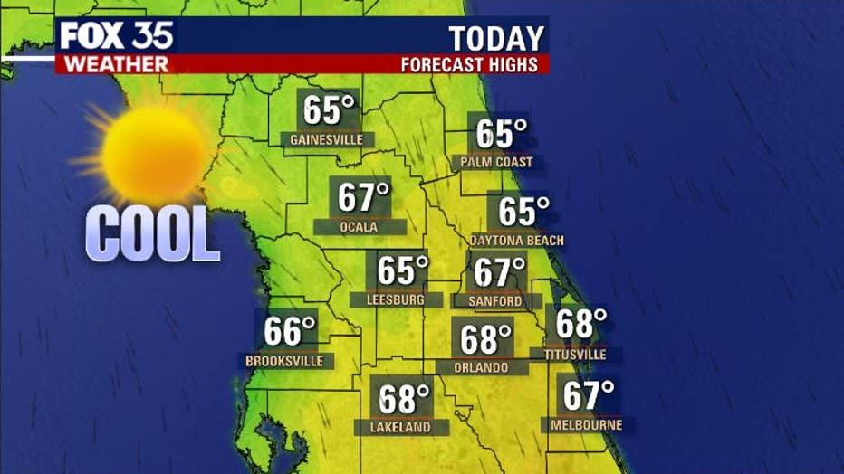
Highs in the 60s, lows in the 30s and 40s to stick around this week

Weather Report: January 4
FOX 35 meteorologist Jayme King gives the latest on the weather in Central Florida.
ORLANDO, Fla. - The first week of 2021 in Central Florida is kicking off with a great run of weather.
A weak cool front came through Sunday afternoon, bringing great weather to the region this Monday. After a chilly morning, afternoon highs are still cool, sticking in the mid to upper 60s. Sunshine will be out in full force from the beaches into the interior areas.
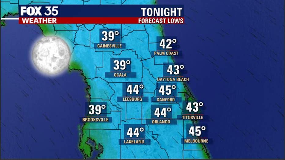
On Monday night, lows tumble down into the 30s over the northern areas of Central Florida, with a mix of 40s south of that. Skies will be clear and winds light, establishing what could be the perfect set up for some patchy frost north and west of the I-4 corridor. It may be a good time to cover up any tender ornamentals or tropical plants in the garden as the frost could burn leaves.
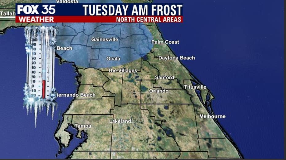
While the frost zone will be limited, you can see that it is mainly confined to Marion, Alachua, and Putnam Counties. It looks like a one night deal and should not be an issue as we head into the week. Temperatures will be warming a bit by then.
WEATHER ALERTS: Download the FOX 35 Weather App for live radar, severe weather alerts, and daily forecast reports on your phone
The next front will arrive by Thursday night.
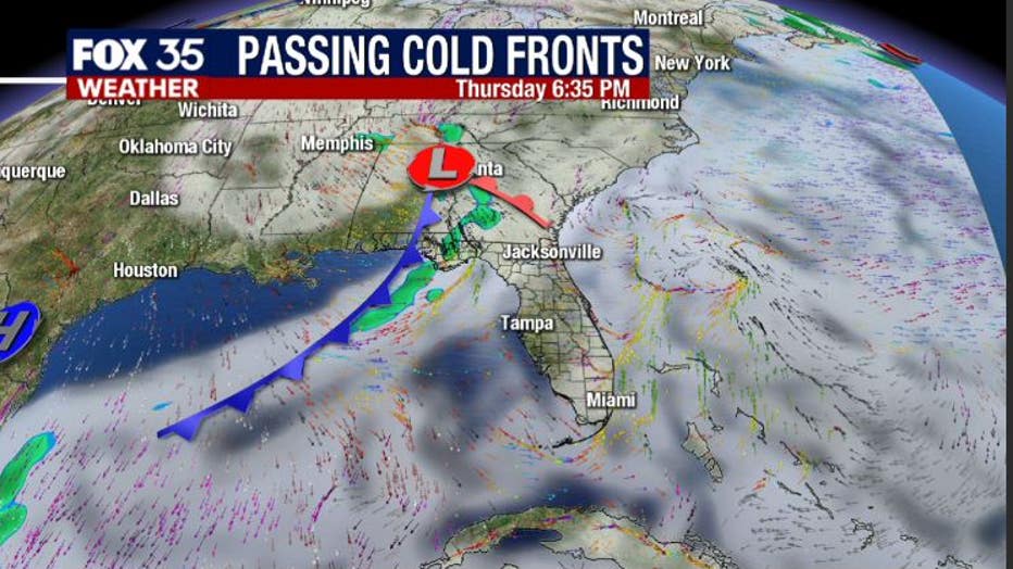
An increase in clouds should be expected at that time. Very isolated showers could develop along the front as it draws closer to Florida from the Gulf. Rain chances right now look quite low with this system, 20 percent or less late Thursday night.
Temperatures will trend a bit chilly behind this system as we head into next weekend.
Tune in to FOX 35 Orlando for the latest weather updates.