"Feels-like" temperatures climb into the upper 90s, record-breaking heat possible
ORLANDO, Fla. - When you factor in the humidity, the heat index or "feels-like" temperature in Central Florida will approach the upper 90s on Monday.
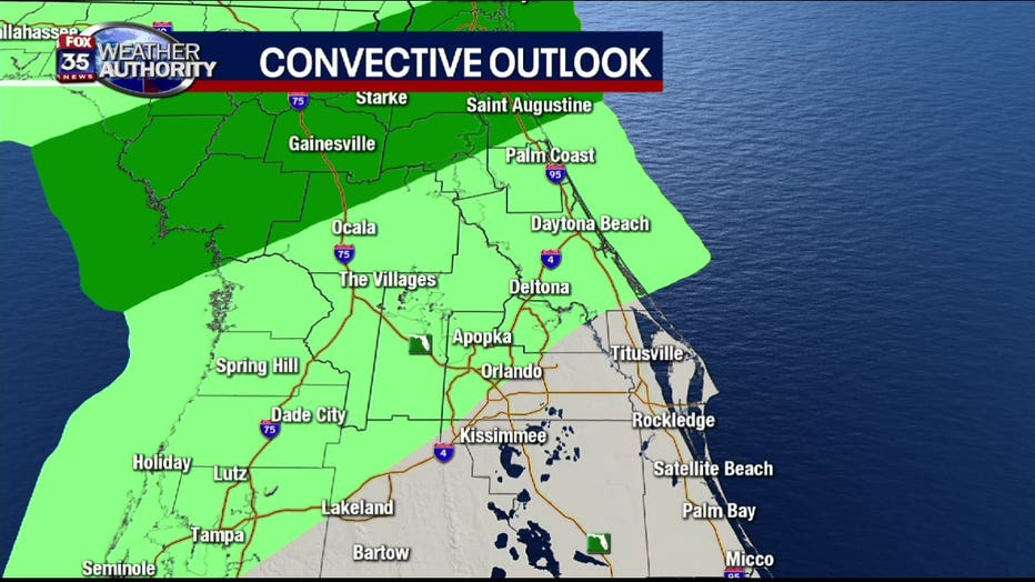
The band of storms associated with a strong cold front that swept over the southeast early in the morning will stop its southward progression.
A marginal risk for severe weather may persist along the trailing portion of the cold front, but the overall threat of severe weather for Marion and Alachua counties has gone down considerably.
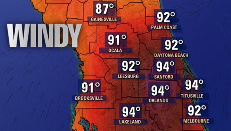
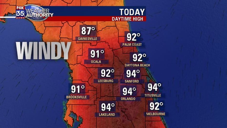
Strong southwesterly winds ahead of the boundary will help increase the heat and humidity in Central Florida.
It will be windy and hot, with a few record afternoon high temperatures expected to be tied and/or broken. Expect sustained winds out of the southwest between 15 to 25 miles per hour with higher gusts into the evening hours. The Space and Treasure Coasts could see wind gusts even higher, reaching up to 40 miles per hour.
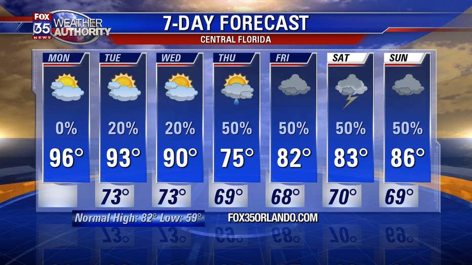
Most of the viewing area will remain dry, with a slight chance -- 20 percent -- for a late-day storm.
A lake wind advisory is in effect until 8:00 p.m. for Volusia, Orange, Seminole, Okeechobee and Osceola counties.
Overnight lows will remain mild, in the upper 60s to low-70s areawide.