

Central Florida rain chances rising again, strong storms possible this weekend
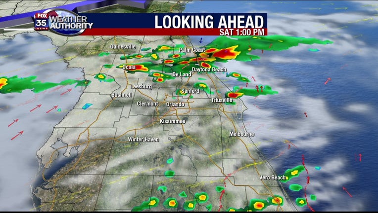
Orlando, FL - After a bit of a lull in rain chances today (20% or less for the PM), coverage will increase yet again as we go into the late morning and afternoon hours Saturday.
The rise in storm/rain chances is tied directly to an approaching cold front. The system looks to bring just rain to the area, a cool down is not in the cards unfortuantely, as highs by Sunday head into the lower 90s in advance of yet another strong storm.
This second front will have a substantial amount of energy as it drops in across the deep South. While rain chances are still fairly low on Sunday, holding at 30%, a few strong storms could be possible of Northern parts of Florida.
| DOWNLOAD THE FOX 35 WEATHER APP |
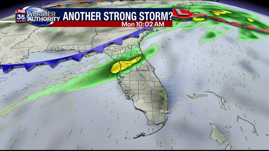
Latest forecast modeling shows the storm threat working Southbound late Sunday night into Monday. It's at this time that strong storms could move across parts of the FOX 35 viewing area North of Orlando.
Late Monday morning into the early afternoon could bring the line of storms through Orlando. While the writing isn't on the wall just yet, we're monitoring the possibillity of severe weather across the Florida Peninsula early next week.
Damaging winds, isolated tornadoes and of course very heavy rain are possible.
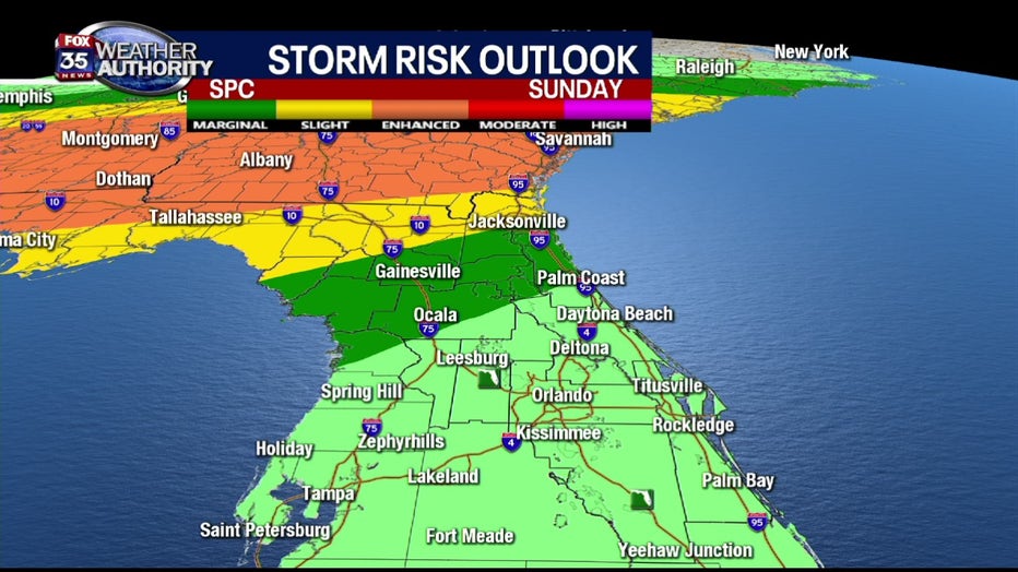
Current severe weather forecasts coming in from the Storm Prediction Center are indicating a MARGINAL RISK of severe storms for Alachua, Dixie, Gilchrist, Levy, Marion and Flagler Counties on Sunday afternoon.
A SLIGHT RISK will be in play for the I-10 Corridor Sunday and an ENHANCED RISK (possible dangerous scenario) across the Florida/Georgia border areas.
Main concerns in the ENHANCED area will be possible tornadoes. Again, we're monitoring the situation and will have much more in the coming days.