

A Taste Of Winter!
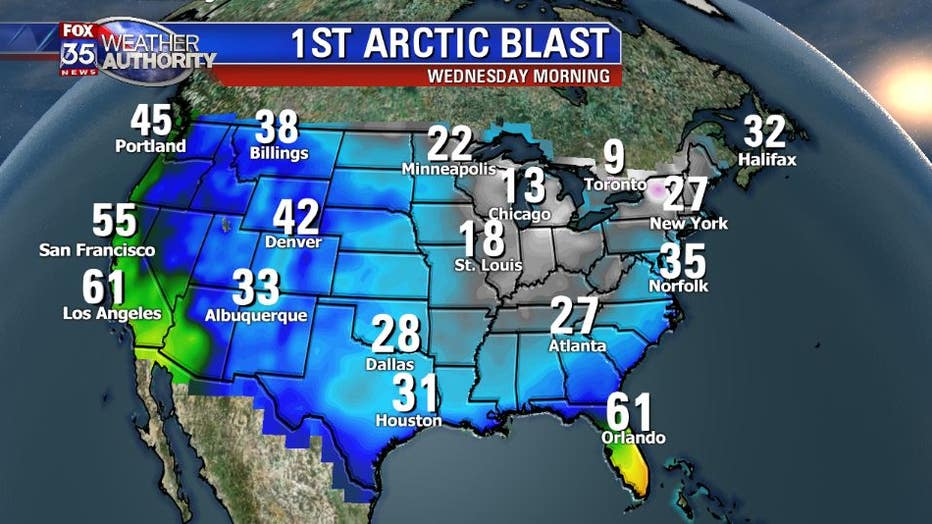
Orlando, Fl - The seasons first big push of arctic air is on the way! Don't expect bone chilling cold down here in Central Florida, but do expect to dust off your light jacket for daytime use on Wednesday. A large storm system will be wrapping up in the coming hours and will tap some arctic air from southern Canada. The temps will fall below zero by Wednesday morning across the arrowhead of Minnesota with temps below freezing as far south as Pensacola.
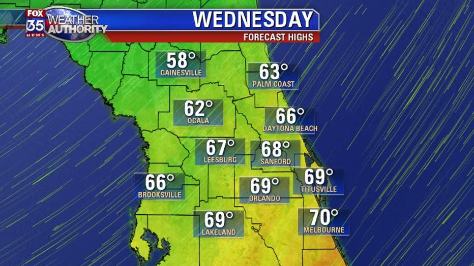
With a stiff northeasterly wind on Wednesday morning there will be plenty of moisture lingering behind the front to produce some stratus clouds. That means a cool/raw day for us on Wednesday with highs struggling to get out of the 50's. Of course, the northeast wind gusts of 20 mph will make it feel even cooler.
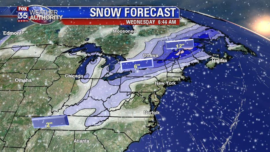
As we Floridians know, the cool blasts are short lived and we will find temps rebounding by Thursday afternoon as the atmosphere preps for the next cold front to come knocking. While we are back in the 70's, underneath are warm Florida sunshine, the folks up in the midwest and northeast will be scratching there heads as they deal with many inches of snow.
The upper level pattern will be very progressive during the next 7-10 days which will swing another cold front or two across Florida. Expect more phone calls and texts from your friends and family up north asking if you have a spare bedroom for them. GR