

TIMELINE: More storms expected to roll through Central Florida

Weather Forecast: September 17, 2021
FOX 35 Storm Team Meteorologist Kristin Giannas has the forecast.
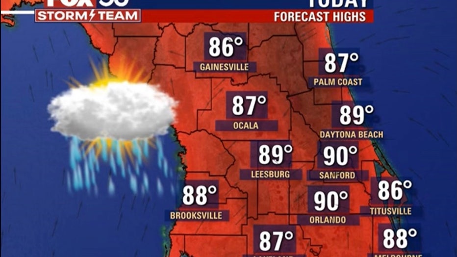
ORLANDO, Fla. - Deep southwesterly flow over Central Florida means another day of heat, humidity, and thunderstorms.
Expect afternoon highs in the upper 80s, around 90 in most spots.
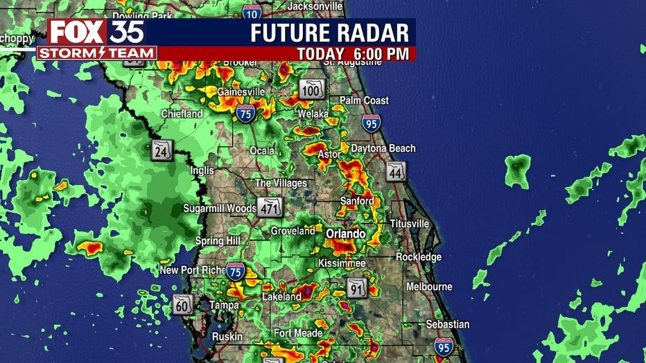
Scattered-to-numerous showers and storms are expected to increase in coverage this afternoon.
RELATED: Temperatures to drop into the 50s, 60s across Central Florida
"Likely going to see those rain delays at high school football games tonight," said FOX 35 Storm Team Meteorologist Kristin Giannas. "By 6 p.m., widespread shower and thunderstorm activity."
We'll keep the rain chance elevated (70%) this weekend, with seasonable afternoon highs around 90 degrees.
WEATHER ALERTS: Download the FOX 35 Storm Team Weather app for live radar, severe weather alerts, and daily forecast reports on your phone
The main concerns with any storms that develop will be strong wind gusts, frequent lightning and heavy rainfall. We can also see minor flooding over low-lying areas.
Widespread storms will be possible through and around midnight before the rain pushes offshore.
Watch FOX 35 News for the latest weather updates.