

Orlando weather: Storms could bring damaging winds, hail on Thursday | See timeline

Orlando p.m. weather forecast: 4/10/24
Thursday is likely to be a storm alert day. FOX 35's Noah Bergren details the timeline for us.
ORLANDO, Fla. - Thursday will be a busy day of weather. A cold front will move across Florida during the afternoon and evening.
All day, separate from the storms and cold front itself, winds will get very gusty. SW winds will gust 30-45 MPH in all locations most of the day. Honestly, this probably will end up a bigger impact for the majority of folks.
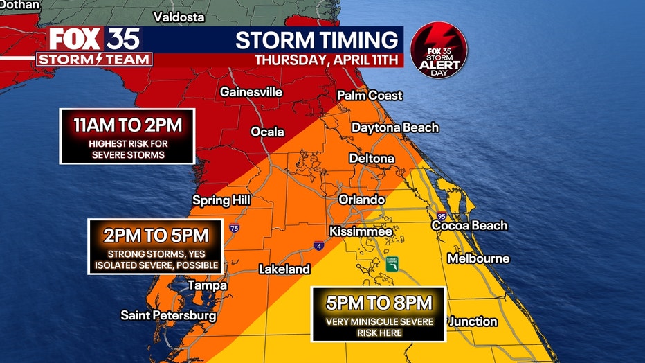
A line of showers and storms will move across central Florida from late morning to early evening. Severe risk for the majority is low and not overly concerning. Chances for a severe storm and/or tornado warning will be maximized along a corridor from Palm Coast to Ocala and Gainesville, where better dynamics for severe storms will be.
While not completely impossible to get a severe storm warning or two around I-4, storms will lose their strength and weaken as they move eastwards.
When will storms reach the Gainesville, Ocala area?
Severe storms may develop from 1pm-3pm for Levy, Dixie, Gilchrist, Alachua and northern Marion County, with gusts past 60 mph and the outside chance for an isolated tornado.
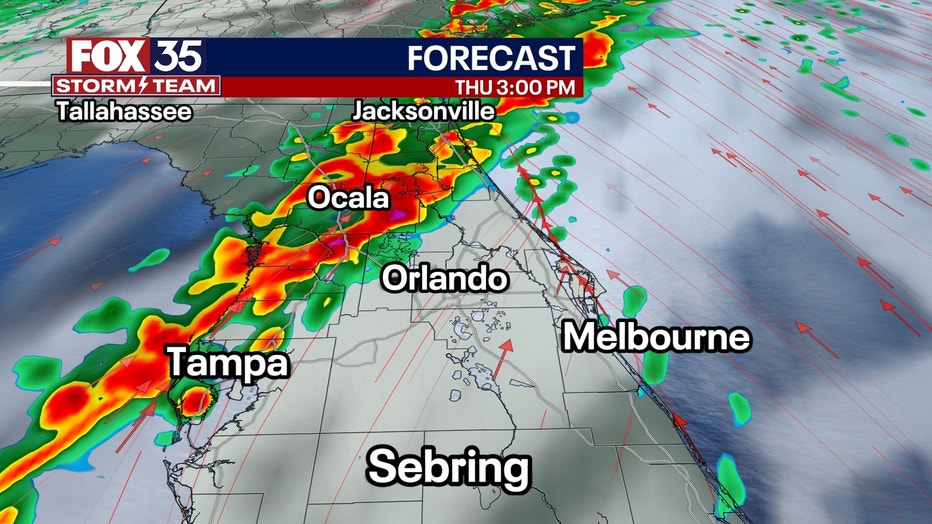
That rain threat ends around 5pm, as storms track southward toward Orlando.
When will storms reach the Orlando region?
Storms will arrive from the north between 4pm-6pm during the heat of the day. This will allow for stronger storms with winds past 60 mph.
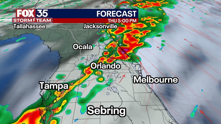
The tornado threat looks minimal, but can't be totally ruled out. Thursday morning through mid-afternoon will be fine for outdoor activities (only cancel twilight tee times).
When will storms reach Brevard and Osceola counties to the south?
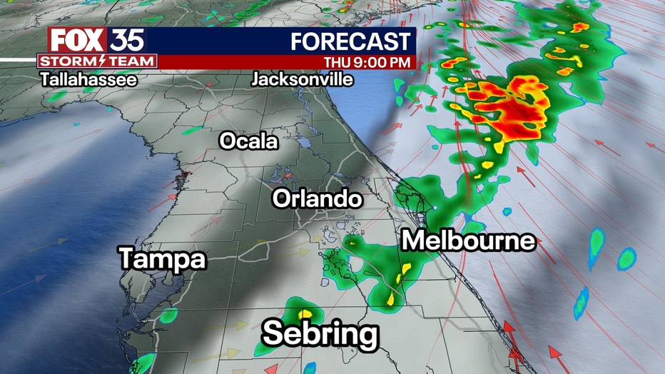
Storms will start falling apart as they make it into Kissimmee and Melbourne around or after dinnertime. Brief downpours and a clap of thunder is the most likely scenario for areas southeast of Orlando.
Forecast Discussion: While Tuesday's timing looked later in the day for storms arrival which would yield weaker storms, Wednesday's update features an earlier onset tapping into the energy associated with a 90°F day. Overall, this will be a, "low-end" Storm Alert Day (especially compared to the high-end Storm Alert Day they face today in the Deep South). The strongest storms will likely develop along and north of the I-10 corridor.