Orlando weather forecast: Friday to be a repeat of afternoon and evening storms

Weather Forecast: August 25, 2022
Storms could linger over Orlando and Central Florida through midnight as they move east. The pattern continues on Friday.
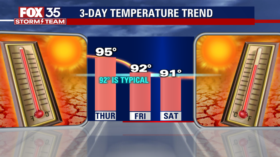
ORLANDO, Fla. - Tonight's low: 76 degrees | Tomorrow's high: 92 degrees | Rain: 80% chance of p.m. Storms
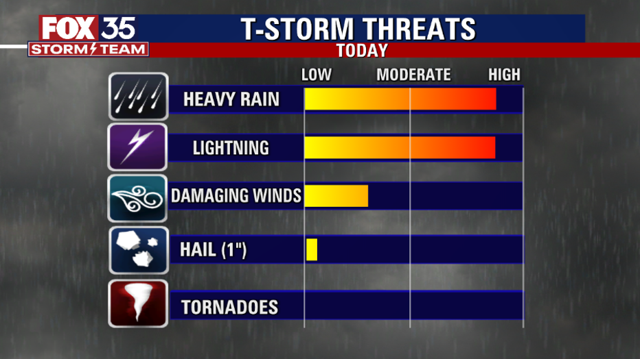
Main weather concerns: Afternoon threats include torrential rain that may cause some minor flooding when storms form between 1 p.m. to 9 p.m. This could lead to "ponding" on some roadways. Dangerous lightning will also be a common hazard. It won't rain for the entire afternoon, but there will be a chance for passing downpours and lightning storms all afternoon and evening.
BEACHES: There will be an 80% chance of afternoon storms at the beaches. Waves 2-3 feet with a moderate risk for rip currents. Lightning will be a big danger between Noon and 5 p.m., but some storms could linger until midnight. Winds southeast at 8mph. The water temperature will be around 83 degrees. Remember, when thunder roars, go to your car.
THEME PARKS: Hot and humid morning with feels-like temps over 100 degrees. Then after lunch, numerous lightning storms. Plan for rain delays on fireworks and outdoor activities. The best chance of rain is between 3 p.m. to 11 p.m. Several inches of rain is possible with minor flooding in some low spots.
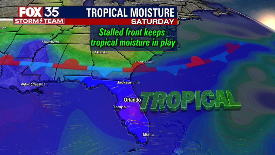
EXTENDED OUTLOOK: The weekend will be much the same with PM storms, at a 70-80% chance. Depend on the FOX 35 Storm Team and download the FOX 35 Storm Team App!
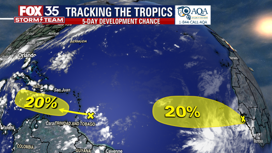
TROPICS: The National Hurricane Center is currently watching two tropical waves for a 20% chance for development (each). No threat to FL yet, but some long-range models remind us to keep our guard up as we approach the peak of the hurricane season. Track the tropics in real-time on the FOX 35 STORM TEAM WEATHER APP.