

County-by-county: When severe weather could strike your area today

ORLANDO, Fla. - The FOX 35 Storm Team is tracking the potential for severe weather in Central Florida for the second day in a row.
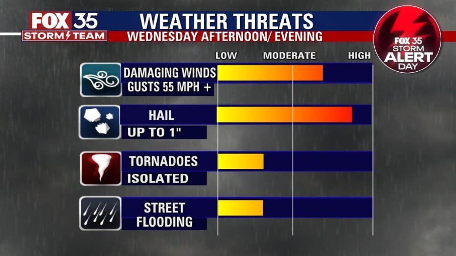
Today's severe weather risk is 'likely' for damaging wind gusts, hail heavy rain and lightning. There is also a chance for an isolated tornado or two.
RELATED: WATCH: Funnel cloud spotted in Central Florida
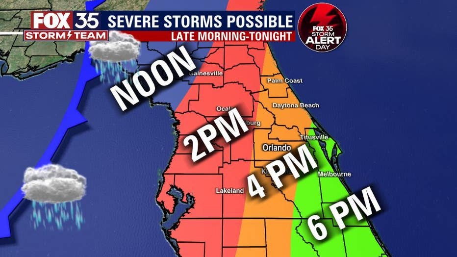
County-By-County estimated shower and thunderstorm arrival times:
- Marion County: Storms likely at noon
- Lake County: 2 p.m.
- Flagler & Volusia counties: 3 p.m.
- Orange County 3:30 p.m.
- Seminole County: 3:34 p.m.
- Brevard: 5:30 p.m.
Remember these are estimated times and could change. The severe risk will heighten this afternoon.
Late night, the storms will have passed and we're looking dry for your St. Patty's Day festivities.
DOWNLOAD: FOX 35 NEWS APP | FOX 35 STORM TEAM WEATHER APP
You can also track the live radar in the palm of your hand. Depend on the FOX 35 Storm Team when it matters most.
Watch FOX 35 News for the latest updates.