

Central Florida heats up with rain forecast through the weekend

Weather Forecast: April 28, 2022
FOX 35 meteorologist Brooks Garner has a look at the upcoming forecast where there are some isolated chances for storms in parts of Central Florida.
ORLANDO, Fla. - WHAT IS THE WEATHER FORECAST FOR TODAY AROUND ORLANDO?
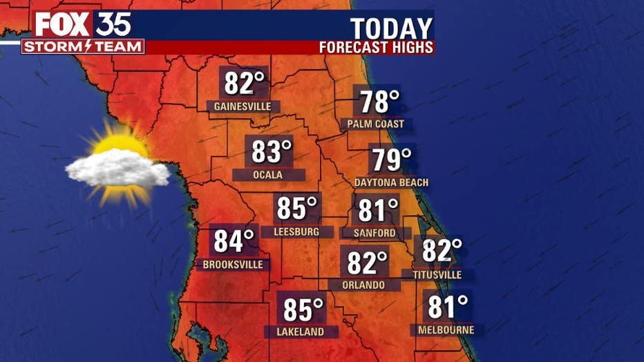
Today's forecast high: 82 degrees
Tomorrow’s forecast low: 65 degrees
MAIN WEATHER CONCERNS:
A cold front will straddle the region today. Could be a few showers around but much of the rain potential will be mainly south of Orlando. Gusty East-Northeast winds are developing North of the front and this will create hazards along the beaches as surf rapidly builds and rip current risk remains high (been this way all week).
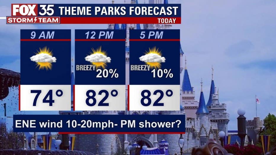
WHAT IS THE WEATHER FORECAST FOR WALT DISNEY WORLD, UNIVERSAL, AND SEAWORLD?
Parks and attractions look decent today. An isolated shower should not be ruled out but, coverage looks low at 20% or less. Breezy winds expected with a mix of sun and clouds.
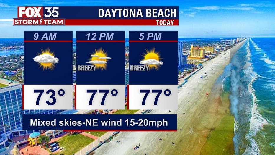
WHAT IS THE WEATHER FORECAST FOR THE BEACHES IN CENTRAL FLORIDA?
Highs in the upper 70s with a mix of sun and clouds. Rain chances are slim over the Northern beach fronts, higher at 30% along the Space Coast.
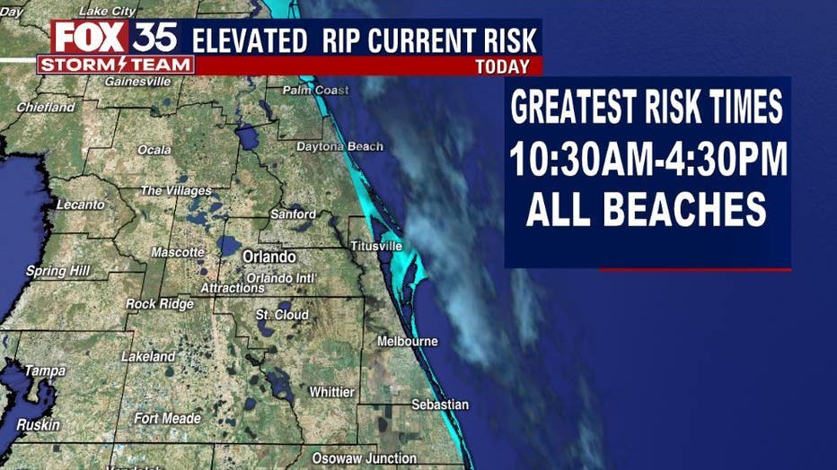
The rip current risk remains moderate-high for the Atlantic beaches with the greatest threat window opening up from 10:30 a.m.- 4:30 a.m. due to tidal effects The surf will be 2-4 feet in a mix of swell. Winds will trend ENE at 20 mph.
LOOKING AHEAD:
A cold front will stall over the Bahamas late week. This front will move North back across the area and combine forces with ocean breezes. This combo will keep rain chances in play through Friday and into the weekend. Coverage look to remain in the 40% range with daily showers, perhaps a storm or 2.