

Wind chill advisory, temperatures in the 30s expected as strong cold front sweeps in

Orlando. FL - Well, so much for our "warmer" weather.
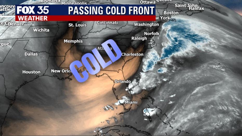
A strong cold front has crossed over Florida, causing temperatures to plunge significantly.
MORE NEWS: Will weather cooperate for Tuesday's Starlink satellites launch?
Most locations are seeing lows by Tuesday morning settle in the 30s. Again, the coldest readings will be up in the northern parts of Central Florida.
Lows in the 30s will be common through midweek as winds remain out of the northerly direction. A freeze for the viewing area does not look likely for east Central Florida right now. However, areas in the northern part of Florida could see a light freeze. If that changes, we will alert you immediately!
WEATHER ALERTS: Download the FOX 35 Weather App for live radar, severe weather alerts, and daily forecast reports on your phone
The gusty winds will spark a wind chill advisory for the shaded counties seen below.
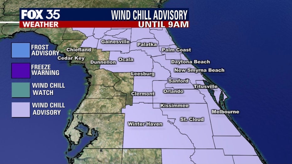
The advisory will kick into effect at 1 a.m. on Tuesday morning and continue until at least 8 a.m. Feels like or wind chill temps will feel more like the upper 20s in most locations.
Be sure to bundle up and stay warm!
Tune in to FOX 35 Orlando for the latest weather updates.