

Rain chances finally heading south into Central Florida

Weather Forecast: April 14, 2020
FOX 35 Meteorologist Jayme King gives you the latest on the weather in Central Florida.
ORLANDO, Fla. - The stalled cold front that's been creating stormy skies across northern Central Florida will finally be on the move southbound Wednesday.
This movement will set the stage for an increasing rain chance across Central Florida, which is one of the driest parts of Florida currently.

Forecast models are showing a band of showers and storms moving from north to south across the FOX 35 viewing area Wednesday afternoon.
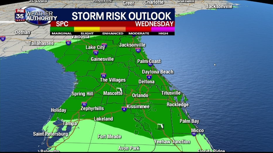
Residents in the FOX 35 viewing area should also know that a risk of severe weather is still possible Wednesday along the front.
The storm prediction center is highlighting the region with a marginal risk of severe weather.
Threats will include the possibility of isolated damaging wind gusts in some of the stronger storms and, of course, very heavy rain and areas of cloud to ground lightning.
The best timing on this appears to be late morning into the afternoon hours.
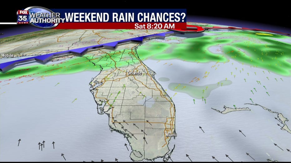
As we head into the weekend, yet another front pushes into Florida from the north.
Current forecast models are suggesting widespread rain breaking out Saturday morning over northern Florida with coverage spreading south into the late morning and early afternoon.
It's still a bit early to assess the severe weather risk, but the possibility is certainly there.