Orlando weather: Tropical systems are brewing

Orlando Weather Forecast: August 26, 2023
FOX 35 Meteorologist Ian Cassette has a look at the weekend forecast in Orlando and Central Florida.
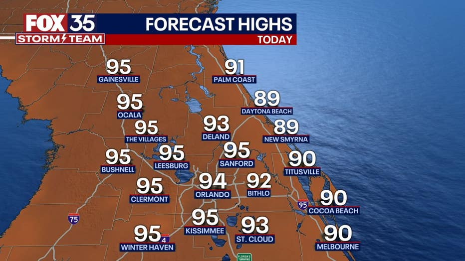
Today's high: 94 degrees
Tonight's low: 78 degrees
Main weather concerns:
Another quiet day with lots of sunshine and hot temperatures. Highs will climb into the low to mid 90s with feels like temperatures ranging from 104 to 107 degrees. Stay hydrated! Storm chances will be unlikely Saturday with slightly higher chances Sunday.
BEACHES:
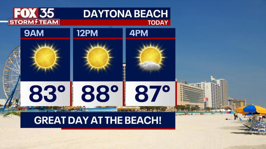
At the beaches today, you can expect a nice breeze out of the northeast. Gusts could reach 15-20 mph. Temperatures will reach the upper-80s today with feels-like temperatures near 100 degrees. Stay hydrated and don't forget your sunscreen. Friendly reminder, there is a moderate risk for rip currents. Surf is up to 3 feet.
THEME PARKS:
Another hot and humid day at the park with no rain expected. Highs will climb to near 95 this afternoon so take breaks and find A/C when you can!

OUTLOOK:
Rain chances are on the rise early next week as tropical moisture will be on the increase. All eyes will be on a tropical system likely developing and pushing towards the Gulf coast of Florida. Impacts in Central Florida will ultimately depend on its path, but expect deteriorating conditions by late Tuesday with the system passing through on Wednesday. More on our thoughts on possible impacts below. We'll continue to see high rain chances through the remainder of the week with highs in the upper 80s to low 90s.
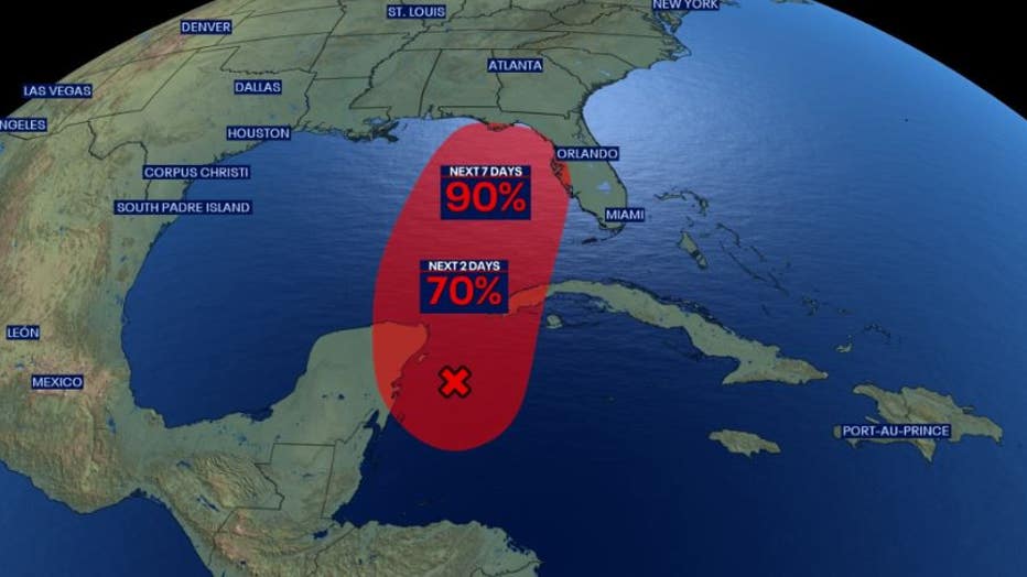
TRACKING THE TROPICS:
As mentioned earlier, the tropics are alive! Models indicate a tropical wave currently east of the Yucatán will develop into a tropical system by early next week, then head north towards FL bringing impacts our way as soon as late Tuesday. Most models forecast this system to become a tropical storm before making landfall somewhere along the Gulf coast of FL. Consensus seems to be near the Big Bend and Nature Coast. As for now, it appears tropical storm force winds are likely over much of Central Florida, especially areas closest to the Gulf (Lake, Marion, Sumter County). This will be a quick-hitting system and likely in and out of Florida by late Wednesday. Rainfall won't be as big of an issue for most areas, but some closer to Gulf could see 3-5" of rain with flooding possible. We will also monitor for potential quick spin-ups as the storms Tuesday night through Wednesday within rain bands. Tropical Storm Franklin remains in the Western Atlantic and is expected to develop into a strong hurricane next week, but remain out at sea. A couple of other tropical waves are deep in the Atlantic, but are currently no concern to us. We will have more updates to come throughout the weekend so keep with the FOX 35 Storm Team.