

Orlando Weather Forecast: Rain chances continue Monday

Weather Forecast: September 19, 2022
FOX 35 Storm Team Meteorologist Allison Gargaro has a look at this week's forecast.
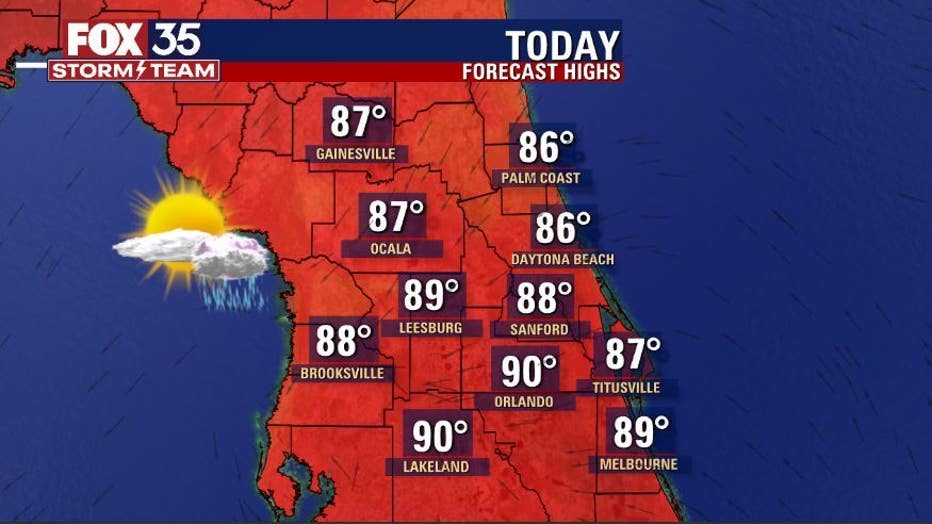
Today's high: 90 degrees | Tonight's low: 74 degrees | Rain: 70% chance PM Storms
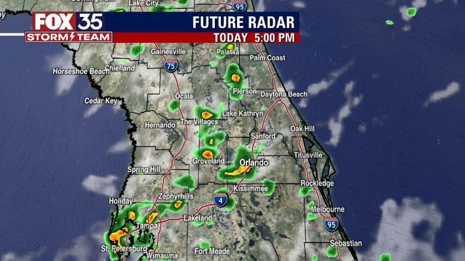
Main weather concerns: The soggy pattern continues with plenty of tropical moisture across Florida for now. Highs remain in the upper 80s to near 90 degrees today. Showers and storms return-mainly after 2pm for most locations. The main storm threats include heavy rain, localized flooding, gusty winds and plenty of lightning strikes. Stay weather aware and download the FOX 35 Storm Team weather app.
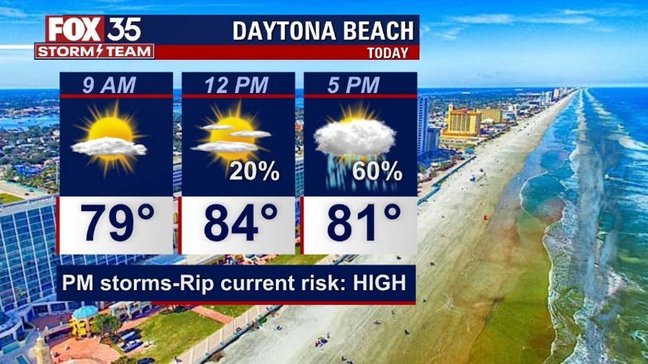
BEACHES
A bit more sunshine today, but with more scattered afternoon storms. Stay weather aware this afternoon/evening for AM + PM storms containing lightning. Rain chances peak around 60%. There is a high rip current risk at all east coast beaches through this weekend. Surf is in the 2-4' range in a mix of swell coming from Hurricane Fiona.
THEME PARKS
Humid again with partly to partly cloudy skies. Stay hydrated and take breaks inside the a/c. Best chance for rain between 3pm-8pm. Heavy rain and lightning will be likely, lightning remains a threat as well.
EXTENDED OUTLOOK
The wet weather pattern continues through at least Tuesday. A northeast wind could bring drier weather by mid week with Fiona in the western Atlantic. Rain chances will fall to 20% or less by midweek and into next weekend.
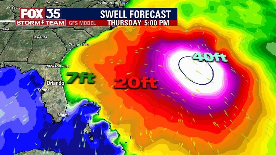
TROPICS:
Hurricane Fiona made a second landfall on the southeast side of the Dominican Republic earlier this morning. Fiona is still a cat. 1 hurricane but, intensification is likely as the storm tracks North away from the Islands. Fiona is forecast to become a Cat. 3 major hurricane through midweek.
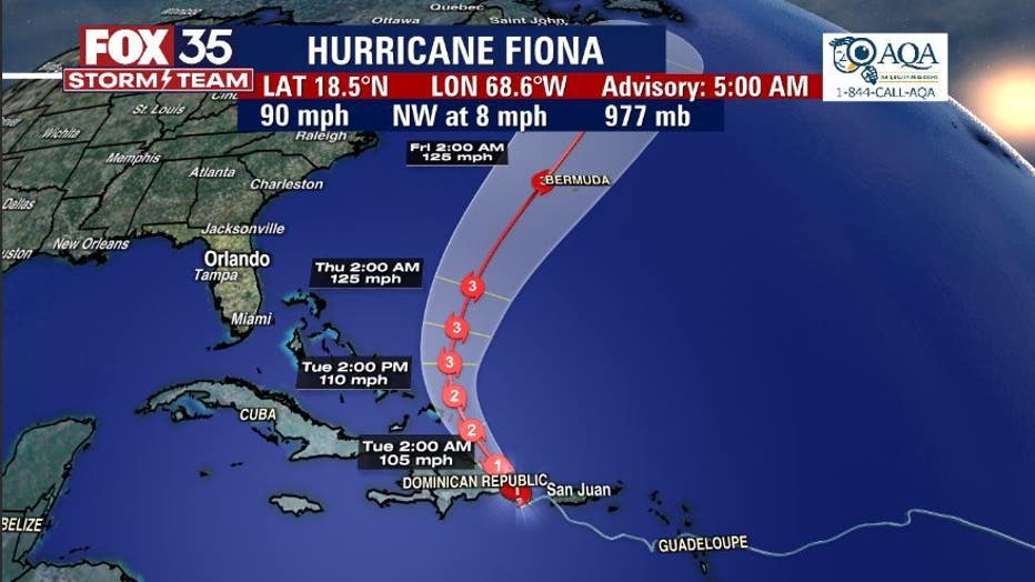
The Island of Bermuda should be watching closely. Rain is a huge threat as tropical downpours soak Puerto Rico and The Dominican Republic. Rain amounts in Puerto Rico could exceed two feet when it's all said and done.