

NHC issuing advisories on Potential Tropical Cyclone in the Central Atlantic

Tracking the Tropics: July 28, 2020
FOX 35 Chief Meteorologist Glenn Richards is tracking a tropical wave in the Atlantic that is targeting the Florida Peninsula early next week.
Orlando, FL - The National Hurricane Center is now issuing advisories on Potential Tropical Cyclone 9 located in the Central Tropical Atlantic. The system is expected to become tropical storm "ISAIAS" by 8 p.m. Tuesday night. The circulation is moving quickly to the West at 23 mph and will impact the islands of the Eastern Caribbean tonight and into Wednesday morning.
Tropical storm warnings are up for the U.S. Virgin Islands and Puerto Rico. The official forecast track from the NHC shows an eventual landfall potentially in South Florida on Sunday morning with winds at that time near 50 mph.
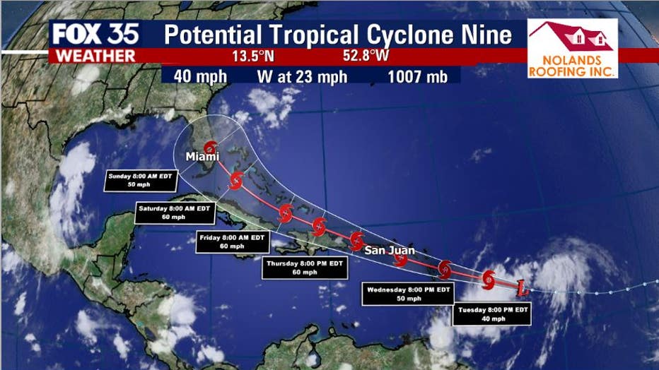
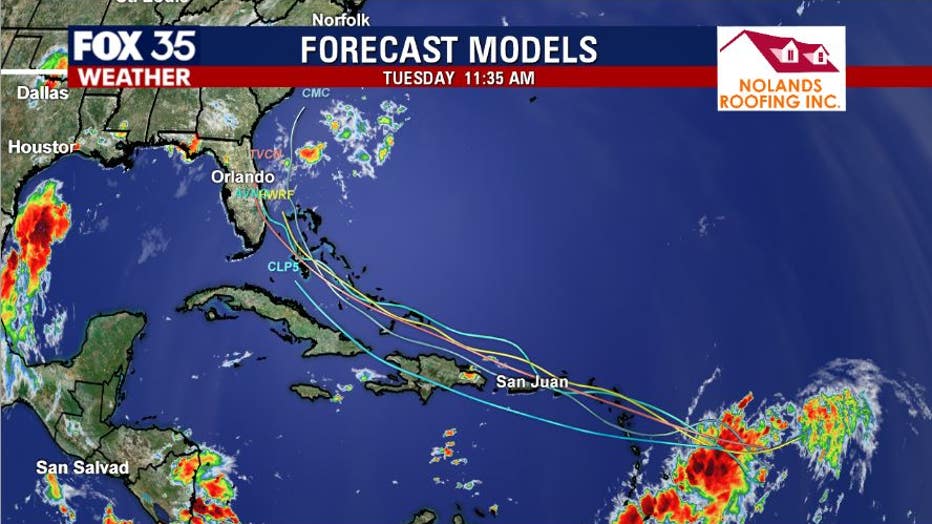
The latest Spaghetti plot models show a general West/Northwest motion of the system over the coming days. Once the system intensifies into a tropical storm, modeling will have an easier time in carving out a better long term track. A stronger storm would produce more of a Northerly track, a weaker system could stay on a more Westerly course.
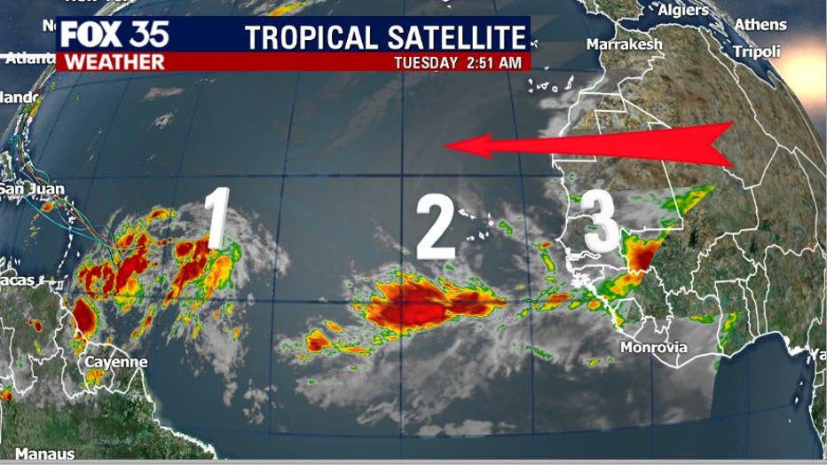
Behind soon to be "ISAIAS" are two more strong tropical waves exiting Africa. Environmental conditions are marginal for additional development but, regardless, these systems need to be watched over the next several days.