

Next cold front incoming: Expected timeline for Central Florida

Weather Report: November 1, 2021
FOX 35 Storm Team Chief Meteorologist Jayme King gives the latest on the weather in Central Florida.
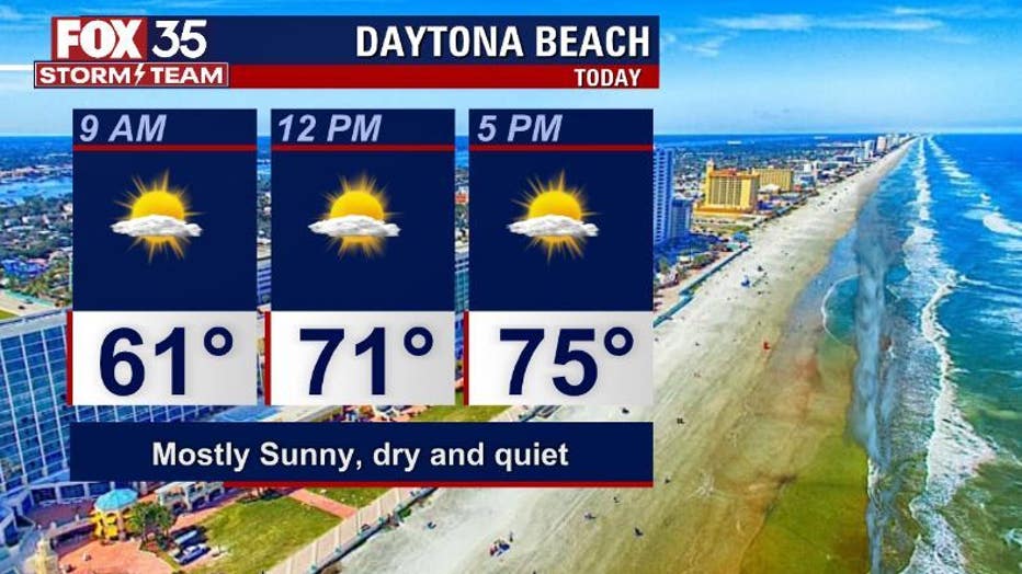
ORLANDO, Fla. - Central Florida starts the new week off cool and quiet.
Sunshine prevails on Monday with only a few extra clouds coming in from the Gulf of Mexico by the mid-afternoon hours. Highs head for the very pleasant 70s from the coastal areas all the way inland.
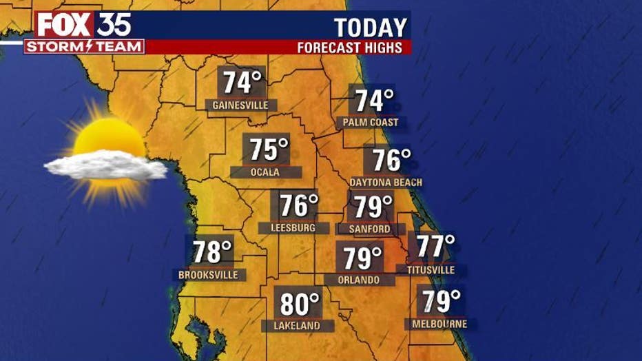
Central Florida’s local measure of atmospheric moisture remains very low, so the region is not only looking good but also feeling good too. It will be rain-free for now and over the next few days.
WEATHER ALERTS: Download the FOX 35 Storm Team Weather app for live radar, severe weather alerts, and daily forecast reports on your phone
If you've got some plans along the beaches on Monday, conditions look amazing. Be mindful of the moderate rip current risk along all of our local beaches though.
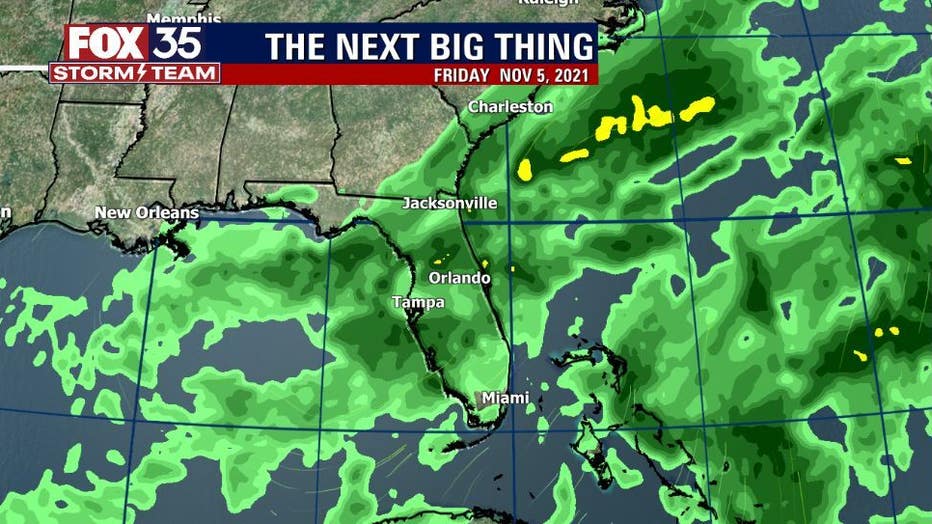
The next cooling system is already loading over the western portion of the country. If future model forecasts are correct, the front will be nearing Florida by late week.
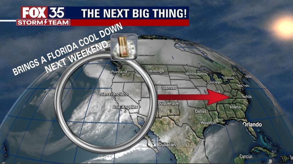
As the feature nears, temperatures will warm as winds align more southerly and highs head for the lower 80s. Clouds will also increase and eventual rain chances return to much of Central Florida.
TRENDING: Orlando woman spots witch in the clouds just days before Halloween
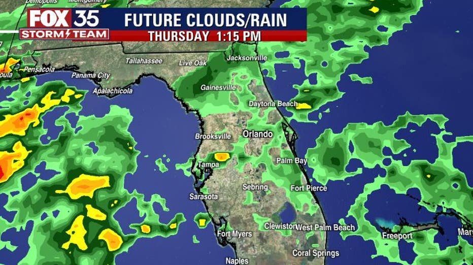
Thursday and Friday will offer up some wetter details in the forecast, while Friday will have the highest coverage with a few storms possible. As the system clears the area, the rain will dry up and clearing will begin.
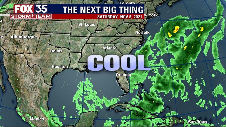
Cooler air will funnel in on Friday morning and continue into the weekend. Expect highs to reside in the lower to mid-70s. Lows will fall into the 50s around Orlando, with the cooler 40s in the northern portions of Central Florida.
Watch FOX 35 Orlando for the latest Central Florida news.