More heat and storms as Central Florida welcomes July
ORLANDO, Fla. - Central Florida will finish out the month of June unseasonably hot and humid.
The heat index or "feels-like" temperature will fall between 102 and 107 on Tuesday.
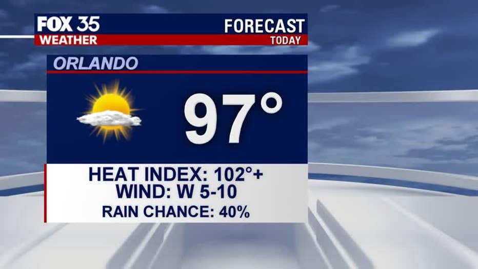
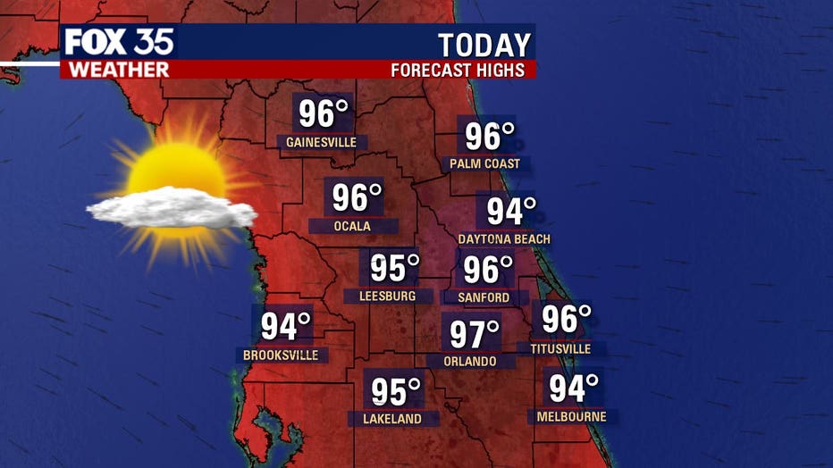
A warm westerly wind will help actual air temperatures climb to the mid-and-upper-90s for most of East-Central Florida.
Expect scattered afternoon thunderstorms as sea breeze collisions occur over the eastern side of the Florida peninsula.
Rain chances around 40% for most of the area.
Storms that develop are capable of producing lightning strikes, gusty winds of 40-50 mph and torrential downpours.
Thunderstorms will dissipate and push offshore by sunset, with quiet weather overnight.
Expect warm and muggy conditions, with temperatures falling to the mid-and-upper 70s.
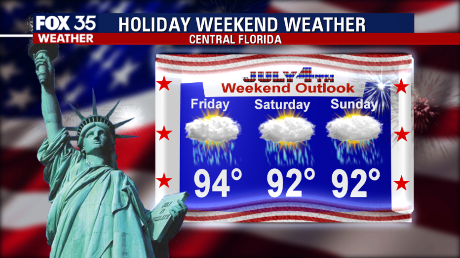
The rain chance will be rising as we finish out the work week and head into the 4th of July weekend.