

Increased rain chances to bring widespread storms
ORLANDO, Fla. - WHAT IS THE WEATHER FORECAST FOR TODAY AROUND ORLANDO?
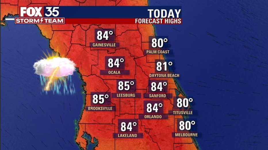
Today’s forecast high: 84 degrees
Tonight’s forecast low: 67 degrees
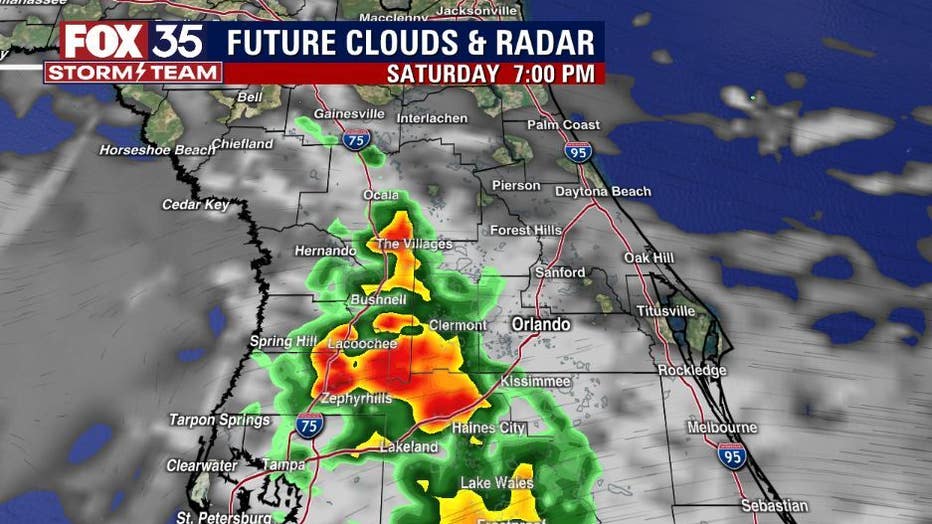
Main weather concerns: The weather today will be near seasonal with mixed skies and an increase in rain chances. Beginning at 2 p.m., isolated showers and storms are on the rise, by 6 p.m. storm coverage will be widespread centered on the west side of the FL peninsula. You can expect heavy rain, cloud-to-ground lightning and gusty winds in these thunderstorms. Winds will be quite gusty again today. Coastal areas in Brevard will see the strongest breezes from the East at 20+ mph. Highs will hit in the 80s area-wide, humidity remains at a medium level.
WHAT IS THE WEATHER FORECAST FOR WALT DISNEY WORLD, UNIVERSAL, AND SEAWORLD?
Parks and attractions will feature some great weather to start the day. A little breezy with warm temperatures. Highs will hit near 84 by this afternoon. By 2 p.m., there is a 40% chance for showers and thunderstorms.
WHAT IS THE WEATHER FORECAST FOR THE BEACHES IN CENTRAL FLORIDA?
Highs in the upper 70s to low 80s with a mix of sun and clouds. Winds will be rather gusty from the East again today. The rip current risk remains high for the Atlantic beaches with the greatest threat window opening up from 11:30AM-5:30PM. The surf will be 3-5 feet in an Easterly wind swell. Winds will trend E at 15-20mph. Make sure you swim near an open lifeguard stand.
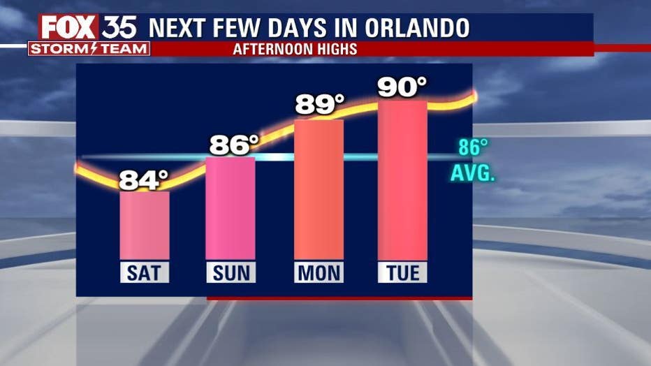
LOOKING AHEAD: Sunday bring another round of afternoon and evening showers and thunderstorms with highs in the mid-80s across the interior. More of a "Summer like" pattern begins to take shape next week. Highs trend hotter and close to if not exceeding the 90-degree mark beginning next Wednesday. Rain chances remain in play during this time and sparked by daily seabreeze circulations. Chances hang in the 30% range.....stay tuned!