

FOX 35 Weather Alert Day - Saturday

FOX 35 Weather Alert Day – Saturday
FOX 35 Chief Meteorologist Glenn Richards has the latest forecast across Central Florida.
ORLANDO, Fla. - Once the temperature climbs, the storms will roam.
Saturday will start out quiet and warm, but will become steamy and stormy.
The storms will fire up along a stalled frontal boundary that will focus the storm right over metro Orlando.
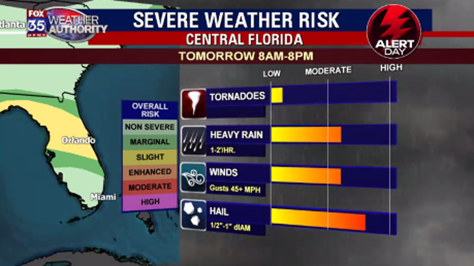
The main threat with these storms will be heavy rain with gusty winds and hail.
An initial wave of storms is expected late morning, with a secondary wave of storms forming late afternoon.
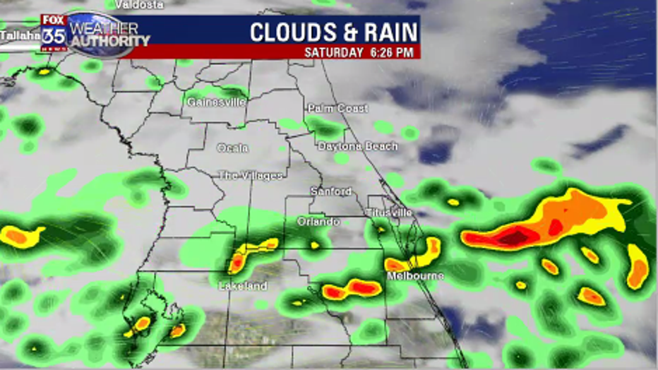
Storm motion on Saturday will be from west to east with the storms coming to an end along our east coast during the early evening hours.
With upper-level temperatures running a little colder than normal, there will be the ability for the storms to form hail and also produce some damaging downburst winds.
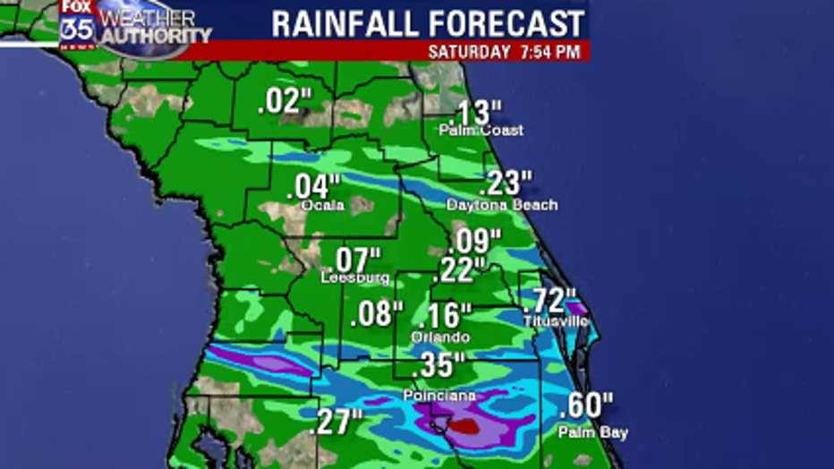
We will gladly take the 1/4 inch to 3/4 inch rainfall totals with these storms.
April is normally a very dry time of the year, so the rainfall ends up being our silver-lining.
Be safe and be sure to use your FOX 35 Weather App to track the storms as they move through.