

FOX 35 Storm Alert Day: Heavy rains and wind expected to be followed by cold front Saturday
Orlando, Fla. - Today is a FOX 35 Storm Alert Day. A strong cold front is moving from North Florida into central Florida this morning.
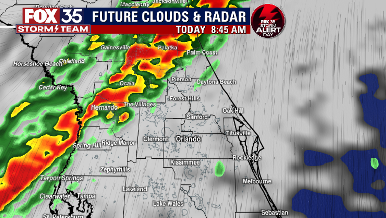
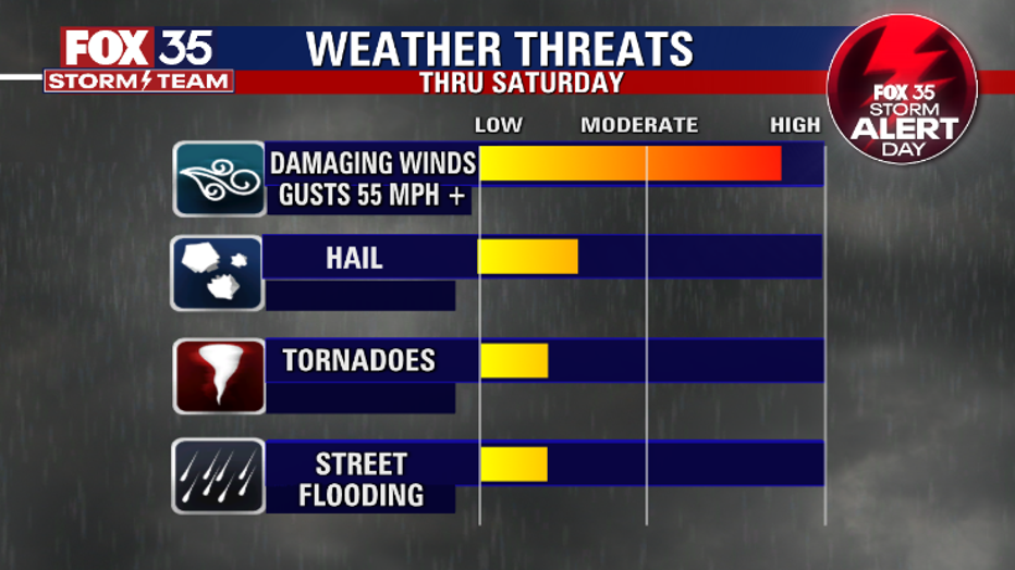
The FOX 35 Storm Team is monitoring conditions closely as this front will bring heavy rain and gusty winds with a threat for isolated tornadoes.
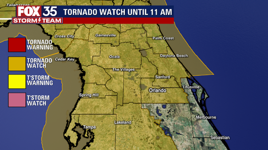
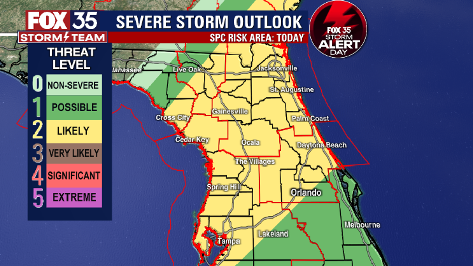
There is a Tornado Watch extending from counties in north Central Florida, all the way south to Orange and Seminole Counties until 11 a.m. Most of our viewing area has a 2 out of 5 risk for strong to severe storms, meaning damaging wind gusts are likely.
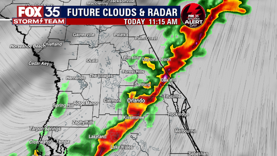
This front is moving quickly; it will arrive in Marion and Lake Counties by 9 a.m. and moving into Orange and Volusia Counties by 11 a.m. The front will clear out of Brevard County by early afternoon.
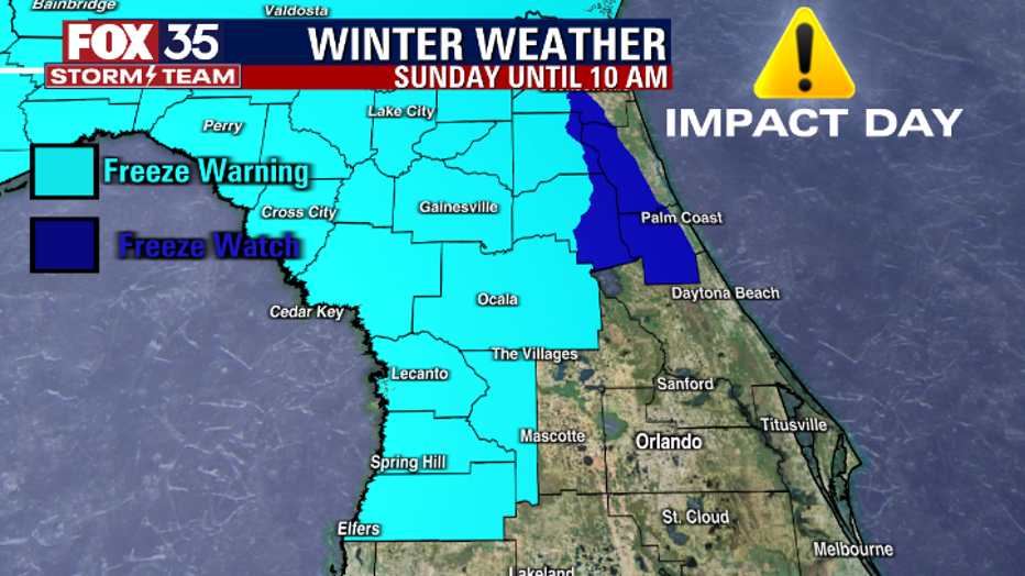
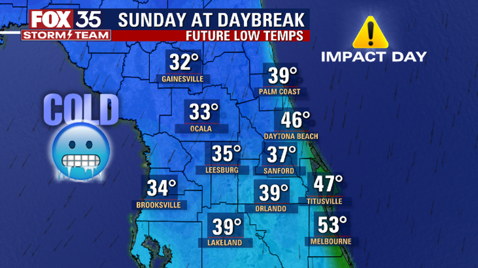
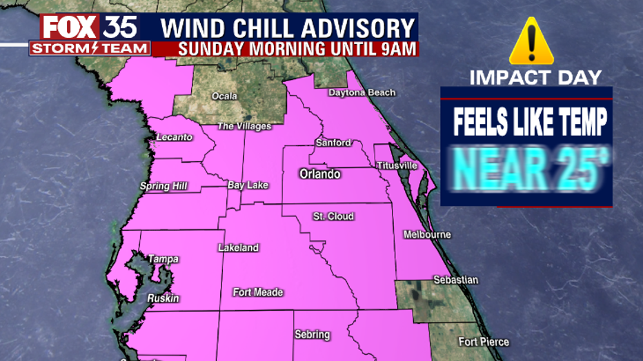
When the front clears, the severe threat will be gone. Arctic air will usher in behind this front, making Sunday morning a FOX 35 Weather Impact Day. Wake up temperatures will be in the 30s and 40s. There is a Wind Chill Advisory until 9 a.m. on Sunday, with feels like temperatures near 25 degrees.
There are also Freeze Watches in Warning across North Central Florida.
Even though it has felt more like summer this last week, find your winter jackets and bundle up tomorrow morning. Don't forget to download the FOX 35 Storm Team weather app to get severe weather alerts sent directly to your cell phone. Remember, you can depend on the FOX 35 Storm Team to bring you the latest updates.