

Storm threat returns to Orlando midweek

Weather Forecast: March 21, 2022
FOX 35 Storm Team Meteorologist Brittany Lockley has the latest on the weather in Central Florida.
ORLANDO, Fla. - We have a comfortable start to the workweek across central Florida.
High pressure is dominating across the southeast keeping skies clear and temperatures right on track for this time of year. Afternoon highs will be near 80 degrees across the interior and in the mid-70s along the coast.
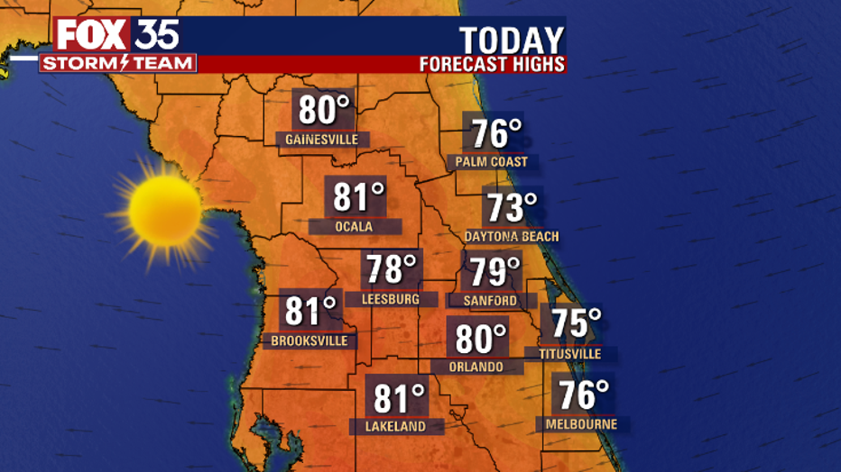
High pressure is dominating across the southeast keeping skies clear and temperatures right on track with seasonal for this time of year. Afternoon highs will be near 80 degrees across the interior and in the mid-70s along the coast. (FOX 35 Orlando)
If you are visiting central Florida for spring break, enjoy all the Orlando area has to offer. If you are heading out to the beach, a friendly reminder to swim near open lifeguard stands as the rip current risk stays elevated this week.
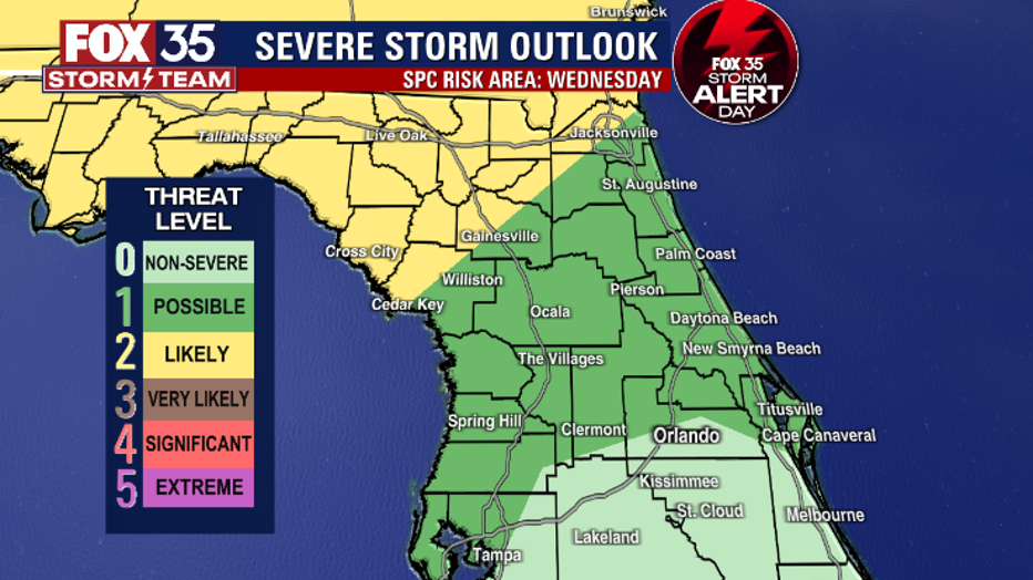
The local weather stays quiet through Tuesday, but big weather changes are on the way beginning Wednesday afternoon. Wednesday is a FOX 35 Storm Alert Day.
Weather energy is ramping up in east Texas on Monday and will push east over the next few days. Once the front pushes into Florida, there will be a "likely" risk (2/5) for strong to severe storms in the Florida panhandle. This threat includes damaging wind gusts, heavy rain and the chance for an isolated tornado or two.
There is a "possible" risk (1/5) for strong storms in north central Florida on Wednesday. The FOX 35 Storm Team is monitoring forecast models on the exact timing of the local severe threat.
Download the FOX 35 Storm Team weather app to track the live radar on your cell phone.
Weather energy is ramping up in east Texas today and will push east across over the next few days. Once the front pushes into Florida, there will be a "likely" (2/5) risk for strong to severe storms in the Florida panhandle. This threat includes dama
Click here for the latest Central Florida news, Florida stories and local headlines.