

After above normal heat, cold front to drop Central Florida into the 30s and 40s
Orlando, FL - Looks like our run of well above normal temperatures will come to a halt slowly but surely over the next few days.
High pressure that's been influencing Central Florida weather will move South of Florida, this in turn will create an open gateway of sorts, allowing cold fronts to move back into the Sunshine State. The incoming fronts look to tap some rather chilly air over Canada, forcing the chill South into Florida.
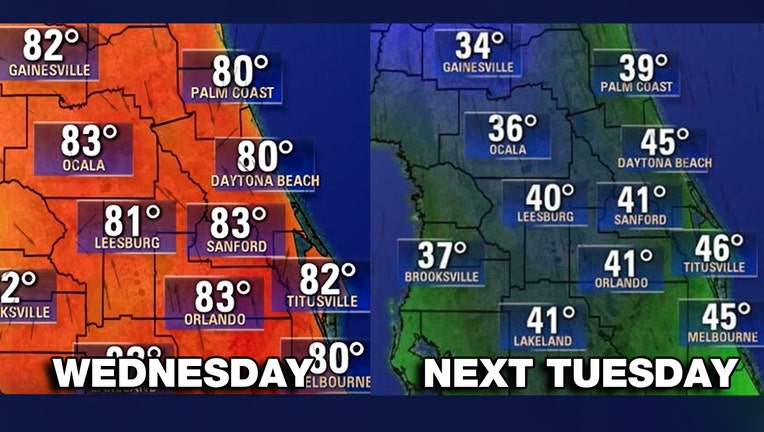
A strong front will finally clear the area late Sunday into Monday. Highest rain chances look to be on Sunday as scattered showers accompany the cold front. Strong Northerly winds will develop on the backside of the system allowing the invasion of colder air to take shape. Depending on which forecast model you look at, we could see some of the coldest temperatures so far this Winter across parts of Central Florida.
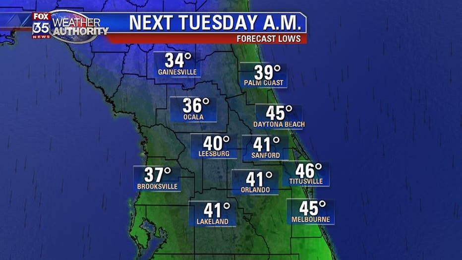
Expect adjustments in the temperatures posted above as we get a better gauge on the incoming colder air. Wake up temps by Monday will be around 50 degrees, colder North of Orlando. By Tuesday morning, the bulk of chill will be arriving with widespread 30s and 40s across the region.
While it's still a bit far out to declare possible freezing temperatures, this is a situation that certainly needs to be watched as we draw closer to next week.
Be sure to download the FOX 35 Weather App to get the weather conditions while you are on-the-go.