

Valentine's Day forecast and week ahead in Central Florida
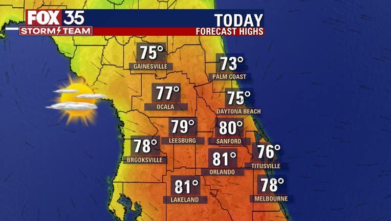
This week's forecast is like a box of chocolates, you get a little bit of everything. We start the weekend on a warm note. Saturday brings mostly clear skies and the warmest temperatures we have felt in several days.
Afternoon highs across the Orlando metro will be in the low-80s, while our coastal communities will be in the mid to upper-70s. Once the sun sets, our next cold front will arrive in north central Florida.
Widespread rain, and the chance for a few claps of thunder are possible. The front brings rain to the Orlando area by Sunday morning.
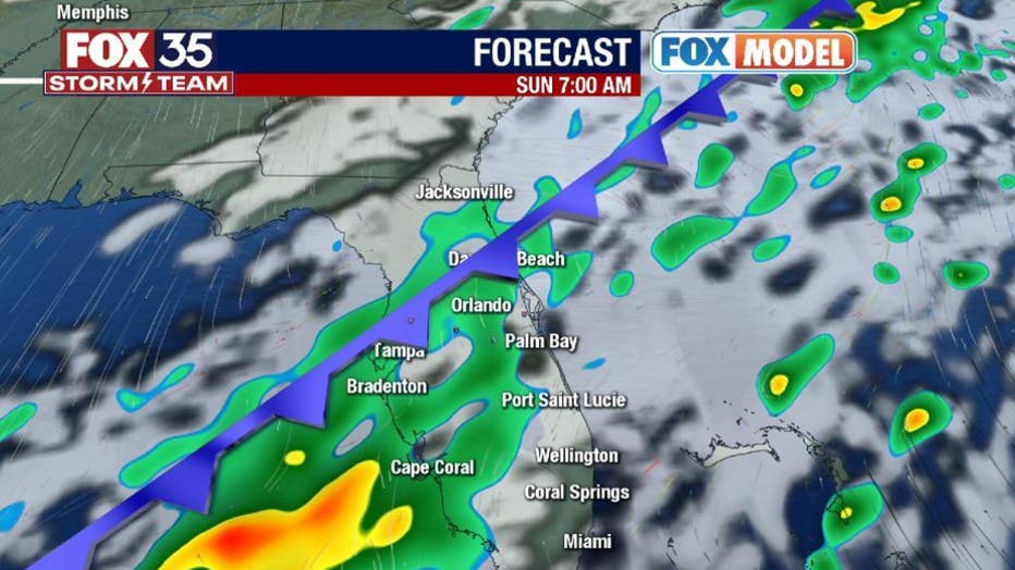
The front will clear out of our viewing area by Sunday afternoon bringing the rain, clouds and warm temperatures with it. Highs go from the 80s on Saturday, to the low-70s on Sunday down to the 60s on Monday.
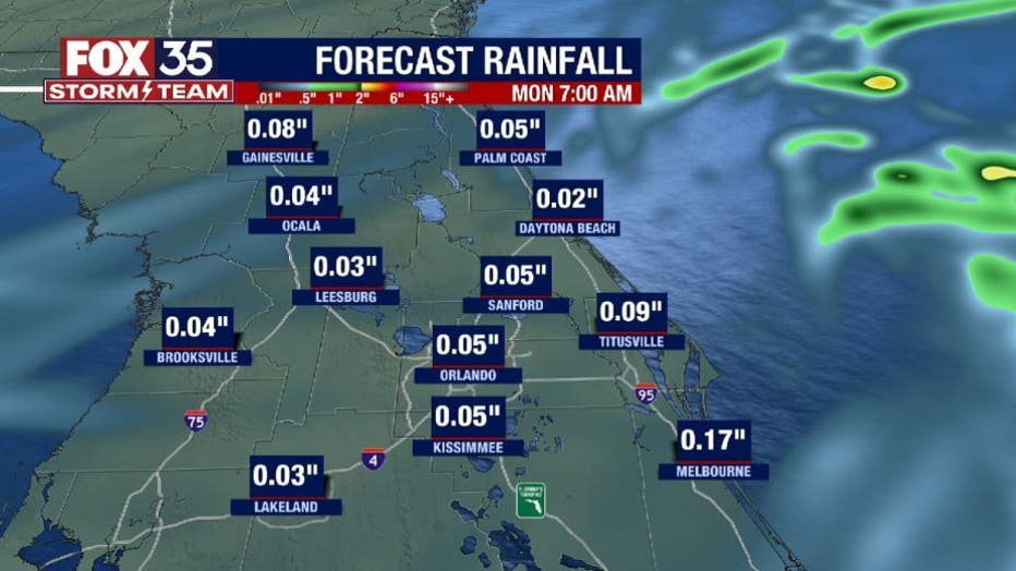
Monday is Valentine's Day, and if you have any outdoor plans with your sweetheart, you will need a light jacket. Highs will be in the low-60s by the afternoon, but overnight lows will dip into the 40s.

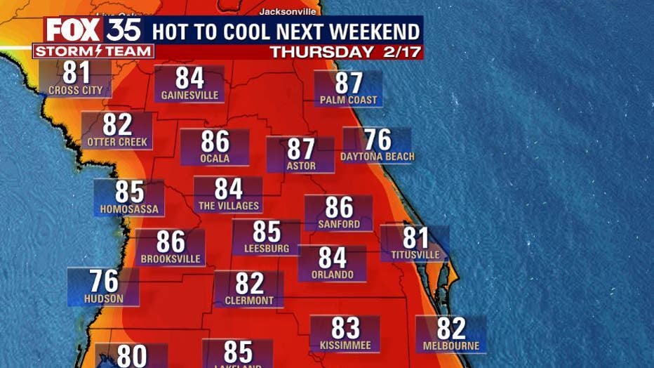
Monday looks to be the coolest day in the extended forecast. Temperatures will soar into the mid-80s by Friday and Saturday! It will feel a lot more like late spring/ summer than winter by the end of the week.
Next weekend brings a different story, a front likely to cause cooler temperatures and an increase in shower activity. Next Sunday is the Daytona 500, we could see a change in the weather.
As we get closer, and models are in more of an agreement, we will have your detailed forecast and let you know if there is a risk of strong storms.
Depend on the FOX 35 Storm Team when it matters most.