

Strong storms possible across parts of Florida this week

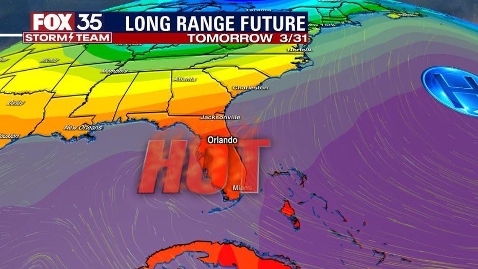
ORLANDO, Fla. - Warm weather lovers will appreciate the forecast over the next couple of days! Think of it as a summer preview as temperatures rise to near the 90-degree mark today and tomorrow. But don't forget the umbrella: our rain chances are rising with some strong storms possible across parts of Florida.
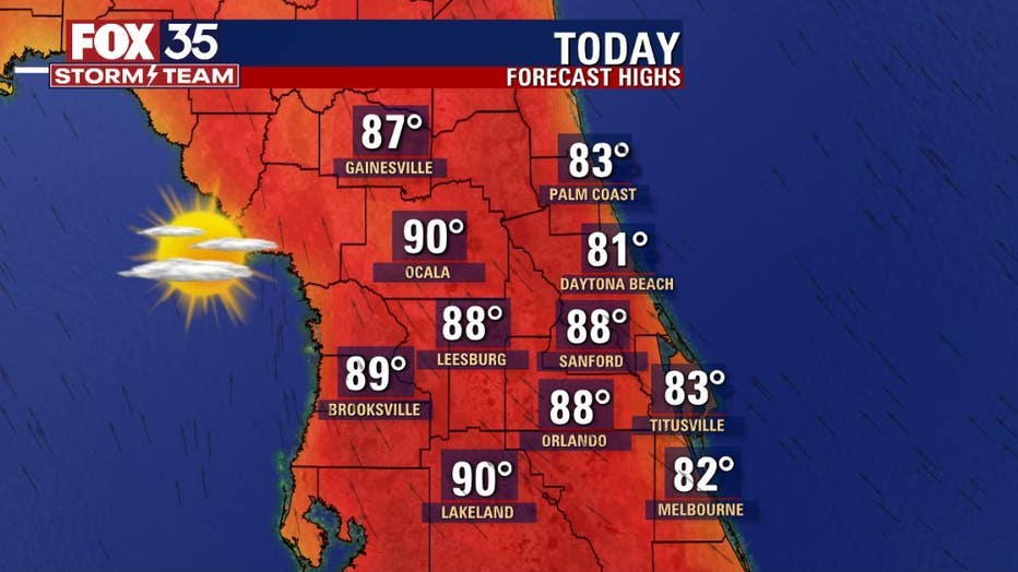
HIGH TODAY
Strengthening southerly wind flow ahead of an approaching storm system will bring the warmth and increasing humidity. Area highs will soar into the upper 80s inland today with a bit of a bump up tomorrow. The beaches will trend just a bit cooler, conditions there will be down right windy.
STORMS ON THE WAY
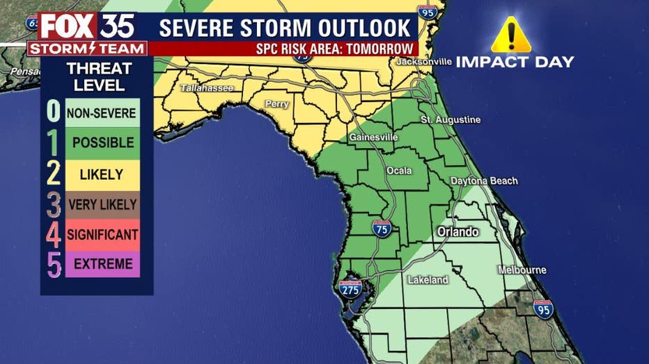
All eyes turn to the Gulf south today as a powerful storm system moves through that area. The risk of severe weather will be sharply rising through this afternoon and remain at a threat level "4" or "SIGNIFICANT" severe potential. This means damaging wind in excess of 70 mph and tornado risk will both be quite high as the line of storms move through.
DOWNLOAD: FOX 35 NEWS APP | FOX 35 STORM TEAM WEATHER APP
SUBSCRIBE: FOX 35 NEWSLETTER | FOX 35 Orlando on YouTube
FOLLOW: Facebook | Instagram | Twitter
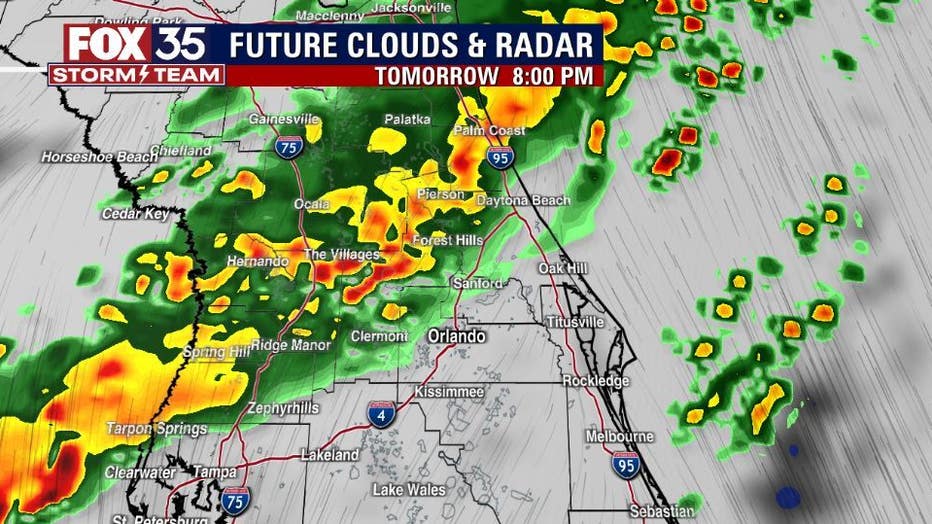
The line moves into northern Florida on Thursday, spreading south into the Central Peninsula early Friday morning. The line of storms will be weakening as it moves south, but a few strong storms should not be ruled out.
WILL IT RAIN THIS WEEKEND?
The latest Storm Prediction Center severe outlook call for a risk level "1" or possible during this time. Heavy rain, gusty winds and lightning will be the norm. Count on rain drops through the day Friday, Saturday and Sunday.
Orlando Weather: Storm alerts, live interactive radar, forecast, and more
Click here for the latest Central Florida news, Florida stories, and local headlines.