

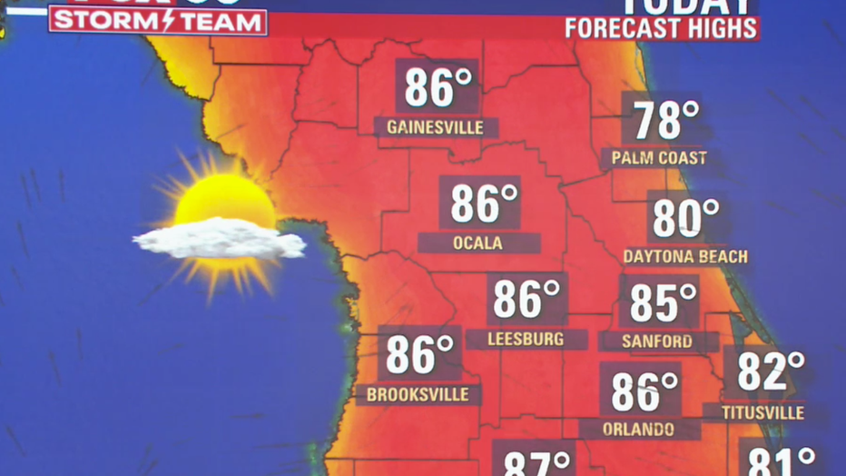
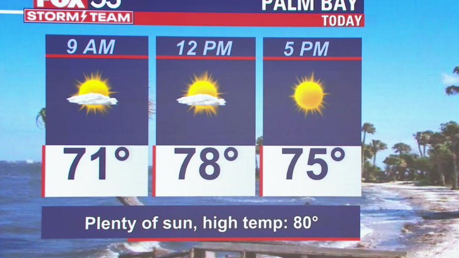
Soaring temperatures make for a toasty day across Central Florida

We Love Florida Forecast: February 24, 2022
FOX 35 Storm Team Chief Meteorologist Jayme King has the forecast.
ORLANDO, Fla. - Looking for a few extra raindrops to cut down on that lawn watering bill? Well, you certainly won't find it around Florida!
Conditions remain rain-free across the state courtesy of a strong, blocking high-pressure center situated over the Atlantic.
"This feature is keeping the storm track adjusted north of Florida so cold fronts and their associated moisture never make it into the region. It's not looking good longer term either," says FOX 35 Storm Team Chief Meteorologist Jayme King.
Closing out February and heading into March looks mostly dry as high pressure remains one of the key figures on the weather maps. Over the last 30 days, all of Central Florida has received only a fraction of normal rainfall and long range forecasts are suggesting even less.
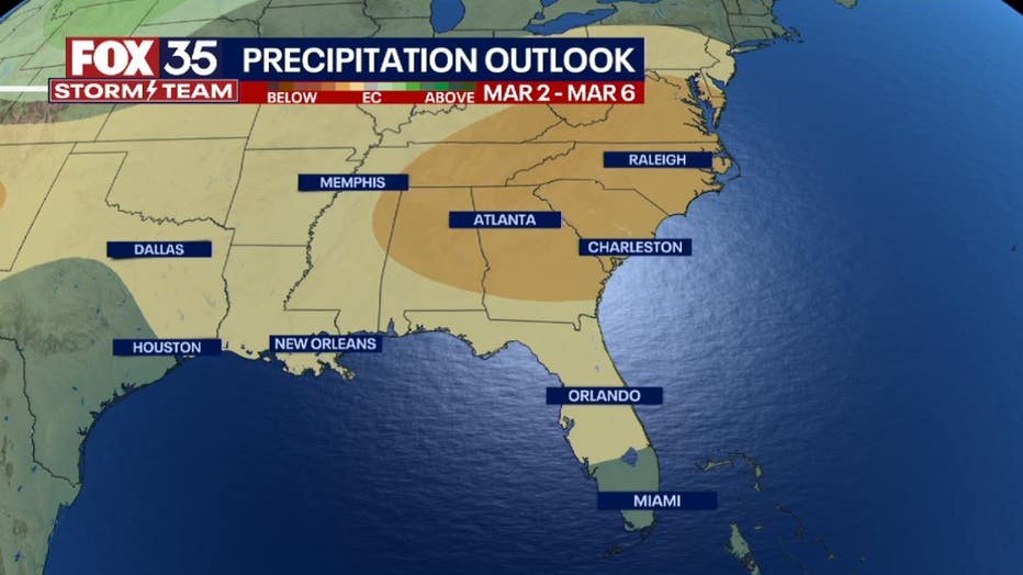
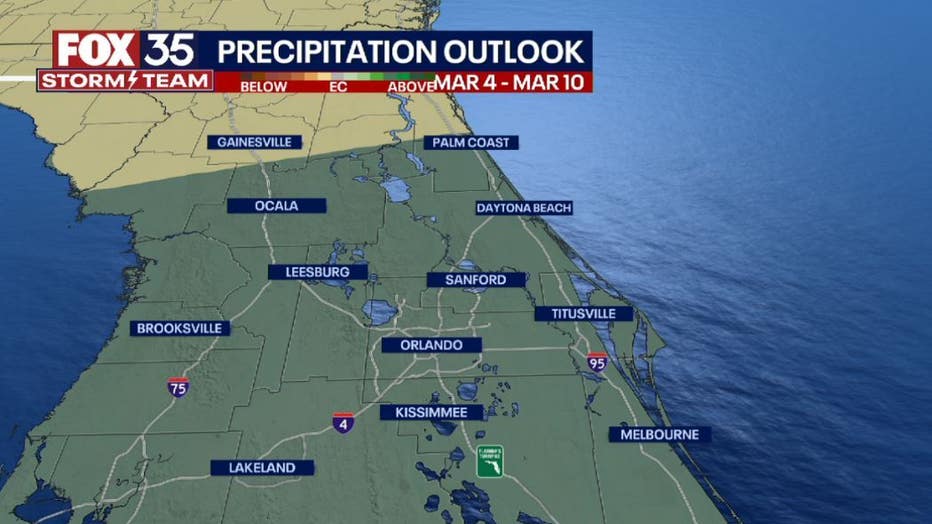
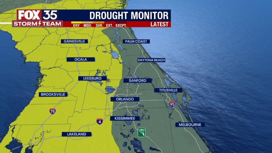
Looking ahead into mid-March, the outlook brings a continued likelihood of dry conditions across the southeast region of the United States.
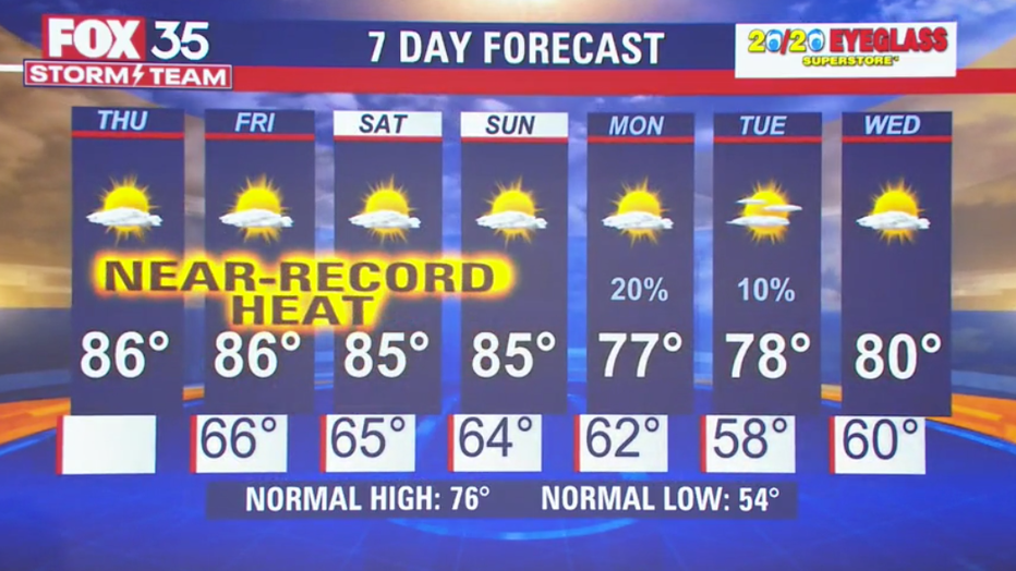
The lack of cold fronts and the associated rain chances also means elevated temperatures. Probabilities are rising for another run of above-normal temps for both day and night all the way through mid-March.