

Florida heat wave: Heat advisories as heat index soars in Central Florida
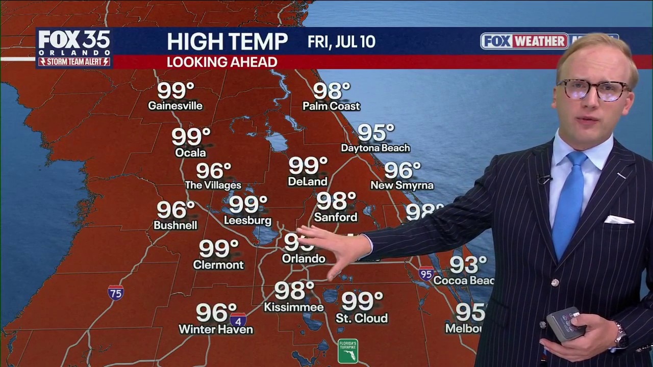
Orlando Weather Forecast: Tracking excessive heat
FOX 35 Storm Team Senior Meteorologist Noah Bergren is tracking record heat again for Friday across central Florida with some places feeling like 114+ degrees.
ORLANDO, Fla. - The FOX 35 Storm Team is tracking potentially dangerous heat across all of Central Florida for the next several days. Daily high temperatures are expected to be in the 90s, while the heat index – the "feels like" temperature – will range between 100–110 degrees.
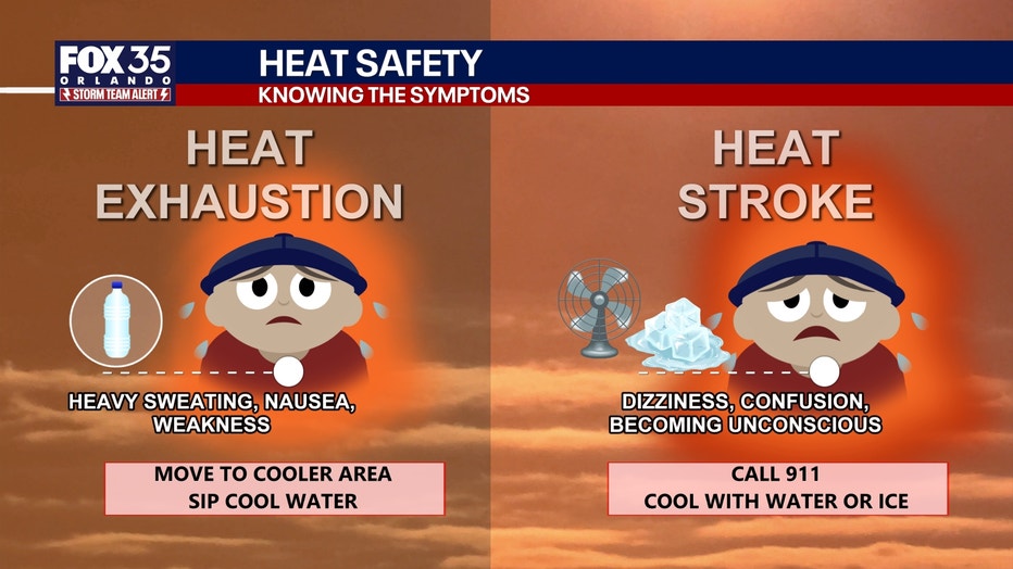
Nearly all of Florida is under a moderate, major, or extreme level of heat risk, signaling the potential for dangerous heat and heat-related illnesses, such as heat exhaustion or heat stroke.
Florida heat: Advisories issued
Some of the summer's hottest temperatures have arrived in Central Florida – and are forecast to stay for several days, back to back. It's due to a large "heat dome" that has formed over Florida and the arrival of a massive swath of Saharan Dust.
Both have increased temperatures a few degrees above what's seasonally considered normal for Central Florida in July.
How hot will it get?
Daily high temperatures are forecast to be between 90-100 degrees. The heat index – or feels like temperature – is expected to be above 100 degrees, potentially as high as 117 in some spots over the weekend.
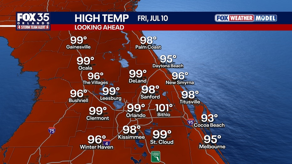
Heat records in Orlando
Thursday, July 9: 98 degrees (1932)
Friday, July 10: 99 (1980)
Saturday, July 11: 98 (1892, 1989)
Heat safety: Heat exhaustion vs heat stroke
Saharan Dust arrives in Florida
A massive swath of Saharan Dust is expected to arrive over Florida this week and weekend, leading to potentially hazy skies. It will also make for some incredible sunrises and sunsets.
What is Saharan Dust?
Saharan Dust blows off the coast of Africa every summer, and travels between 5,000 and 15,000 feet up in the atmosphere across the Atlantic Ocean. Some years the plume of dust makes it all the way to the southeast United States, other years it does not.
Vibrant sunsets and sunrises + tropical activity dampens
Saharan Dust acts to reduce tropical activity, heat the atmosphere up more, and provide abnormally vibrant sunrises and sunsets. That's because the dust suspended high up in the atmosphere can help to spread the light out, making it more vibrant.
Watch out for air quality
Because of the dust, it can sometimes impact air quality. So, if you're sensitive to that, take measures to protect yourself.
Rain chances return this weekend
We could see some widespread showers and thunderstorms on Sunday as energy and a front move in from the north. A couple of those storms could become severe, meaning strong wind gusts and the chance for hail.
These storms, like the ones we saw this week, would have vivid and frequent lightning.
Quietest start to the Atlantic hurricane season in 12+ years
With just Arthur in the Gulf so far, this is the calmest start to the Atlantic hurricane season since 2014.
No Atlantic hurricane season since 1950 has gone hurricane-less, even in the most quiet years similar to this year.
El Nino should keep the total number of tropical systems this year in the Atlantic very low, but that does not mean 0. We could end up with two storms this year, and if the 2nd hits Florida, it's a big deal for us.
- The average historical second named storm of the Atlantic hurricane season is July 17th
- The average first hurricane of the year is generally August 11th
- The average first major (Cat. 3+) hurricane is Sep
The Source: The information in the story was provided by the FOX 35 Storm Team.