

National Hurricane Center: Invest 95L likely to become tropical depression this week
ORLANDO, Fla. - The National Hurricane Center (NHC) says Invest 95L is likely to become a tropical depression or tropical storm later this week as it moves quickly across the Central Tropical Atlantic.
Here's what we know about the sytem as we continue to track the tropics.
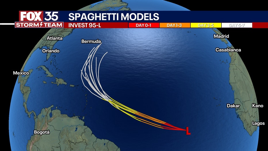
Tracking Invest 95L: Future Jerry?
What we know:
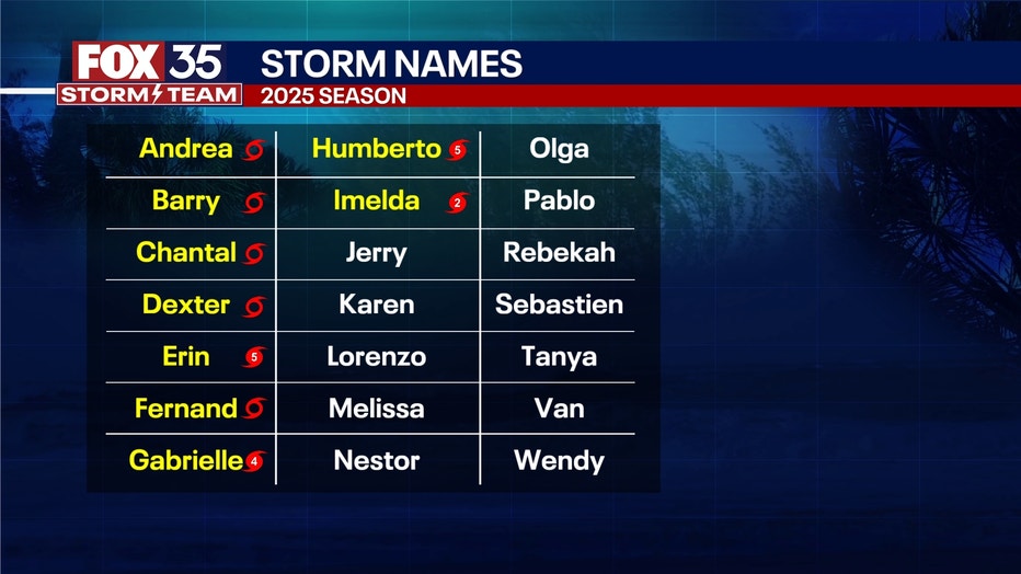
A zone in the Atlantic, designated as Invest 95L, has a high (80%) chance of development and could become a depression and eventually Tropical Storm Jerry in a few days.
As of Monday evening, the NHC said this broad area of low pressure associated with a low-latitude tropical wave continues to produce a large area of disorganized cloudiness and showers several hundred miles southwest of the Cabo Verde Islands.
CLICK TO DOWNLOAD THE FOX LOCAL APP
Forecasters say environmental conditions appear conducive for gradual development of this system, and a tropical depression is likely to form by midweek as it moves quickly across the Central Tropical Atlantic, approaching the Leeward Islands, by the latter part of this week.

"This is not a ‘fish’ storm, and could have some glancing blow impacts on places like Dominica, Antigua and Barbuda, the British Virgin Islands, and even eastern Puerto Rico later this week," said FOX 35 Storm Team Meteorologist Noah Bergren. "After that, the likely system will ‘recurve’ away from the eastern U.S. and into the Atlantic this weekend. Some models show the potential to become a hurricane."

Invest 95L currently has a 70% chance of development over the next 48 hours and an 80% chance of development over the next week. If the system does develop, it will be named Jerry.
What we don't know:
It is currently too early to tell if the system has a chance of impacting Florida.
SIGN-UP FOR FOX 35'S BREAKING NEWS, DAILY NEWS NEWSLETTERS
Zone in the southern Gulf
An area near the Yucatán Peninsula has a low (10%) chance of development and does not look to be that impactful other than rain for eastern Mexico this week.
Third zone not yet outlined
There is a growing chance for a strong low pressure system to form off the Florida east coast and track into the Carolinas or Mid Atlantic later this week.
The reason why the NHC doesn't have a zone outline yet is that this storm may be "hybrid," meaning exhibiting tropical and non-tropical characteristics.
That technicality aside, it could produce hurricane or tropical storm force winds in the coastal Carolinas and Jersey Shore/Long Island late this week, with coastal flooding and rain bands as well.
This potential storm would form off Florida's east coast then track northwards. We will monitor it.
2025 Atlantic hurricane season
Big picture view:
No other activity is being tracked in the Atlantic at this time, but now that we are in October, our focus will start to shift from activity in the Central Atlantic to activity possibly brewing in the Caribbean and the Gulf.
The Central American Gyre is a low pressure system that forms over Central America and pulls in moisture from the Gulf, the Atlantic and the Pacific.
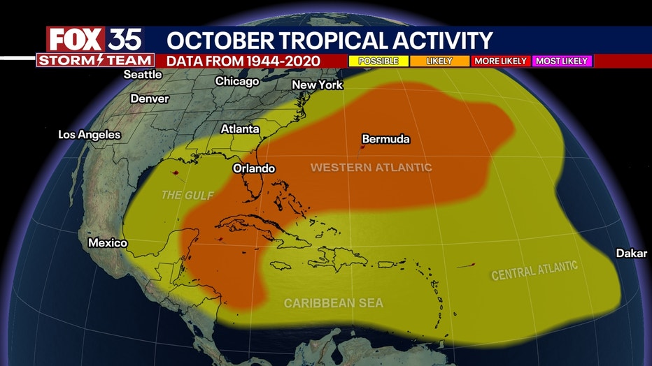
This annual pattern can lead to tropical activity in the back half of the season.
The Atlantic hurricane season began on June 1 and runs through Nov. 30.
The Source: This story was written based on information shared by the National Hurricane Center (NHC), FOX Weather and the FOX 35 Storm Team on Oct. 6, 2025.