

Gorgeous, warm day ahead -- but another cold front is coming

Weather Forecast: January 20, 2022
FOX 35 Storm Team Chief Meteorologist Jayme King has the forecast.
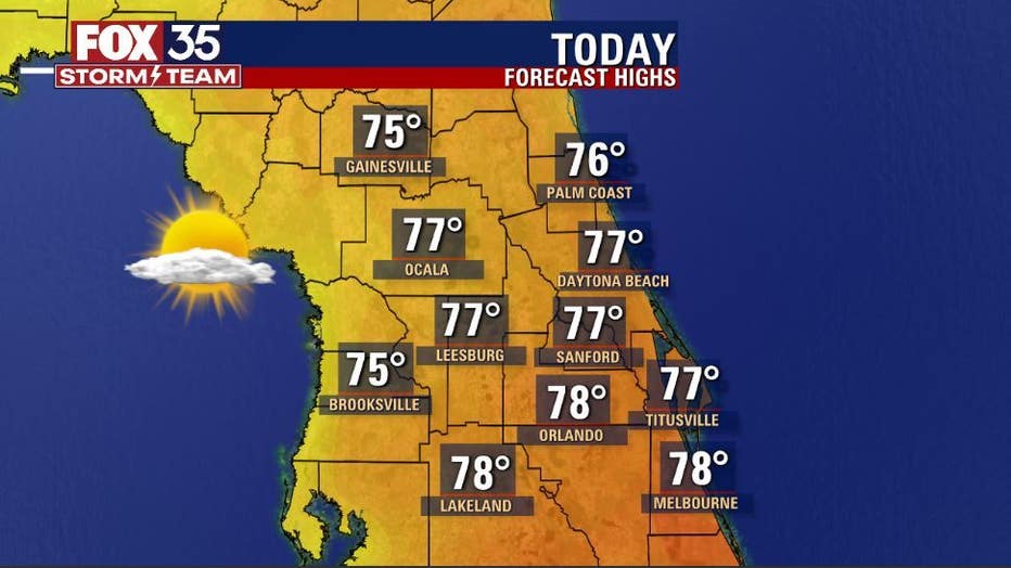
ORLANDO, Fla. - What a day, what a day! Gorgeous weather returns to Central Florida yet again on this Thursday!
After a cool morning, highs fly into the widespread mid-upper 70s by this afternoon. Sunshine will fill the skies with a slight increase in clouds late day.
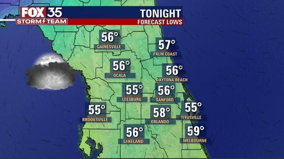
Tonight, clouds continue rolling in as a cold front closes in on the area from the northwest. The front is producing quite a stark contrast in temps with big warming in advance of the system, much colder behind.
RELATED: Florida saw snow 45 years ago. Could it happen again?
Rain will remain north of Florida today, but this will be changing by tomorrow!
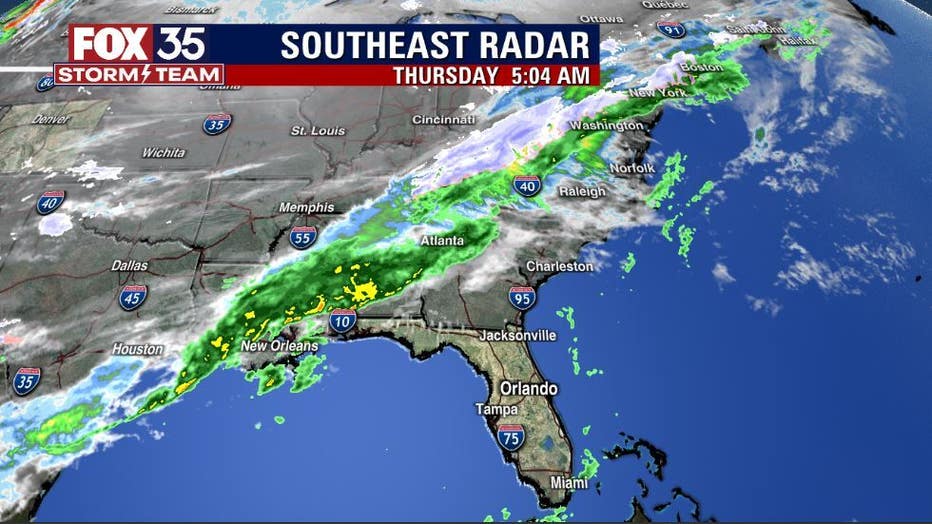
The front will move into north Florida Friday morning, slowly sagging southbound through the day. Expect a few showers to result.
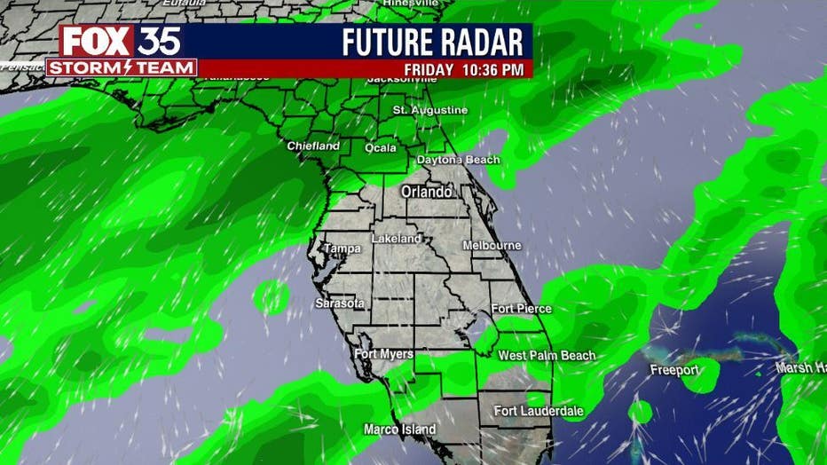
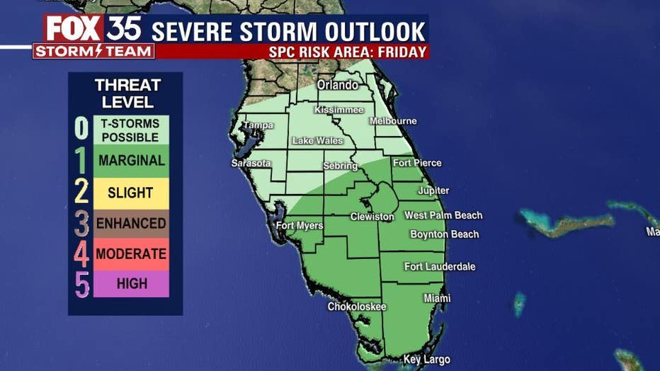
As the FOX 35 Storm Team expected, the severe storm risk has been pushed to the southern Peninsula on Friday.
DOWNLOAD: FOX 35 NEWS APP | FOX 35 STORM TEAM WEATHER APP
SUBSCRIBE: FOX 35 NEWSLETTER | FOX 35 Orlando on YouTube
FOLLOW: Facebook | Instagram | Twitter
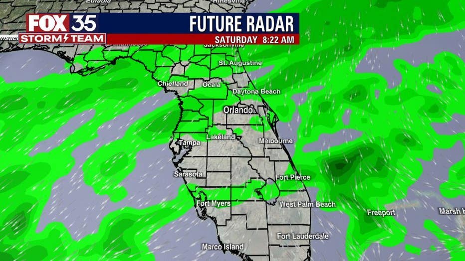
A few stronger storms will be possible in that region mainly during the late afternoon and early evening hours. The weekend brings more shower risk, breezes and cooler weather. Rain chances will be the highest overnight Friday and into Saturday afternoon, coverage around 30-40%. Highs will be much cooler on Saturday and Sunday, near 60 on both days. Lows over the weekend hang in the lower 50s to mid-upper 40s.
Click here for the most accurate Central Florida weather updates, live radar, and weather forecast for Orlando.
Watch FOX 35 News for the latest launch updates.