

Forecast: Central Florida to drop into the 30s, 40s next week

Weather Report: November 26th
FOX 35 meteorologist Allison Gargaro gives the latest on the weather in Central Florida.
ORLANDO, Fla. - The first big cold front of the season for Central Florida is just days away.
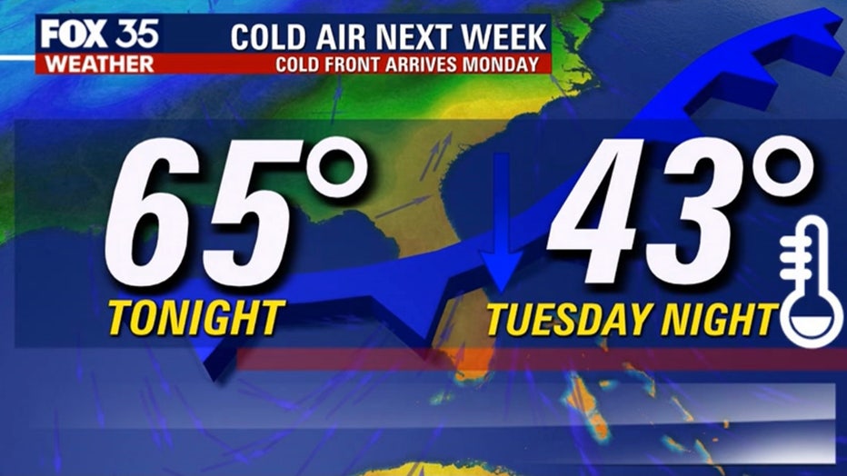
Looks for a dramatic fall in local temperatures for both day and night for much of next week. By Monday and Tuesday, we could see some of the coldest air in our area since last January and February when parts of Central Florida drop into the 30s and 40s.
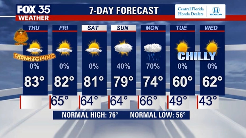
We will get the perfect combination of sunshine, light winds, comfortable humidity, and slightly warmer than normal temperatures on Thanksgiving. At night, it will be cool in the 60s.
The first front will approach the area Sunday night into Monday morning. A line of showers and fast-moving storms will likely accompany the front according to our latest forecast modeling in the FOX 35 Weather Center.
Once the rain clears out, the cooler air will be funneling into Central Florida.
"It looks like a chiller," said FOX 35 meteorologist Jayme King. "A very strong cold front is going to move through."
Central Florida will see temperatures drop into the 30s and 40s on Tuesday. Those living in North Central Florida will be the ones feeling the 30s.
MORE NEWS: Thanksgiving Day forecast: Sunny and warm before cold front moves in
Highs on Tuesday will be in the 50s and 60s, so even with full sunshine out, it will be a chilly change indeed for the entire viewing area.
Some of the early model forecasts are showing some rare, deep South snowfall or perhaps a slushy mix around North Georgia and possibly some of the Gulf States. Something to certainly keep an eye on as we head into late weekend and early next week.
Stay with the FOX 35 Weather Team for the very latest on this developing weather story as the event draws closer!
Watch FOX 35 News for the latest local stories.