

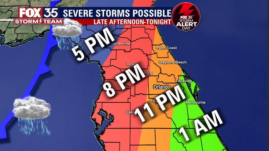
TIMELINE: When storms could impact your Central Florida neighborhood

FOX 35 Storm Alert Days
FOX 35 Storm Team Meteorologist Allison Gargaro has a look at the potential weather threats for Central Florida.
LAKE MARY, Fla. - Another storm system is set to move across Central Florida on Tuesday and Wednesday bringing with it rain, damaging winds, and even the potential for tornadoes.
Here is a quick look at what areas could see rain – and when -- and what the biggest threats are.
RELATED: NWS radar may not detect some tornadoes in North Central Florida
Track the storm: View extended weather forecast and radar. You can also download FOX 35 Weather app.
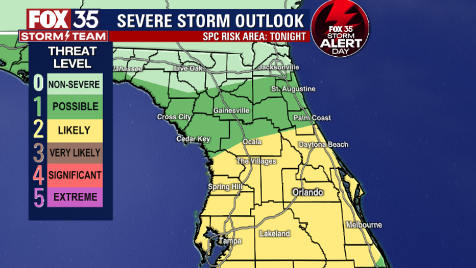
The current timeline: Right now, an upper-level storm system is expected to move through the region Tuesday night, and throughout the evening hours. Rain is expected around 7 p.m.
The biggest threats: Heavy rain, gusty winds, thunder, and lightning.
RELATED: 'Thankful to be alive': Tornado reaching 110 mph winds destroys Ocala homes
How it will happen: After a warmer Tuesday with increasing humidity, thunder will sound by evening for most communities. The good news is that while atmospheric conditions are primed to produce big storms, the lift required to make that happen from warm weather at the surface will not be present in a vast enough quantity to yield a major outbreak. As highs are only likely to reach the upper 70s to around 80°, and dew points will only reach the mid-60s, there simply will not be enough convective energy to spark a widespread outbreak. However, if one or two storms can tap enough energy as they begin Tuesday evening, damaging wind gusts and isolated twister are in play.
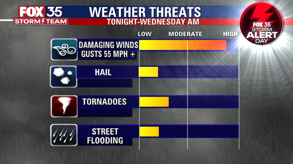
Tornado threat: There is potential for weak tornados to form, but the threat is low.
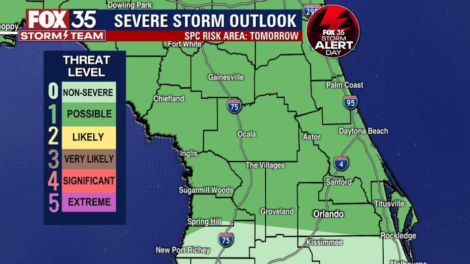
More rain ahead: As the system lingers overnight Tuesday, it will allow the atmosphere to recharge and bring a second round of storms Wednesday afternoon. These are likely to not be as strong, but gusty winds and even a little hail is possible. These storms could bring up to a half-inch of rain to areas along the Atlantic Coast and up to two inches of rain more inland.
Watch FOX 35 News for the latest updates.