

Strong storms to roll through on Wednesday ahead of cold front

Weather Forecast: December 16, 2020
FOX 35 meteorologist Kristin Giannas has your Central Florida forecast.
Orlando. FL - The roller coaster ride known as Central Florida's weather continues this week.
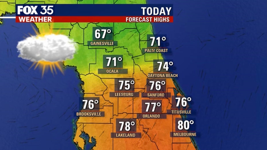
A strong cold front will zip across the Gulf of Mexico early Wednesday morning. The system will push clouds into Central Florida on Wednesday morning, as highs hit in the upper 70s.
Southerly breezes will warm things up in advance of the cold front. The latest forecast models are showing a line of showers and storms coming in off the Gulf after 1 p.m. on Wednesday. Rain chances will rise into the 50 to 60 percent range.
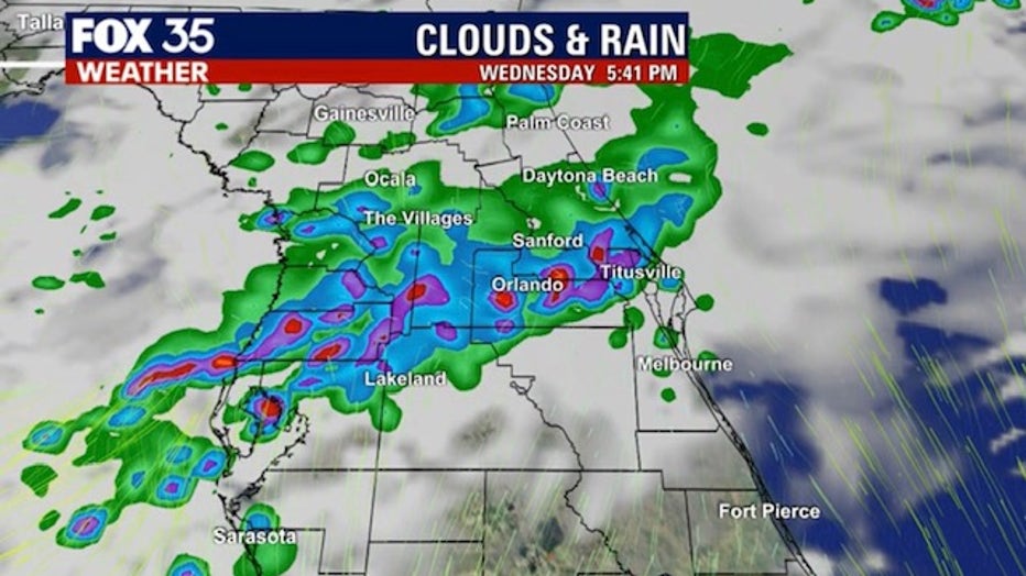
Parts of the FOX 35 and FOX 51 viewing areas are outlined with a 'marginal' risk of severe storms. The main threats to watch for are damaging wind gusts and the chance of isolated and brief tornados.
WEATHER ALERTS: Download the FOX 35 Weather App to track the tropics on your phone, receive severe weather alerts, and get the latest daily forecasts
The timing on the stronger storms looks to take shape early Wednesday afternoon through evening. The line of weather should weaken as it moves through Florida.
The timeline for the threats is between one and two p.m., with most models bringing it into the western peninsula and Big Bend region around that time.
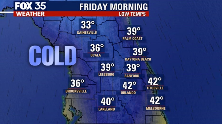
Behind the departing front, conditions in Central Florida will turn much colder. Highs both Thursday and Friday will remain in the 60s with lots of sunshine. Lows will drop down again, with the coldest air of the week arriving overnight Thursday into Friday morning. The 30s and 40s will return to the region with breezy winds developing on Friday.
Tune in to FOX 35 Orlando for the latest weather updates.